Begins Where The River Parallels A Two-Lane Highway To The Western Boundary Of Yellowstone National Park River Run
Community Reviews
Been here? Share the conditions.
Reviews, ratings & photos are added in the free Snoflo iOS app — rate a spot, tag the conditions, and your visit is verified by location. Add or manage your reviews from the app.
Begins Where The River Parallels A Two-Lane Highway To The Western Boundary Of Yellowstone National Park
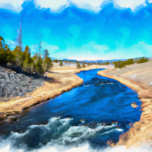
The segment mileage of the Whitewater River run is approximately 10 miles long. During this run, there are several specific river rapids and obstacles to navigate. The most notable rapid is Big Rock, which is a Class III+ rapid that requires skilled maneuvering to safely navigate. Other notable obstacles include several large boulders, tight turns, and narrow channels.
There are specific regulations in place for the Whitewater River run to ensure the safety of all participants. Those who wish to embark on this run are required to have a permit from the National Park Service. Additionally, all participants must wear a Coast Guard-approved personal flotation device at all times while on the river. Finally, no alcohol or drugs are allowed on the river.
In conclusion, the Whitewater River run is a challenging and exciting adventure that requires skill and experience to navigate safely. With its ideal streamflow range, class rating, segment mileage, specific river rapids/obstacles, and specific regulations, this run should only be attempted by experienced whitewater paddlers with the proper equipment and permits.
Plan your run down to the hour
Same weather feed Snoflo's iOS app uses -- updated continuously from NOAA / yr.no. Watch the precipitation column on the meteogram; rain ahead of a run typically lifts flows 12-48 hours later depending on the basin.
Next 5 days, hour by hour
Temperature line with weather symbols on top, snow + rain accumulation as columns, humidity as a dotted line.
5-day forecast table
Every 3 hours, broken out across temperature, snow, rain, humidity, and wind. Each cell is colour-coded relative to the column min/max.
| Time | Condition | Temp (°F) | Snow (in) | Rain (in) | Humidity (%) | Wind (mps) | Wind dir |
|---|---|---|---|---|---|---|---|
| Loading detailed forecast… | |||||||
15-day temperature & precipitation
Daily temperatures, snow, and rain projected over the next two weeks -- the upstream story that drives next week's flows.
Regional streamflow levels
USGS streamgauges around Begins Where The River Parallels A Two-Lane Highway To The Western Boundary Of Yellowstone National Park -- useful for spotting upstream pulses and gauging which tributary is contributing what.
| Streamgauge | Discharge | View |
|---|---|---|
| Madison River Bl Hebgen Lake Nr Grayling Mt | 1,200 cfs | → |
| Yellowstone River At Corwin Springs Mt | 3,760 cfs | → |
| Gardner River Near Mammoth Ynp | 181 cfs | → |
| Boiling River At Mammoth | 22 cfs | → |
| Madison River Near West Yellowstone Mt | 363 cfs | → |
| Tantalus Creek At Norris Junction | 3 cfs | → |
Plan a longer trip
The closest boat launches, other paddle runs, and campgrounds so a day on the water can grow into a full weekend.
Boat launches
Other river runs
- The Headwaters, In The Gallatin Range To Ends Downstream Of Osprey Falls
- The Headwaters In The Gallatin Range To Ends Where The River Parallels A Two-Lane Highway
- Gallatin Canyon, Sec. 19, T4s, R4e To Yellowstone National Park, Sec. 27, T9s, R5e
- Begins Downstream Of Osprey Falls To Confluence With Yellowstone River, At The Northern Park Boundary
- Gardiner Town Run
Campgrounds
- Lower Fan Creek
- Gallatin River
- Gallatin River Stock
- Fan Creek
- Upper Gallatin River Stock
- Upper Gallatin River
Fishing spots
Whitewater safety
- Check the flow before you run
- Use the linked-gauge card and Regional Flow panel above. Class ratings change with flow -- a Class III at low water can become Class IV+ at high water.
- Know your skill ceiling
- Pick runs comfortably below your ceiling. Cold-water and big-water runs raise the consequences of any mistake.
- Wear the right gear
- Helmet, PFD, drysuit / wetsuit when water is below 60°F. Throw bag, knife, and whistle on your person, not in the boat.
- Scout, set safety, and run with a team
- Scout new rapids on foot, set safety with throw bags above the consequence pool, and run with at least one other competent paddler.
- Respect the river
- Strainers, undercuts, low-head dams, and wood can kill at any class rating. When in doubt, portage.
Set push alerts in the Snoflo app
Save Begins Where The River Parallels A Two-Lane Highway To The Western Boundary Of Yellowstone National Park as a favorite, set a discharge threshold (e.g. "alert me when flow hits 600 cfs"), and the iOS app pushes the moment the linked gauge crosses.
About Begins Where The River Parallels A Two-Lane Highway To The Western Boundary Of Yellowstone National Park
What's the optimal flow for Begins Where The River Parallels A Two-Lane Highway To The Western Boundary Of Yellowstone National Park?
The optimal flow depends on the section and the craft. Check the Run Details panel for the linked gauge and current status.
How fresh is the cfs reading on this page?
The linked USGS streamgauge reports continuously (every 15 minutes); Snoflo refreshes throughout the day. Hover the streamflow sparkline to read individual datapoints.
What's the whitewater class?
See the Run Details panel for the class rating Snoflo tracks for this run. Class ratings change with flow -- a Class III at low water can become Class IV in high water.
Where do I put in / take out?
Tap Directions in the hero above to open driving directions to the put-in. For shuttle planning, check the Nearby Boat Launches panel and the river run operator's site.
Can I get alerts when flows hit the optimal range?
Yes -- alerts are managed in the Snoflo iOS app. Favorite this run, set a discharge threshold, and you'll get a push the moment the gauge crosses.
Other runs near here
Snoflo-tracked paddle runs within driving distance of Begins Where The River Parallels A Two-Lane Highway To The Western Boundary Of Yellowstone National Park.