Dobrota Headwaters, Sec. 23, T18n, R10w To Mainstem, Sec. 31, T18n, R9w River Run
Community Reviews
Been here? Share the conditions.
Reviews, ratings & photos are added in the free Snoflo iOS app — rate a spot, tag the conditions, and your visit is verified by location. Add or manage your reviews from the app.
Dobrota Headwaters, Sec. 23, T18n, R10w To Mainstem, Sec. 31, T18n, R9w
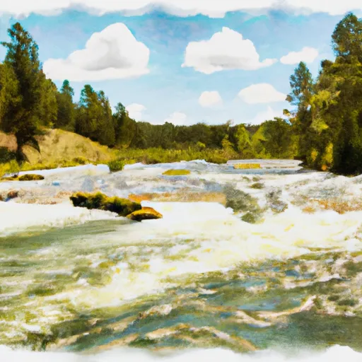
This section of the river is rated as Class III-IV, with several challenging rapids and obstacles. The segment mileage of this run is approximately 10 miles, starting at Dobrota Headwaters in Section 23, T18N, R10W and ending at the Mainstem in Section 31, T18N, R9W.
The river features several notable rapids, including the "Big Drop," "Pineapple Express," and "Twin Needles." These rapids require technical maneuvering and skilled paddling to navigate successfully.
There are specific regulations in place for this area to ensure safety and protect the environment. Montana state law requires all boaters to wear a personal flotation device (PFD) while on the river. Additionally, camping permits are required for overnight stays in the adjacent national forest.
Overall, the Whitewater River Run Dobrota Headwaters is a challenging and exciting stretch of river for experienced paddlers. It offers a variety of rapids and obstacles, as well as stunning scenery and opportunities for camping and exploring the surrounding wilderness.
Plan your run down to the hour
Same weather feed Snoflo's iOS app uses -- updated continuously from NOAA / yr.no. Watch the precipitation column on the meteogram; rain ahead of a run typically lifts flows 12-48 hours later depending on the basin.
Next 5 days, hour by hour
Temperature line with weather symbols on top, snow + rain accumulation as columns, humidity as a dotted line.
5-day forecast table
Every 3 hours, broken out across temperature, snow, rain, humidity, and wind. Each cell is colour-coded relative to the column min/max.
| Time | Condition | Temp (°F) | Snow (in) | Rain (in) | Humidity (%) | Wind (mps) | Wind dir |
|---|---|---|---|---|---|---|---|
| Loading detailed forecast… | |||||||
15-day temperature & precipitation
Daily temperatures, snow, and rain projected over the next two weeks -- the upstream story that drives next week's flows.
Regional streamflow levels
USGS streamgauges around Dobrota Headwaters, Sec. 23, T18n, R10w To Mainstem, Sec. 31, T18n, R9w -- useful for spotting upstream pulses and gauging which tributary is contributing what.
| Streamgauge | Discharge | View |
|---|---|---|
| Nf Blackfoot R Ab Dry Gulch Nr Ovando Mt | 373 cfs | → |
| Sun River Bl Diversion Dam Nr Augusta Mt | 107 cfs | → |
| South Fork Sun River Near Augusta Mt | 246 cfs | → |
| Blackfoot R Ab Nevada Cr Nr Helmville Mt | 458 cfs | → |
| North Fork Sun River Near Augusta Mt | 252 cfs | → |
| Sun River Bl Willow Cr Nr Augusta Mt | 247 cfs | → |
Plan a longer trip
The closest boat launches, other paddle runs, and campgrounds so a day on the water can grow into a full weekend.
Other river runs
- Cooney Cr Headwaters, Sec. 17, T19n, R9w To Mainstem, Sec. 1, T17n, R10w
- Cabin Creek Headwaters, Sec. 13, T17n, R10w To Dry Fork, Sec. 13, T17n, R11w
- Dry Fork Headwaters, Sec. 30, T17n, R10w To Mainstem, Sec. 30, T17n, R10w
- Headwaters, Sec. 15, T18n, R10w To Straight Creek, Sec. 25, T19n, R10w
- Canyon Creek Headwaters, Sec. 28, T17n, R11w To Dry Creek, Sec. 11, T17n, R11w
Campgrounds
- Double Falls Campground
- Wood Lake
- Wood Lake Campground
- Big Nelson Complex
- Big Nelson Campground
- Van Deriet Campground
Whitewater safety
- Check the flow before you run
- Use the linked-gauge card and Regional Flow panel above. Class ratings change with flow -- a Class III at low water can become Class IV+ at high water.
- Know your skill ceiling
- Pick runs comfortably below your ceiling. Cold-water and big-water runs raise the consequences of any mistake.
- Wear the right gear
- Helmet, PFD, drysuit / wetsuit when water is below 60°F. Throw bag, knife, and whistle on your person, not in the boat.
- Scout, set safety, and run with a team
- Scout new rapids on foot, set safety with throw bags above the consequence pool, and run with at least one other competent paddler.
- Respect the river
- Strainers, undercuts, low-head dams, and wood can kill at any class rating. When in doubt, portage.
Set push alerts in the Snoflo app
Save Dobrota Headwaters, Sec. 23, T18n, R10w To Mainstem, Sec. 31, T18n, R9w as a favorite, set a discharge threshold (e.g. "alert me when flow hits 600 cfs"), and the iOS app pushes the moment the linked gauge crosses.
About Dobrota Headwaters, Sec. 23, T18n, R10w To Mainstem, Sec. 31, T18n, R9w
What's the optimal flow for Dobrota Headwaters, Sec. 23, T18n, R10w To Mainstem, Sec. 31, T18n, R9w?
The optimal flow depends on the section and the craft. Check the Run Details panel for the linked gauge and current status.
How fresh is the cfs reading on this page?
The linked USGS streamgauge reports continuously (every 15 minutes); Snoflo refreshes throughout the day. Hover the streamflow sparkline to read individual datapoints.
What's the whitewater class?
See the Run Details panel for the class rating Snoflo tracks for this run. Class ratings change with flow -- a Class III at low water can become Class IV in high water.
Where do I put in / take out?
Tap Directions in the hero above to open driving directions to the put-in. For shuttle planning, check the Nearby Boat Launches panel and the river run operator's site.
Can I get alerts when flows hit the optimal range?
Yes -- alerts are managed in the Snoflo iOS app. Favorite this run, set a discharge threshold, and you'll get a push the moment the gauge crosses.
Other runs near here
Snoflo-tracked paddle runs within driving distance of Dobrota Headwaters, Sec. 23, T18n, R10w To Mainstem, Sec. 31, T18n, R9w.