Wagon Box Creek To Dry Fork Trail River Run
Community Reviews
Been here? Share the conditions.
Reviews, ratings & photos are added in the free Snoflo iOS app — rate a spot, tag the conditions, and your visit is verified by location. Add or manage your reviews from the app.
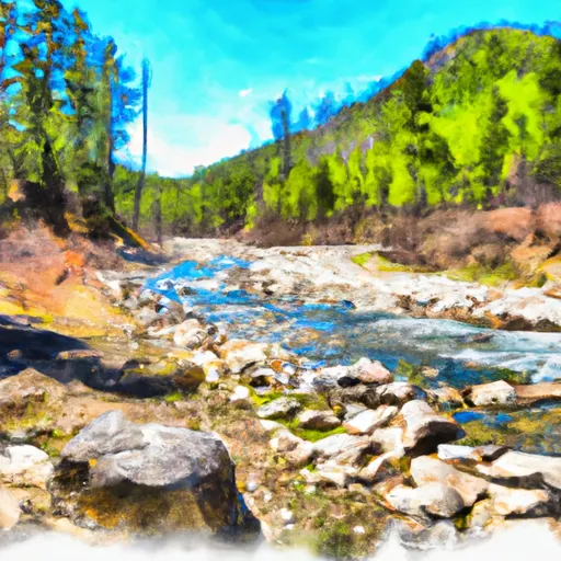
Wagon Box Creek To Dry Fork Trail
Some of the specific river rapids and obstacles that paddlers will encounter include the Wagon Box Drop, a Class IV rapid with a steep drop and a tight turn; the Broken Bridge, a Class III obstacle with a large rock in the center of the river that requires careful navigation around it; and the Double Drop, a Class IV/V rapid with two steep drops that require precise maneuvering.
Paddlers planning to embark on this river run must follow specific regulations, including obtaining a permit from the Montana Fish, Wildlife & Parks department, wearing appropriate safety equipment such as a helmet and life jacket, and avoiding disturbing wildlife or damaging the natural environment.
In summary, the Wagon Box Creek to Dry Fork Trail in Montana offers an exciting and challenging whitewater river run for experienced paddlers. With its ideal streamflow range, Class III to IV rating, memorable rapids, and specific regulations, this river run provides an unforgettable adventure for those seeking a thrilling outdoor experience.
Plan your run down to the hour
Same weather feed Snoflo's iOS app uses -- updated continuously from NOAA / yr.no. Watch the precipitation column on the meteogram; rain ahead of a run typically lifts flows 12-48 hours later depending on the basin.
Next 5 days, hour by hour
Temperature line with weather symbols on top, snow + rain accumulation as columns, humidity as a dotted line.
5-day forecast table
Every 3 hours, broken out across temperature, snow, rain, humidity, and wind. Each cell is colour-coded relative to the column min/max.
| Time | Condition | Temp (°F) | Snow (in) | Rain (in) | Humidity (%) | Wind (mps) | Wind dir |
|---|---|---|---|---|---|---|---|
| Loading detailed forecast… | |||||||
15-day temperature & precipitation
Daily temperatures, snow, and rain projected over the next two weeks -- the upstream story that drives next week's flows.
Regional streamflow levels
USGS streamgauges around Wagon Box Creek To Dry Fork Trail -- useful for spotting upstream pulses and gauging which tributary is contributing what.
| Streamgauge | Discharge | View |
|---|---|---|
| Little Bighorn River At State Line Nr Wyola Mt | 86 cfs | → |
| West Pass Creek Near Parkman | 10 cfs | → |
| East Pass Creek Near Dayton | 12 cfs | → |
| Tongue River Near Dayton | 48 cfs | → |
| Shell Creek Near Shell | 74 cfs | → |
| Bighorn River Near St. Xavier | 1,630 cfs | → |
Plan a longer trip
The closest boat launches, other paddle runs, and campgrounds so a day on the water can grow into a full weekend.
Other river runs
- Dry Fork River From Its Confluence With Lake Creek To Confluence With Little Big Horn
- Fools Gold Crossing (Fdr 480) To Wagon Box Creek
- Nf Tongue From Burgess Picnic Ground To Pole Creek
- Sf Tongue- Johnson Creek To Confluence With Nf Tongue
- Porcupine Creek
Campgrounds
- Porcupine Campground
- Porcupine
- Bald Mountain
- North Tongue
- North Tongue Campground
- North Tongue River Campground
Whitewater safety
- Check the flow before you run
- Use the linked-gauge card and Regional Flow panel above. Class ratings change with flow -- a Class III at low water can become Class IV+ at high water.
- Know your skill ceiling
- Pick runs comfortably below your ceiling. Cold-water and big-water runs raise the consequences of any mistake.
- Wear the right gear
- Helmet, PFD, drysuit / wetsuit when water is below 60°F. Throw bag, knife, and whistle on your person, not in the boat.
- Scout, set safety, and run with a team
- Scout new rapids on foot, set safety with throw bags above the consequence pool, and run with at least one other competent paddler.
- Respect the river
- Strainers, undercuts, low-head dams, and wood can kill at any class rating. When in doubt, portage.
Set push alerts in the Snoflo app
Save Wagon Box Creek To Dry Fork Trail as a favorite, set a discharge threshold (e.g. "alert me when flow hits 600 cfs"), and the iOS app pushes the moment the linked gauge crosses.
About Wagon Box Creek To Dry Fork Trail
What's the optimal flow for Wagon Box Creek To Dry Fork Trail?
The optimal flow depends on the section and the craft. Check the Run Details panel for the linked gauge and current status.
How fresh is the cfs reading on this page?
The linked USGS streamgauge reports continuously (every 15 minutes); Snoflo refreshes throughout the day. Hover the streamflow sparkline to read individual datapoints.
What's the whitewater class?
See the Run Details panel for the class rating Snoflo tracks for this run. Class ratings change with flow -- a Class III at low water can become Class IV in high water.
Where do I put in / take out?
Tap Directions in the hero above to open driving directions to the put-in. For shuttle planning, check the Nearby Boat Launches panel and the river run operator's site.
Can I get alerts when flows hit the optimal range?
Yes -- alerts are managed in the Snoflo iOS app. Favorite this run, set a discharge threshold, and you'll get a push the moment the gauge crosses.
Other runs near here
Snoflo-tracked paddle runs within driving distance of Wagon Box Creek To Dry Fork Trail.