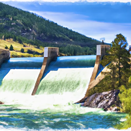
Hebgen Lake Dam, Sec. 23, T11s, R3e To Gallatin Forest Boundary, Sec. 35, T11s, R2e River Run
Community Reviews
Been here? Share the conditions.
Reviews, ratings & photos are added in the free Snoflo iOS app — rate a spot, tag the conditions, and your visit is verified by location. Add or manage your reviews from the app.
Hebgen Lake Dam, Sec. 23, T11s, R3e To Gallatin Forest Boundary, Sec. 35, T11s, R2e
The ideal streamflow range for this stretch of the river is between 1,500 and 3,000 cubic feet per second (cfs), which typically occurs during the spring and early summer months. The class rating for this section of the river ranges from class III to IV, providing a thrilling experience for experienced paddlers.
The segment mileage of this river run is approximately 10 miles, with numerous rapids and obstacles to navigate along the way. Some of the more challenging rapids include House Rock, Green Wall, and Screaming Left Turn. Paddlers should be aware of potential hazards such as submerged rocks, undercut ledges, and strong currents.
Specific regulations to the area include a permit requirement for commercial outfitters, as well as restrictions on the use of motorized watercraft. Additionally, all paddlers are required to wear a personal flotation device (PFD) and follow Leave No Trace principles to minimize their impact on the environment.
Overall, the Whitewater River Run in Montana offers a challenging and scenic experience for experienced paddlers. It is important to check current streamflow conditions and adhere to all regulations and safety precautions to ensure a safe and enjoyable trip.
Plan your run down to the hour
Same weather feed Snoflo's iOS app uses -- updated continuously from NOAA / yr.no. Watch the precipitation column on the meteogram; rain ahead of a run typically lifts flows 12-48 hours later depending on the basin.
Next 5 days, hour by hour
Temperature line with weather symbols on top, snow + rain accumulation as columns, humidity as a dotted line.
5-day forecast table
Every 3 hours, broken out across temperature, snow, rain, humidity, and wind. Each cell is colour-coded relative to the column min/max.
| Time | Condition | Temp (°F) | Snow (in) | Rain (in) | Humidity (%) | Wind (mps) | Wind dir |
|---|---|---|---|---|---|---|---|
| Loading detailed forecast… | |||||||
15-day temperature & precipitation
Daily temperatures, snow, and rain projected over the next two weeks -- the upstream story that drives next week's flows.
Regional streamflow levels
USGS streamgauges around Hebgen Lake Dam, Sec. 23, T11s, R3e To Gallatin Forest Boundary, Sec. 35, T11s, R2e -- useful for spotting upstream pulses and gauging which tributary is contributing what.
| Streamgauge | Discharge | View |
|---|---|---|
| Madison River Bl Hebgen Lake Nr Grayling Mt | 1,300 cfs | → |
| Madison River At Kirby Ranch Nr Cameron Mt | 1,460 cfs | → |
| Henrys Fork Nr Lake Id | 192 cfs | → |
| Red Rock Cr Ab Lakes Nr Lakeview Mt | 31 cfs | → |
| Madison River Near West Yellowstone Mt | 309 cfs | → |
| Henrys Fork Blw Coffee Pot Rapids Nr Macks Inn Id | 372 cfs | → |
Plan a longer trip
The closest boat launches, other paddle runs, and campgrounds so a day on the water can grow into a full weekend.
Boat launches
Other river runs
- Madison River
- Wf Madison River, Sec. 10 T11s R1e To Jackpine Rd #1209, Sec. 4, T12s R1e
- Jackpine Rd & Wf Madison Rd, Sec. 4, T12s, R1e To Shakelford Homestead, Sec. 25, T1s, R1w
- Elk Rv & Wf Madison Rv, Sec. 17, T12s, R1e To Dirty Creek, Sec. 11, T11s, R1w
Campgrounds
Fishing spots
Whitewater safety
- Check the flow before you run
- Use the linked-gauge card and Regional Flow panel above. Class ratings change with flow -- a Class III at low water can become Class IV+ at high water.
- Know your skill ceiling
- Pick runs comfortably below your ceiling. Cold-water and big-water runs raise the consequences of any mistake.
- Wear the right gear
- Helmet, PFD, drysuit / wetsuit when water is below 60°F. Throw bag, knife, and whistle on your person, not in the boat.
- Scout, set safety, and run with a team
- Scout new rapids on foot, set safety with throw bags above the consequence pool, and run with at least one other competent paddler.
- Respect the river
- Strainers, undercuts, low-head dams, and wood can kill at any class rating. When in doubt, portage.
Set push alerts in the Snoflo app
Save Hebgen Lake Dam, Sec. 23, T11s, R3e To Gallatin Forest Boundary, Sec. 35, T11s, R2e as a favorite, set a discharge threshold (e.g. "alert me when flow hits 600 cfs"), and the iOS app pushes the moment the linked gauge crosses.
About Hebgen Lake Dam, Sec. 23, T11s, R3e To Gallatin Forest Boundary, Sec. 35, T11s, R2e
What's the optimal flow for Hebgen Lake Dam, Sec. 23, T11s, R3e To Gallatin Forest Boundary, Sec. 35, T11s, R2e?
The optimal flow depends on the section and the craft. Check the Run Details panel for the linked gauge and current status.
How fresh is the cfs reading on this page?
The linked USGS streamgauge reports continuously (every 15 minutes); Snoflo refreshes throughout the day. Hover the streamflow sparkline to read individual datapoints.
What's the whitewater class?
See the Run Details panel for the class rating Snoflo tracks for this run. Class ratings change with flow -- a Class III at low water can become Class IV in high water.
Where do I put in / take out?
Tap Directions in the hero above to open driving directions to the put-in. For shuttle planning, check the Nearby Boat Launches panel and the river run operator's site.
Can I get alerts when flows hit the optimal range?
Yes -- alerts are managed in the Snoflo iOS app. Favorite this run, set a discharge threshold, and you'll get a push the moment the gauge crosses.
Other runs near here
Snoflo-tracked paddle runs within driving distance of Hebgen Lake Dam, Sec. 23, T11s, R3e To Gallatin Forest Boundary, Sec. 35, T11s, R2e.