Absaroka-Beartooth Wilderness Boundary To Headwaters, Sec. 20, T9s, R17e River Run
Community Reviews
Been here? Share the conditions.
Reviews, ratings & photos are added in the free Snoflo iOS app — rate a spot, tag the conditions, and your visit is verified by location. Add or manage your reviews from the app.
Absaroka-Beartooth Wilderness Boundary To Headwaters, Sec. 20, T9s, R17e
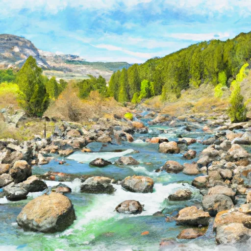
The river features several noteworthy rapids, including Pinball, Ledge Drop, and The Squeeze. Pinball is a series of boulder-choked drops that require precise maneuvering. Ledge Drop is a steep and technical rapid that requires careful scouting. The Squeeze is a narrow channel with a sharp turn that requires quick reflexes and precise navigation.
There are specific regulations to the area that paddlers should be aware of. The Beartooth Ranger District requires all boats to be registered and have a permit, which can be obtained at the district office. Additionally, there are strict guidelines for camping and fires, as well as regulations for the use of motorized watercraft.
Overall, the Whitewater River run is a thrilling and challenging whitewater experience for experienced paddlers. It is essential to check the streamflow levels and be aware of the specific regulations in the area before embarking on this adventure.
Plan your run down to the hour
Same weather feed Snoflo's iOS app uses -- updated continuously from NOAA / yr.no. Watch the precipitation column on the meteogram; rain ahead of a run typically lifts flows 12-48 hours later depending on the basin.
Next 5 days, hour by hour
Temperature line with weather symbols on top, snow + rain accumulation as columns, humidity as a dotted line.
5-day forecast table
Every 3 hours, broken out across temperature, snow, rain, humidity, and wind. Each cell is colour-coded relative to the column min/max.
| Time | Condition | Temp (°F) | Snow (in) | Rain (in) | Humidity (%) | Wind (mps) | Wind dir |
|---|---|---|---|---|---|---|---|
| Loading detailed forecast… | |||||||
15-day temperature & precipitation
Daily temperatures, snow, and rain projected over the next two weeks -- the upstream story that drives next week's flows.
Regional streamflow levels
USGS streamgauges around Absaroka-Beartooth Wilderness Boundary To Headwaters, Sec. 20, T9s, R17e -- useful for spotting upstream pulses and gauging which tributary is contributing what.
| Streamgauge | Discharge | View |
|---|---|---|
| Rock Creek Near Red Lodge Mt | 423 cfs | → |
| West Rosebud Creek Near Roscoe Mt | 361 cfs | → |
| Soda Butte Cr At Park Bndry At Silver Gate | 60 cfs | → |
| Clarks Fork Yellowstone River Nr Belfry Mt | 1,420 cfs | → |
| Willow Creek Near Boyd Mt | 67 cfs | → |
| Red Lodge Cr Ab Cooney Re Nr Boyd Mt | 47 cfs | → |
Plan a longer trip
The closest boat launches, other paddle runs, and campgrounds so a day on the water can grow into a full weekend.
Boat launches
Other river runs
- Absaroka-Beartooth Wilderness Boundary To Headwaters, Sec. 10, T9s, R17e
- Confluence Rock Creek, Sec. 34, T8s, R19e To Absaroka-Beartooth Wilderness Boundary
- Absaroka-Beartooth Wilderness Boundary To Headwaters, Sec. 25, T8s, R17e
- Custer Forest Boundary, Sec. 19, T8s, R20e To Absaroka-Beartooth Wilderness Boundary
- Custer Boundary, Sec. 6, T8s, R20e To Absaroka-Beartooth Wilderness Boundary
Campgrounds
- M-K Campground
- Limber Pine Campground
- Greenough Lake Campground
- Beartooth Lake Campground
- Parkside Campground And Group Campsites
- Lily Lake Camping Area
Fishing spots
Whitewater safety
- Check the flow before you run
- Use the linked-gauge card and Regional Flow panel above. Class ratings change with flow -- a Class III at low water can become Class IV+ at high water.
- Know your skill ceiling
- Pick runs comfortably below your ceiling. Cold-water and big-water runs raise the consequences of any mistake.
- Wear the right gear
- Helmet, PFD, drysuit / wetsuit when water is below 60°F. Throw bag, knife, and whistle on your person, not in the boat.
- Scout, set safety, and run with a team
- Scout new rapids on foot, set safety with throw bags above the consequence pool, and run with at least one other competent paddler.
- Respect the river
- Strainers, undercuts, low-head dams, and wood can kill at any class rating. When in doubt, portage.
Set push alerts in the Snoflo app
Save Absaroka-Beartooth Wilderness Boundary To Headwaters, Sec. 20, T9s, R17e as a favorite, set a discharge threshold (e.g. "alert me when flow hits 600 cfs"), and the iOS app pushes the moment the linked gauge crosses.
About Absaroka-Beartooth Wilderness Boundary To Headwaters, Sec. 20, T9s, R17e
What's the optimal flow for Absaroka-Beartooth Wilderness Boundary To Headwaters, Sec. 20, T9s, R17e?
The optimal flow depends on the section and the craft. Check the Run Details panel for the linked gauge and current status.
How fresh is the cfs reading on this page?
The linked USGS streamgauge reports continuously (every 15 minutes); Snoflo refreshes throughout the day. Hover the streamflow sparkline to read individual datapoints.
What's the whitewater class?
See the Run Details panel for the class rating Snoflo tracks for this run. Class ratings change with flow -- a Class III at low water can become Class IV in high water.
Where do I put in / take out?
Tap Directions in the hero above to open driving directions to the put-in. For shuttle planning, check the Nearby Boat Launches panel and the river run operator's site.
Can I get alerts when flows hit the optimal range?
Yes -- alerts are managed in the Snoflo iOS app. Favorite this run, set a discharge threshold, and you'll get a push the moment the gauge crosses.
Other runs near here
Snoflo-tracked paddle runs within driving distance of Absaroka-Beartooth Wilderness Boundary To Headwaters, Sec. 20, T9s, R17e.