Big Hole River River Run
Community Reviews
Been here? Share the conditions.
Reviews, ratings & photos are added in the free Snoflo iOS app — rate a spot, tag the conditions, and your visit is verified by location. Add or manage your reviews from the app.
Big Hole River
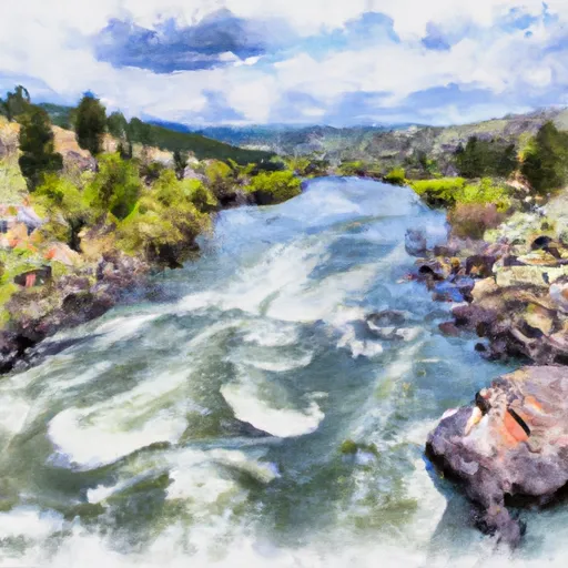
The river can be broken down into several segments, with the upper section spanning 35 miles from Skinner Meadows to Fish Trap. This section is the most challenging and features several Class III rapids, including the "Maidenrock" and "Windy Hill" rapids. The middle section, spanning 68 miles from Fish Trap to Notch Bottom Fishing Access, is the most popular for recreational floating and features several Class II rapids, including the "Jerry Creek" and "Fishtrap" rapids. The lower section, spanning 52 miles from Notch Bottom Fishing Access to the confluence with the Beaverhead River, is slower moving and features Class I-II rapids.
The Big Hole River is regulated by Montana Fish, Wildlife & Parks, and anglers must have a valid fishing license to fish in the river. Additionally, there are specific regulations regarding the types of bait and lures that can be used, as well as the size and number of fish that can be kept. For those interested in floating the river, there are regulations regarding the use of watercraft and safety equipment, such as life jackets and fire extinguishers.
Overall, the Big Hole River offers a variety of challenges and experiences for anglers and recreational floaters alike, with its ideal streamflow range, class rating, segment mileage, specific river rapids/obstacles, and specific regulations making it a unique and popular destination in Montana.
Plan your run down to the hour
Same weather feed Snoflo's iOS app uses -- updated continuously from NOAA / yr.no. Watch the precipitation column on the meteogram; rain ahead of a run typically lifts flows 12-48 hours later depending on the basin.
Next 5 days, hour by hour
Temperature line with weather symbols on top, snow + rain accumulation as columns, humidity as a dotted line.
5-day forecast table
Every 3 hours, broken out across temperature, snow, rain, humidity, and wind. Each cell is colour-coded relative to the column min/max.
| Time | Condition | Temp (°F) | Snow (in) | Rain (in) | Humidity (%) | Wind (mps) | Wind dir |
|---|---|---|---|---|---|---|---|
| Loading detailed forecast… | |||||||
15-day temperature & precipitation
Daily temperatures, snow, and rain projected over the next two weeks -- the upstream story that drives next week's flows.
Regional streamflow levels
USGS streamgauges around Big Hole River -- useful for spotting upstream pulses and gauging which tributary is contributing what.
| Streamgauge | Discharge | View |
|---|---|---|
| Big Hole River Near Glen Mt | 655 cfs | → |
| Beaverhead River Near Twin Bridges Mt | 79 cfs | → |
| Big Hole River Near Melrose Mt | 744 cfs | → |
| Ruby River Near Twin Bridges Mt | 45 cfs | → |
| Beaverhead River At Dillon Mt | 135 cfs | → |
| Jefferson River Near Twin Bridges Mt | 840 cfs | → |
Plan a longer trip
The closest boat launches, other paddle runs, and campgrounds so a day on the water can grow into a full weekend.
Boat launches
Campgrounds
Fishing spots
Whitewater safety
- Check the flow before you run
- Use the linked-gauge card and Regional Flow panel above. Class ratings change with flow -- a Class III at low water can become Class IV+ at high water.
- Know your skill ceiling
- Pick runs comfortably below your ceiling. Cold-water and big-water runs raise the consequences of any mistake.
- Wear the right gear
- Helmet, PFD, drysuit / wetsuit when water is below 60°F. Throw bag, knife, and whistle on your person, not in the boat.
- Scout, set safety, and run with a team
- Scout new rapids on foot, set safety with throw bags above the consequence pool, and run with at least one other competent paddler.
- Respect the river
- Strainers, undercuts, low-head dams, and wood can kill at any class rating. When in doubt, portage.
Set push alerts in the Snoflo app
Save Big Hole River as a favorite, set a discharge threshold (e.g. "alert me when flow hits 600 cfs"), and the iOS app pushes the moment the linked gauge crosses.
About Big Hole River
What's the optimal flow for Big Hole River?
The optimal flow depends on the section and the craft. Check the Run Details panel for the linked gauge and current status.
How fresh is the cfs reading on this page?
The linked USGS streamgauge reports continuously (every 15 minutes); Snoflo refreshes throughout the day. Hover the streamflow sparkline to read individual datapoints.
What's the whitewater class?
See the Run Details panel for the class rating Snoflo tracks for this run. Class ratings change with flow -- a Class III at low water can become Class IV in high water.
Where do I put in / take out?
Tap Directions in the hero above to open driving directions to the put-in. For shuttle planning, check the Nearby Boat Launches panel and the river run operator's site.
Can I get alerts when flows hit the optimal range?
Yes -- alerts are managed in the Snoflo iOS app. Favorite this run, set a discharge threshold, and you'll get a push the moment the gauge crosses.
Other runs near here
Snoflo-tracked paddle runs within driving distance of Big Hole River.