Headwaters To Confluence With Las Animas Creek river run
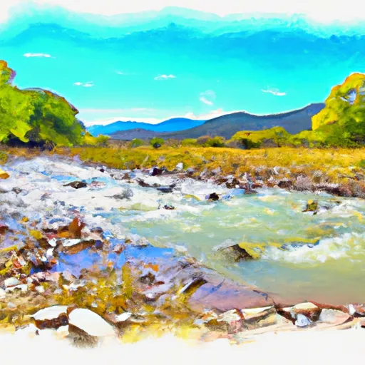
Headwaters To Confluence With Las Animas Creek
Kayakers and rafters should be aware of specific regulations to the area, including a permit requirement for commercial outfitters and a maximum group size of 15 people. The river is also closed to boating during times of high water or when water levels are above 3,000 cfs. It is important for boaters to respect the regulations in place to ensure the safety and preservation of the area.
Overall, the Whitewater River Headwaters to Confluence With Las Animas Creek run is an exciting and challenging adventure for experienced kayakers and rafters. It is important to check current streamflow and regulations before embarking on a trip to ensure a safe and enjoyable experience.
Plan your run down to the hour
Same weather feed Snoflo's iOS app uses -- updated continuously from NOAA / yr.no. Watch the precipitation column on the meteogram; rain ahead of a run typically lifts flows 12-48 hours later depending on the basin.
Next 5 days, hour by hour
Temperature line with weather symbols on top, snow + rain accumulation as columns, humidity as a dotted line.
5-day forecast table
Every 3 hours, broken out across temperature, snow, rain, humidity, and wind. Each cell is colour-coded relative to the column min/max.
| Time | Condition | Temp (°F) | Snow (in) | Rain (in) | Humidity (%) | Wind (mps) | Wind dir |
|---|---|---|---|---|---|---|---|
| Loading detailed forecast… | |||||||
15-day temperature & precipitation
Daily temperatures, snow, and rain projected over the next two weeks -- the upstream story that drives next week's flows.
Regional streamflow levels
USGS streamgauges around Headwaters To Confluence With Las Animas Creek -- useful for spotting upstream pulses and gauging which tributary is contributing what.
| Streamgauge | Discharge | View |
|---|---|---|
| Mimbres River At Mimbres | 4 cfs | → |
| Rio Grande Below Elephant Butte Dam | 529 cfs | → |
| Gila River Near Gila | 33 cfs | → |
| Rio Grande At Narrows In Elephant Butte Res. | 66 cfs | → |
| Mogollon Creek Near Cliff | 2 cfs | → |
| Gila River Near Redrock | 21 cfs | → |
Plan a longer trip
The closest boat launches, other paddle runs, and campgrounds so a day on the water can grow into a full weekend.
Other river runs
- Junction Of Water Canyon And Holden Prong To Aldo Leopold Wilderness Boundary
- Aldo Wilderness Boundary To Nf Boundary
- Headwaters To Junction Of Trails 707/68 (Sec 35, T12s, R11w)
- Headwaters To Confluence With Diamond Creek
- Headwaters To Aldo Leopold Wilderness Boundary
Whitewater safety
- Check the flow before you run
- Use the linked-gauge card and Regional Flow panel above. Class ratings change with flow -- a Class III at low water can become Class IV+ at high water.
- Know your skill ceiling
- Pick runs comfortably below your ceiling. Cold-water and big-water runs raise the consequences of any mistake.
- Wear the right gear
- Helmet, PFD, drysuit / wetsuit when water is below 60°F. Throw bag, knife, and whistle on your person, not in the boat.
- Scout, set safety, and run with a team
- Scout new rapids on foot, set safety with throw bags above the consequence pool, and run with at least one other competent paddler.
- Respect the river
- Strainers, undercuts, low-head dams, and wood can kill at any class rating. When in doubt, portage.
Set push alerts in the Snoflo app
Save Headwaters To Confluence With Las Animas Creek as a favorite, set a discharge threshold (e.g. "alert me when flow hits 600 cfs"), and the iOS app pushes the moment the linked gauge crosses.
About Headwaters To Confluence With Las Animas Creek
What's the optimal flow for Headwaters To Confluence With Las Animas Creek?
The optimal flow depends on the section and the craft. Check the Run Details panel for the linked gauge and current status.
How fresh is the cfs reading on this page?
The linked USGS streamgauge reports continuously (every 15 minutes); Snoflo refreshes throughout the day. Hover the streamflow sparkline to read individual datapoints.
What's the whitewater class?
See the Run Details panel for the class rating Snoflo tracks for this run. Class ratings change with flow -- a Class III at low water can become Class IV in high water.
Where do I put in / take out?
Tap Directions in the hero above to open driving directions to the put-in. For shuttle planning, check the Nearby Boat Launches panel and the river run operator's site.
Can I get alerts when flows hit the optimal range?
Yes -- alerts are managed in the Snoflo iOS app. Favorite this run, set a discharge threshold, and you'll get a push the moment the gauge crosses.
Other runs near here
Snoflo-tracked paddle runs within driving distance of Headwaters To Confluence With Las Animas Creek.