Summary
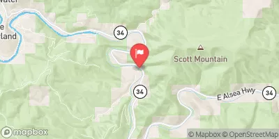
The ideal streamflow range for this run is between 800-1500 cfs. The class rating ranges from Class III to IV, depending on the section of the river. The segment mileage for this run is approximately 6 miles.
The Whitewater River run includes several notable rapids, including "The Narrows," "Ledges," and "The Pinball Machine." Paddlers must be prepared to navigate through boulder gardens, tight chutes, and technical drops. The Pinball Machine is a particularly challenging rapid that requires precise maneuvering through a series of rocks and drops.
There are specific regulations to the area that paddlers must be aware of. The Whitewater River is located on private property, and paddlers must obtain permission from the landowners before accessing the river. Additionally, paddlers must be respectful of the environment and avoid damaging the river's ecosystem.
In conclusion, the Whitewater River run from Head of Tide to Confluence of North and South Forks in Oregon is a thrilling and challenging river trip for experienced paddlers. With a specific ideal streamflow range, class rating, segment mileage, and specific river rapids/obstacles, paddlers must be prepared for a technical and exhilarating ride. It is crucial to follow specific regulations in the area and respect the environment.
°F
°F
mph
Wind
%
Humidity
15-Day Weather Outlook
River Run Details
| Last Updated | 2026-02-07 |
| River Levels | 334 cfs (2.23 ft) |
| Percent of Normal | 28% |
| Status | |
| Class Level | iii |
| Elevation | ft |
| Streamflow Discharge | cfs |
| Gauge Height | ft |
| Reporting Streamgage | USGS 14306500 |
5-Day Hourly Forecast Detail
Nearby Streamflow Levels
 Alsea River Near Tidewater
|
864cfs |
 East Fork Lobster Creek Near Alsea
|
21cfs |
 Siletz River At Siletz
|
1130cfs |
 Siuslaw River Near Mapleton
|
1640cfs |
 Marys River Near Philomath
|
295cfs |
 Long Tom River At Monroe
|
671cfs |
Area Campgrounds
| Location | Reservations | Toilets |
|---|---|---|
 Canal Creek Group Campground
|
||
 Blackberry Campground
|
||
 Blackberry
|
||
 River Edge Group Campground
|
||
 Beachside State Rec Area
|
||
 Tillicum Beach Campground
|


 Barclay Slide
 Head Of Tide To Confluence Of North And South Forks
 Drift Creek
 Fall Creek - Salem
 WB Nelson State Recreation Site
 William P Keady State Wayside
 Governor Patterson Memorial State Recreation Site
 L. Presley & Vera C. Gill State Natural Site
 Beachside State Recreation Site