Sandy River River Run
Community Reviews
Been here? Share the conditions.
Reviews, ratings & photos are added in the free Snoflo iOS app — rate a spot, tag the conditions, and your visit is verified by location. Add or manage your reviews from the app.
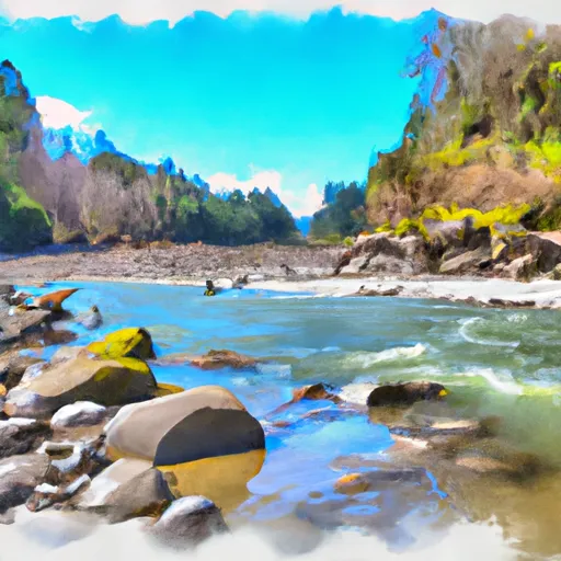
Sandy River
The river includes several notable rapids and obstacles, including the Four Foot Falls, Carnage Rapid, and the Narrows. The Four Foot Falls is a class IV rapid that features a steep drop and requires precise navigation. Carnage Rapid is another class IV rapid that is known for its large waves and powerful hydraulics. The Narrows is a narrow section of the river that requires tight maneuvering due to the numerous boulders and rocks.
There are specific regulations for the Sandy River area, including the requirement for a permit to launch a watercraft at the Sandy River Delta Park. Additionally, there are specific rules for camping in the area, including the prohibition of fires and camping within 200 feet of the river. It is important to note that the Sandy River can be dangerous during high water and extreme caution should be exercised.
Plan your run down to the hour
Same weather feed Snoflo's iOS app uses -- updated continuously from NOAA / yr.no. Watch the precipitation column on the meteogram; rain ahead of a run typically lifts flows 12-48 hours later depending on the basin.
Next 5 days, hour by hour
Temperature line with weather symbols on top, snow + rain accumulation as columns, humidity as a dotted line.
5-day forecast table
Every 3 hours, broken out across temperature, snow, rain, humidity, and wind. Each cell is colour-coded relative to the column min/max.
| Time | Condition | Temp (°F) | Snow (in) | Rain (in) | Humidity (%) | Wind (mps) | Wind dir |
|---|---|---|---|---|---|---|---|
| Loading detailed forecast… | |||||||
15-day temperature & precipitation
Daily temperatures, snow, and rain projected over the next two weeks -- the upstream story that drives next week's flows.
Regional streamflow levels
USGS streamgauges around Sandy River -- useful for spotting upstream pulses and gauging which tributary is contributing what.
| Streamgauge | Discharge | View |
|---|---|---|
| Sandy River Near Marmot | 277 cfs | → |
| South Fork Bull Run River Near Bull Run | 10 cfs | → |
| Fir Creek Near Brightwood | 3 cfs | → |
| Little Sandy River Near Bull Run | 13 cfs | → |
| North Fork Bull Run River Near Multnomah Falls | 11 cfs | → |
| Bull Run River Near Bull Run | 28 cfs | → |
Plan a longer trip
The closest boat launches, other paddle runs, and campgrounds so a day on the water can grow into a full weekend.
Boat launches
- Lost Lake Resort
- North Fork Reservoir
- North Shore Hand Launch
- Moore Creek Boat Access Day Site
- Promontory Park
- Dalton Park
Other river runs
- Mt. Hood Wilderness Boundary To Confluence With Sandy River
- Welches Run
- North Fork Clackamas River
- Salmon River Canyon (Split Falls To Road Access)
- Headwaters To North Section Line Of Sec 17, T4s, R5e
Campgrounds
Whitewater safety
- Check the flow before you run
- Use the linked-gauge card and Regional Flow panel above. Class ratings change with flow -- a Class III at low water can become Class IV+ at high water.
- Know your skill ceiling
- Pick runs comfortably below your ceiling. Cold-water and big-water runs raise the consequences of any mistake.
- Wear the right gear
- Helmet, PFD, drysuit / wetsuit when water is below 60°F. Throw bag, knife, and whistle on your person, not in the boat.
- Scout, set safety, and run with a team
- Scout new rapids on foot, set safety with throw bags above the consequence pool, and run with at least one other competent paddler.
- Respect the river
- Strainers, undercuts, low-head dams, and wood can kill at any class rating. When in doubt, portage.
Set push alerts in the Snoflo app
Save Sandy River as a favorite, set a discharge threshold (e.g. "alert me when flow hits 600 cfs"), and the iOS app pushes the moment the linked gauge crosses.
About Sandy River
What's the optimal flow for Sandy River?
The optimal flow depends on the section and the craft. Check the Run Details panel for the linked gauge and current status.
How fresh is the cfs reading on this page?
The linked USGS streamgauge reports continuously (every 15 minutes); Snoflo refreshes throughout the day. Hover the streamflow sparkline to read individual datapoints.
What's the whitewater class?
See the Run Details panel for the class rating Snoflo tracks for this run. Class ratings change with flow -- a Class III at low water can become Class IV in high water.
Where do I put in / take out?
Tap Directions in the hero above to open driving directions to the put-in. For shuttle planning, check the Nearby Boat Launches panel and the river run operator's site.
Can I get alerts when flows hit the optimal range?
Yes -- alerts are managed in the Snoflo iOS app. Favorite this run, set a discharge threshold, and you'll get a push the moment the gauge crosses.
Other runs near here
Snoflo-tracked paddle runs within driving distance of Sandy River.