2026-02-18T17:00:00-07:00
* WHAT...Snow expected. Total snow accumulations between 1 to 4 inches with higher totals up to 10 inches above 7000 feet. * WHERE...South Central Utah, Upper Sevier River Valleys, and Zion National Park. * WHEN...From 8 PM this evening to 5 PM MST Wednesday. * IMPACTS...Winter driving conditions are likely.
Summary
The ideal streamflow range for this run is between 200-400 cfs, with higher flows creating more difficult rapids. The run is classified as Class III-IV, with some sections reaching Class V during high water.
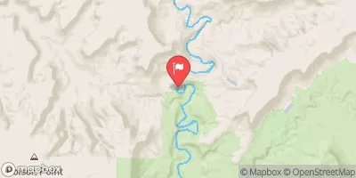
The segment mileage of the Whitewater River Run is approximately 25 miles, taking paddlers through scenic canyons and challenging rapids. Some of the specific rapids and obstacles along the run include The Narrows, where the river narrows and becomes more technical, as well as Halls Creek Rapid, a Class IV drop with a large boulder in the middle.
There are specific regulations to the area that paddlers must follow, including obtaining a permit from the Bureau of Land Management before entering the run. Additionally, all paddlers must wear a properly fitting life jacket and a helmet while on the river.
°F
°F
mph
Wind
%
Humidity
15-Day Weather Outlook
River Run Details
| Last Updated | 2026-02-07 |
| River Levels | 162 cfs (6.14 ft) |
| Percent of Normal | 74% |
| Status | |
| Class Level | iii-iv |
| Elevation | ft |
| Run Length | 4.0 Mi |
| Streamflow Discharge | cfs |
| Gauge Height | ft |
| Reporting Streamgage | USGS 09333500 |
5-Day Hourly Forecast Detail
Nearby Streamflow Levels
Area Campgrounds
| Location | Reservations | Toilets |
|---|---|---|
 Hall's Crossing Campground
|
||
 Halls Crossing - Glen Canyon National Rec Area
|
||
 Hall's Crossing Village
|
||
 Bullfrog camp 7-1-2018
|


 Headwaters At T39S, R9E To Confluence With Escalante River
 Headwaters To Confluence With Colorado River
 Fence Canyon
 Headwaters At T39S, R9E To Confluence With Escalante River
 Cow Canyon
 Headwaters At T38S, R9E To Confluence With Fence Canyon Creek