Trial Lake To U35 Bridge River Run
Community Reviews
Been here? Share the conditions.
Reviews, ratings & photos are added in the free Snoflo iOS app — rate a spot, tag the conditions, and your visit is verified by location. Add or manage your reviews from the app.
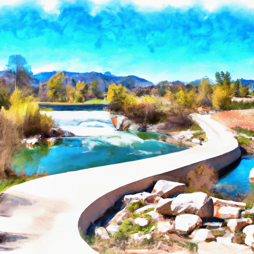
Trial Lake To U35 Bridge
There are several rapids and obstacles on this stretch of the river, including the Three Forks rapid, which has a large, technical drop, and the Narrows, which is a steep and narrow section of the river. There are also several other class III-IV rapids, including Hells Hole and the Box.
There are specific regulations to the area, including a requirement for personal floatation devices (PFDs) and helmets for all boaters. There are also restrictions on camping and fires in the area, as well as regulations on fishing and hunting.
Plan your run down to the hour
Same weather feed Snoflo's iOS app uses -- updated continuously from NOAA / yr.no. Watch the precipitation column on the meteogram; rain ahead of a run typically lifts flows 12-48 hours later depending on the basin.
Next 5 days, hour by hour
Temperature line with weather symbols on top, snow + rain accumulation as columns, humidity as a dotted line.
5-day forecast table
Every 3 hours, broken out across temperature, snow, rain, humidity, and wind. Each cell is colour-coded relative to the column min/max.
| Time | Condition | Temp (°F) | Snow (in) | Rain (in) | Humidity (%) | Wind (mps) | Wind dir |
|---|---|---|---|---|---|---|---|
| Loading detailed forecast… | |||||||
15-day temperature & precipitation
Daily temperatures, snow, and rain projected over the next two weeks -- the upstream story that drives next week's flows.
Regional streamflow levels
USGS streamgauges around Trial Lake To U35 Bridge -- useful for spotting upstream pulses and gauging which tributary is contributing what.
| Streamgauge | Discharge | View |
|---|---|---|
| Provo River Near Woodland | 54 cfs | → |
| Provo River Near Hailstone | 24 cfs | → |
| Weber River Near Oakley | 89 cfs | → |
| Provo River At River Road Bridge | 178 cfs | → |
| Provo River Near Charleston | 228 cfs | → |
| Snake Creek Near Charleston | 24 cfs | → |
Plan a longer trip
The closest boat launches, other paddle runs, and campgrounds so a day on the water can grow into a full weekend.
Boat launches
- Rock Cliff Boat Ramp
- Smith And Morehouse West
- Smith And Morehouse East
- Jordanelle State Park - Hailstone North
- State Route 319 Wasatch County
- Forest Service Road Wasatch County
Other river runs
- Source To Nf Boundary
- Upper Slate Gorge
- Upper Provo Falls
- Middle Provo (Jordanelle To Deer Creek)
- Source To Mouth
Campgrounds
- Lower Provo River Campground
- Lower Provo River
- Horsemen Camps Campground
- Shingle Creek Atv Campground
- Shingle Creek Atv
- Taylors Fork Atv
Fishing spots
Parks
Whitewater safety
- Check the flow before you run
- Use the linked-gauge card and Regional Flow panel above. Class ratings change with flow -- a Class III at low water can become Class IV+ at high water.
- Know your skill ceiling
- Pick runs comfortably below your ceiling. Cold-water and big-water runs raise the consequences of any mistake.
- Wear the right gear
- Helmet, PFD, drysuit / wetsuit when water is below 60°F. Throw bag, knife, and whistle on your person, not in the boat.
- Scout, set safety, and run with a team
- Scout new rapids on foot, set safety with throw bags above the consequence pool, and run with at least one other competent paddler.
- Respect the river
- Strainers, undercuts, low-head dams, and wood can kill at any class rating. When in doubt, portage.
Set push alerts in the Snoflo app
Save Trial Lake To U35 Bridge as a favorite, set a discharge threshold (e.g. "alert me when flow hits 600 cfs"), and the iOS app pushes the moment the linked gauge crosses.
About Trial Lake To U35 Bridge
What's the optimal flow for Trial Lake To U35 Bridge?
The optimal flow depends on the section and the craft. Check the Run Details panel for the linked gauge and current status.
How fresh is the cfs reading on this page?
The linked USGS streamgauge reports continuously (every 15 minutes); Snoflo refreshes throughout the day. Hover the streamflow sparkline to read individual datapoints.
What's the whitewater class?
See the Run Details panel for the class rating Snoflo tracks for this run. Class ratings change with flow -- a Class III at low water can become Class IV in high water.
Where do I put in / take out?
Tap Directions in the hero above to open driving directions to the put-in. For shuttle planning, check the Nearby Boat Launches panel and the river run operator's site.
Can I get alerts when flows hit the optimal range?
Yes -- alerts are managed in the Snoflo iOS app. Favorite this run, set a discharge threshold, and you'll get a push the moment the gauge crosses.
Other runs near here
Snoflo-tracked paddle runs within driving distance of Trial Lake To U35 Bridge.