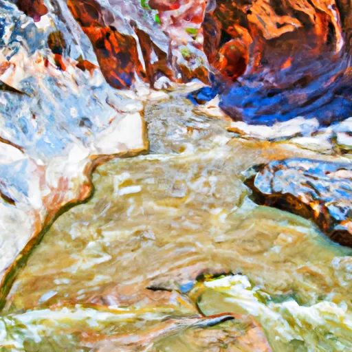
Hell Dive Canyon Segment 30-31 river run
Community Reviews
Been here? Share the conditions.
Reviews, ratings & photos are added in the free Snoflo iOS app — rate a spot, tag the conditions, and your visit is verified by location. Add or manage your reviews from the app.
Hell Dive Canyon Segment 30-31
One of the most challenging rapids in this segment is called Hell Hole, which is a narrow and technical rapid with a steep drop. Another notable obstacle is the Squeezebox, which requires precise navigation through a narrow channel between rocks. The rapids in this segment are continuous and can be physically demanding, making it important for rafters to be in good physical shape.
Specific regulations for this area require all boaters to wear personal flotation devices, and children under the age of 13 must wear a helmet. Commercial guides must also hold a permit from the Bureau of Land Management to operate in this area.
Plan your run down to the hour
Same weather feed Snoflo's iOS app uses -- updated continuously from NOAA / yr.no. Watch the precipitation column on the meteogram; rain ahead of a run typically lifts flows 12-48 hours later depending on the basin.
Next 5 days, hour by hour
Temperature line with weather symbols on top, snow + rain accumulation as columns, humidity as a dotted line.
5-day forecast table
Every 3 hours, broken out across temperature, snow, rain, humidity, and wind. Each cell is colour-coded relative to the column min/max.
| Time | Condition | Temp (°F) | Snow (in) | Rain (in) | Humidity (%) | Wind (mps) | Wind dir |
|---|---|---|---|---|---|---|---|
| Loading detailed forecast… | |||||||
15-day temperature & precipitation
Daily temperatures, snow, and rain projected over the next two weeks -- the upstream story that drives next week's flows.
Regional streamflow levels
USGS streamgauges around Hell Dive Canyon Segment 30-31 -- useful for spotting upstream pulses and gauging which tributary is contributing what.
| Streamgauge | Discharge | View |
|---|---|---|
| Kanab Creek Near Kanab | 3 cfs | → |
| East Fork Virgin River Near Springdale | 38 cfs | → |
| East Fork Virgin River Near Glendale | 4 cfs | → |
| North Fork Virgin River Near Springdale | 25 cfs | → |
| Virgin River At Virgin | 49 cfs | → |
| Virgin River Ab La Verkin Creek Nr La Verkin | 36 cfs | → |
Plan a longer trip
The closest boat launches, other paddle runs, and campgrounds so a day on the water can grow into a full weekend.
Other river runs
- Indian Canyon Seg 24-25, North Branch South Fork
- Water Canyon Segment 20-21
- Cottonwood Creek Segment 28-29
- Indian Canyon Segment 26-27
- Indian Canyon, South Fork Segment 22-23
Campgrounds
- Ponderosa Grove Campground
- Ponderosa Grove - Coral Pink Sand Dunes
- Meadows Dispersed - Coral Pink Sand Dunes
- Kanab Rv Corral
- Coral Pink Sand Dunes State Park
- Mount Carmel Free Campsite
Parks
- Jacob Hamblin Park
- Coral Pink Sand Dunes State Park
- Pipe Spring National Monument
- Cottonwood Point Wilderness
- Wilderness Zion Wilderness (Draft Boundary)
- Zion National Park
Points of interest
- Hidden Lake Recreation Site
- Oos'eev Yucca Kanabensis Yucca Interpretive Exhibit
- Powell's Surveyors At Pipe Spring Interpretive Exhibit
- Kwi'-Uv Quercus Turbinella Scrub Live-Oak Interpretive Exhibit
- A New National Monument Interpretive Exhibit
- Stephen Tyng Mather Interpretive Exhibit
Whitewater safety
- Check the flow before you run
- Use the linked-gauge card and Regional Flow panel above. Class ratings change with flow -- a Class III at low water can become Class IV+ at high water.
- Know your skill ceiling
- Pick runs comfortably below your ceiling. Cold-water and big-water runs raise the consequences of any mistake.
- Wear the right gear
- Helmet, PFD, drysuit / wetsuit when water is below 60°F. Throw bag, knife, and whistle on your person, not in the boat.
- Scout, set safety, and run with a team
- Scout new rapids on foot, set safety with throw bags above the consequence pool, and run with at least one other competent paddler.
- Respect the river
- Strainers, undercuts, low-head dams, and wood can kill at any class rating. When in doubt, portage.
Set push alerts in the Snoflo app
Save Hell Dive Canyon Segment 30-31 as a favorite, set a discharge threshold (e.g. "alert me when flow hits 600 cfs"), and the iOS app pushes the moment the linked gauge crosses.
About Hell Dive Canyon Segment 30-31
What's the optimal flow for Hell Dive Canyon Segment 30-31?
The optimal flow depends on the section and the craft. Check the Run Details panel for the linked gauge and current status.
How fresh is the cfs reading on this page?
The linked USGS streamgauge reports continuously (every 15 minutes); Snoflo refreshes throughout the day. Hover the streamflow sparkline to read individual datapoints.
What's the whitewater class?
See the Run Details panel for the class rating Snoflo tracks for this run. Class ratings change with flow -- a Class III at low water can become Class IV in high water.
Where do I put in / take out?
Tap Directions in the hero above to open driving directions to the put-in. For shuttle planning, check the Nearby Boat Launches panel and the river run operator's site.
Can I get alerts when flows hit the optimal range?
Yes -- alerts are managed in the Snoflo iOS app. Favorite this run, set a discharge threshold, and you'll get a push the moment the gauge crosses.
Other runs near here
Snoflo-tracked paddle runs within driving distance of Hell Dive Canyon Segment 30-31.