Cottonwood Creek Segment 28-29 River Run
Community Reviews
Been here? Share the conditions.
Reviews, ratings & photos are added in the free Snoflo iOS app — rate a spot, tag the conditions, and your visit is verified by location. Add or manage your reviews from the app.
Cottonwood Creek Segment 28-29
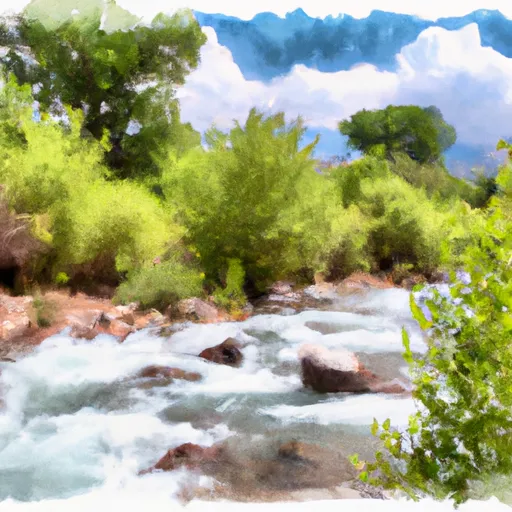
The Cottonwood Creek Segment 28-29 is a popular whitewater river run located in the state of Utah. The ideal streamflow range for this segment is between 300-600 cfs. The class rating for this run is Class IV-V, making it a challenging and exhilarating experience for experienced paddlers. The segment mileage is approximately 4.5 miles long, starting at the Cottonwood Creek Bridge and ending at the confluence with the Colorado River.
The Cottonwood Creek Segment is known for its technical rapids, steep drops, and boulder gardens. This particular stretch of the river features several challenging class V rapids such as "The Squeeze" and "The Meatgrinder". Paddlers should be aware of other potential hazards such as strainers, undercut rocks, and strong currents.
In terms of regulations, paddlers must obtain a permit to run this section of the river. The permit can be obtained through the Bureau of Land Management and is required between March 1st and June 30th. The permit system helps to limit the amount of traffic on the river and ensure that everyone adheres to safety protocols.
Overall, the Cottonwood Creek Segment 28-29 is a thrilling and challenging whitewater river run for experienced paddlers. It is important for paddlers to be aware of the ideal streamflow range, class rating, specific rapids and obstacles, and regulations in order to ensure a safe and enjoyable experience on the water.
Plan your run down to the hour
Same weather feed Snoflo's iOS app uses -- updated continuously from NOAA / yr.no. Watch the precipitation column on the meteogram; rain ahead of a run typically lifts flows 12-48 hours later depending on the basin.
Next 5 days, hour by hour
Temperature line with weather symbols on top, snow + rain accumulation as columns, humidity as a dotted line.
5-day forecast table
Every 3 hours, broken out across temperature, snow, rain, humidity, and wind. Each cell is colour-coded relative to the column min/max.
| Time | Condition | Temp (°F) | Snow (in) | Rain (in) | Humidity (%) | Wind (mps) | Wind dir |
|---|---|---|---|---|---|---|---|
| Loading detailed forecast… | |||||||
15-day temperature & precipitation
Daily temperatures, snow, and rain projected over the next two weeks -- the upstream story that drives next week's flows.
Regional streamflow levels
USGS streamgauges around Cottonwood Creek Segment 28-29 -- useful for spotting upstream pulses and gauging which tributary is contributing what.
| Streamgauge | Discharge | View |
|---|---|---|
| Kanab Creek Near Kanab | 3 cfs | → |
| East Fork Virgin River Near Glendale | 4 cfs | → |
| East Fork Virgin River Near Springdale | 46 cfs | → |
| North Fork Virgin River Near Springdale | 38 cfs | → |
| Virgin River At Virgin | 74 cfs | → |
| Virgin River Ab La Verkin Creek Nr La Verkin | 52 cfs | → |
Plan a longer trip
The closest boat launches, other paddle runs, and campgrounds so a day on the water can grow into a full weekend.
Other river runs
- Indian Canyon Seg 24-25, North Branch South Fork
- Indian Canyon Segment 26-27
- Hell Dive Canyon Segment 30-31
- Indian Canyon, South Fork Segment 22-23
- Water Canyon Segment 20-21
Campgrounds
- Ponderosa Grove Campground
- Ponderosa Grove - Coral Pink Sand Dunes
- Meadows Dispersed - Coral Pink Sand Dunes
- Kanab Rv Corral
- Coral Pink Sand Dunes State Park
- Mount Carmel Free Campsite
Whitewater safety
- Check the flow before you run
- Use the linked-gauge card and Regional Flow panel above. Class ratings change with flow -- a Class III at low water can become Class IV+ at high water.
- Know your skill ceiling
- Pick runs comfortably below your ceiling. Cold-water and big-water runs raise the consequences of any mistake.
- Wear the right gear
- Helmet, PFD, drysuit / wetsuit when water is below 60°F. Throw bag, knife, and whistle on your person, not in the boat.
- Scout, set safety, and run with a team
- Scout new rapids on foot, set safety with throw bags above the consequence pool, and run with at least one other competent paddler.
- Respect the river
- Strainers, undercuts, low-head dams, and wood can kill at any class rating. When in doubt, portage.
Set push alerts in the Snoflo app
Save Cottonwood Creek Segment 28-29 as a favorite, set a discharge threshold (e.g. "alert me when flow hits 600 cfs"), and the iOS app pushes the moment the linked gauge crosses.
About Cottonwood Creek Segment 28-29
What's the optimal flow for Cottonwood Creek Segment 28-29?
The optimal flow depends on the section and the craft. Check the Run Details panel for the linked gauge and current status.
How fresh is the cfs reading on this page?
The linked USGS streamgauge reports continuously (every 15 minutes); Snoflo refreshes throughout the day. Hover the streamflow sparkline to read individual datapoints.
What's the whitewater class?
See the Run Details panel for the class rating Snoflo tracks for this run. Class ratings change with flow -- a Class III at low water can become Class IV in high water.
Where do I put in / take out?
Tap Directions in the hero above to open driving directions to the put-in. For shuttle planning, check the Nearby Boat Launches panel and the river run operator's site.
Can I get alerts when flows hit the optimal range?
Yes -- alerts are managed in the Snoflo iOS app. Favorite this run, set a discharge threshold, and you'll get a push the moment the gauge crosses.
Other runs near here
Snoflo-tracked paddle runs within driving distance of Cottonwood Creek Segment 28-29.