Ford Where Route 609 Departs From Route 678 To Confluence With Cowpasture River River Run
Community Reviews
Been here? Share the conditions.
Reviews, ratings & photos are added in the free Snoflo iOS app — rate a spot, tag the conditions, and your visit is verified by location. Add or manage your reviews from the app.
Ford Where Route 609 Departs From Route 678 To Confluence With Cowpasture River
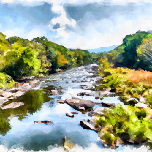
The class rating for the Whitewater River Run is Class III to IV, with several Class IV rapids along the way. Some of the notable rapids include "Pinball", "The Chute", and "Gobbler's Knob". These rapids are known for their technical difficulty and require skilled navigation.
There are specific regulations that must be followed when paddling in this area. All boaters must wear a properly fitting Personal Floatation Device (PFD) at all times on the river. Additionally, there are no camping or fires allowed in the immediate area. It is important to check for any additional regulations before embarking on this run.
In conclusion, the Whitewater River Run in Virginia offers a challenging and exciting experience for whitewater enthusiasts. The ideal streamflow range, class rating, segment mileage, specific rapids, and regulations must all be taken into consideration before beginning this adventure. It is important to follow all regulations and safety measures to ensure a safe and enjoyable trip.
Plan your run down to the hour
Same weather feed Snoflo's iOS app uses -- updated continuously from NOAA / yr.no. Watch the precipitation column on the meteogram; rain ahead of a run typically lifts flows 12-48 hours later depending on the basin.
Next 5 days, hour by hour
Temperature line with weather symbols on top, snow + rain accumulation as columns, humidity as a dotted line.
5-day forecast table
Every 3 hours, broken out across temperature, snow, rain, humidity, and wind. Each cell is colour-coded relative to the column min/max.
| Time | Condition | Temp (°F) | Snow (in) | Rain (in) | Humidity (%) | Wind (mps) | Wind dir |
|---|---|---|---|---|---|---|---|
| Loading detailed forecast… | |||||||
15-day temperature & precipitation
Daily temperatures, snow, and rain projected over the next two weeks -- the upstream story that drives next week's flows.
Regional streamflow levels
USGS streamgauges around Ford Where Route 609 Departs From Route 678 To Confluence With Cowpasture River -- useful for spotting upstream pulses and gauging which tributary is contributing what.
| Streamgauge | Discharge | View |
|---|---|---|
| Bullpasture River At Williamsville | 31 cfs | → |
| Back Creek Near Sunrise | 6 cfs | → |
| Back Creek At Sunrise | 26 cfs | → |
| Little Back Creek Near Sunrise | 4 cfs | → |
| Calfpasture River Above Mill Creek At Goshen | 9 cfs | → |
| Back Creek Near Mountain Grove | 32 cfs | → |
Plan a longer trip
The closest boat launches, other paddle runs, and campgrounds so a day on the water can grow into a full weekend.
Other river runs
- Segment B--Northern Boundary, Hidden Valley Tract To Southern Boundary Of Hidden Valley Tract
- Segment B--Pump Storage Lake To Blowing Springs Campground
- Segment C--Southern Boundary Hidden Valley Tract To Mcclintic Bridge
- Segment A--State Route 39 At Blowing Springs Campground To Lake Moomaw
- Segment B--Confluence With Bullpasture River To Route 42 Bridge
Campgrounds
- Shaws Fork Equestrian Campground
- Bird Run
- Hidden Valley Recreation Area
- Camp Nimrod
- Camp Ross Site 1
- Camp Ross Site 2
Whitewater safety
- Check the flow before you run
- Use the linked-gauge card and Regional Flow panel above. Class ratings change with flow -- a Class III at low water can become Class IV+ at high water.
- Know your skill ceiling
- Pick runs comfortably below your ceiling. Cold-water and big-water runs raise the consequences of any mistake.
- Wear the right gear
- Helmet, PFD, drysuit / wetsuit when water is below 60°F. Throw bag, knife, and whistle on your person, not in the boat.
- Scout, set safety, and run with a team
- Scout new rapids on foot, set safety with throw bags above the consequence pool, and run with at least one other competent paddler.
- Respect the river
- Strainers, undercuts, low-head dams, and wood can kill at any class rating. When in doubt, portage.
Set push alerts in the Snoflo app
Save Ford Where Route 609 Departs From Route 678 To Confluence With Cowpasture River as a favorite, set a discharge threshold (e.g. "alert me when flow hits 600 cfs"), and the iOS app pushes the moment the linked gauge crosses.
About Ford Where Route 609 Departs From Route 678 To Confluence With Cowpasture River
What's the optimal flow for Ford Where Route 609 Departs From Route 678 To Confluence With Cowpasture River?
The optimal flow depends on the section and the craft. Check the Run Details panel for the linked gauge and current status.
How fresh is the cfs reading on this page?
The linked USGS streamgauge reports continuously (every 15 minutes); Snoflo refreshes throughout the day. Hover the streamflow sparkline to read individual datapoints.
What's the whitewater class?
See the Run Details panel for the class rating Snoflo tracks for this run. Class ratings change with flow -- a Class III at low water can become Class IV in high water.
Where do I put in / take out?
Tap Directions in the hero above to open driving directions to the put-in. For shuttle planning, check the Nearby Boat Launches panel and the river run operator's site.
Can I get alerts when flows hit the optimal range?
Yes -- alerts are managed in the Snoflo iOS app. Favorite this run, set a discharge threshold, and you'll get a push the moment the gauge crosses.
Other runs near here
Snoflo-tracked paddle runs within driving distance of Ford Where Route 609 Departs From Route 678 To Confluence With Cowpasture River.