Headwaters And Includes All Tributaries To Confluence With Quinault River River Run
Community Reviews
Been here? Share the conditions.
Reviews, ratings & photos are added in the free Snoflo iOS app — rate a spot, tag the conditions, and your visit is verified by location. Add or manage your reviews from the app.
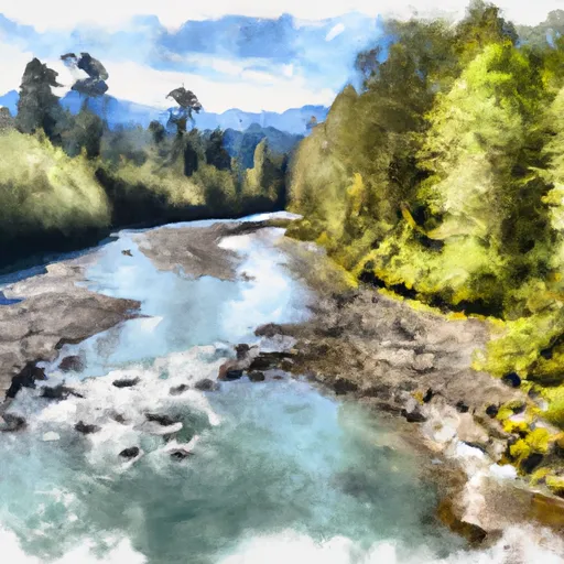
Headwaters And Includes All Tributaries To Confluence With Quinault River
The area is regulated, and visitors are required to obtain a permit from the Quinault Indian Nation. The permit allows visitors to access the river, and there are specific rules and guidelines to adhere to, including carrying out all trash and waste, using biodegradable soap, and not disturbing any cultural or historical sites. Additionally, visitors are required to practice low-impact camping techniques, including camping only in designated areas and not camping within 200 feet of the river.
In conclusion, the Whitewater River Run is an exciting and challenging destination for kayaking and rafting enthusiasts. With its ideal streamflow range, class rating, segment mileage, and specific rapids and obstacles, the run offers an exhilarating experience for visitors. Visitors are required to obtain permits and follow specific regulations to preserve the area's natural and cultural resources.
Plan your run down to the hour
Same weather feed Snoflo's iOS app uses -- updated continuously from NOAA / yr.no. Watch the precipitation column on the meteogram; rain ahead of a run typically lifts flows 12-48 hours later depending on the basin.
Next 5 days, hour by hour
Temperature line with weather symbols on top, snow + rain accumulation as columns, humidity as a dotted line.
5-day forecast table
Every 3 hours, broken out across temperature, snow, rain, humidity, and wind. Each cell is colour-coded relative to the column min/max.
| Time | Condition | Temp (°F) | Snow (in) | Rain (in) | Humidity (%) | Wind (mps) | Wind dir |
|---|---|---|---|---|---|---|---|
| Loading detailed forecast… | |||||||
15-day temperature & precipitation
Daily temperatures, snow, and rain projected over the next two weeks -- the upstream story that drives next week's flows.
Regional streamflow levels
USGS streamgauges around Headwaters And Includes All Tributaries To Confluence With Quinault River -- useful for spotting upstream pulses and gauging which tributary is contributing what.
| Streamgauge | Discharge | View |
|---|---|---|
| Nf Skokomish R Bl Staircase Rpds Nr Hoodsport | 60 cfs | → |
| Wynoochee River Near Grisdale | 235 cfs | → |
| South Fork Skokomish River Near Union | 121 cfs | → |
| North Fork Skokomish River Near Potlatch | 154 cfs | → |
| Duckabush River Near Brinnon | 68 cfs | → |
| Skokomish River Near Potlatch | 235 cfs | → |
Plan a longer trip
The closest boat launches, other paddle runs, and campgrounds so a day on the water can grow into a full weekend.
Boat launches
Other river runs
- Headwaters- Includes All Tributaries To Confluence With North Fork Skokomish River
- Headwaters- Includes All Tributaries And Excludes Flapjack Lakes To Confluence With North Fork Skokomish River
Campgrounds
Parks
- Wilderness Wonder Mountain
- Wilderness Mount Skokomish
- Lake Cushman State Park
- Hoodsport Park Trail
- Wilderness The Brothers
- Wilderness Colonel Bob
Points of interest
Whitewater safety
- Check the flow before you run
- Use the linked-gauge card and Regional Flow panel above. Class ratings change with flow -- a Class III at low water can become Class IV+ at high water.
- Know your skill ceiling
- Pick runs comfortably below your ceiling. Cold-water and big-water runs raise the consequences of any mistake.
- Wear the right gear
- Helmet, PFD, drysuit / wetsuit when water is below 60°F. Throw bag, knife, and whistle on your person, not in the boat.
- Scout, set safety, and run with a team
- Scout new rapids on foot, set safety with throw bags above the consequence pool, and run with at least one other competent paddler.
- Respect the river
- Strainers, undercuts, low-head dams, and wood can kill at any class rating. When in doubt, portage.
Set push alerts in the Snoflo app
Save Headwaters And Includes All Tributaries To Confluence With Quinault River as a favorite, set a discharge threshold (e.g. "alert me when flow hits 600 cfs"), and the iOS app pushes the moment the linked gauge crosses.
About Headwaters And Includes All Tributaries To Confluence With Quinault River
What's the optimal flow for Headwaters And Includes All Tributaries To Confluence With Quinault River?
The optimal flow depends on the section and the craft. Check the Run Details panel for the linked gauge and current status.
How fresh is the cfs reading on this page?
The linked USGS streamgauge reports continuously (every 15 minutes); Snoflo refreshes throughout the day. Hover the streamflow sparkline to read individual datapoints.
What's the whitewater class?
See the Run Details panel for the class rating Snoflo tracks for this run. Class ratings change with flow -- a Class III at low water can become Class IV in high water.
Where do I put in / take out?
Tap Directions in the hero above to open driving directions to the put-in. For shuttle planning, check the Nearby Boat Launches panel and the river run operator's site.
Can I get alerts when flows hit the optimal range?
Yes -- alerts are managed in the Snoflo iOS app. Favorite this run, set a discharge threshold, and you'll get a push the moment the gauge crosses.
Other runs near here
Snoflo-tracked paddle runs within driving distance of Headwaters And Includes All Tributaries To Confluence With Quinault River.