Alpine Lakes Wilderness Boundary To Confluence With West Fork Miller River River Run
Community Reviews
Been here? Share the conditions.
Reviews, ratings & photos are added in the free Snoflo iOS app — rate a spot, tag the conditions, and your visit is verified by location. Add or manage your reviews from the app.
Alpine Lakes Wilderness Boundary To Confluence With West Fork Miller River
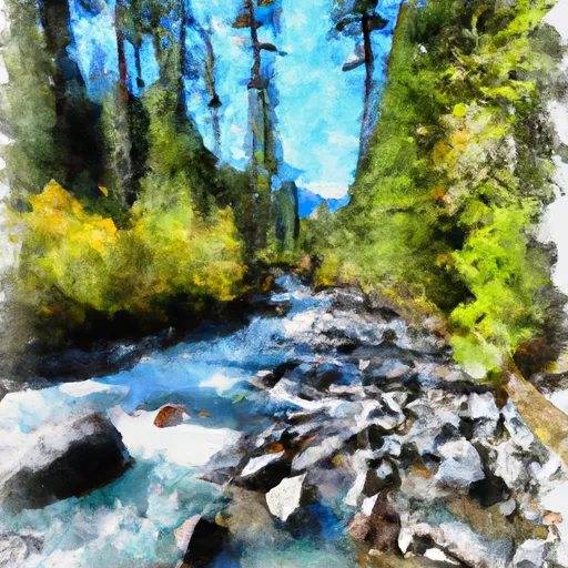
The Whitewater River run features several exciting rapids and obstacles, including Boulder Drop, Pinball, and Tippy Canoe. Boulder Drop is a class IV rapid with a large boulder in the middle of the river, creating a challenging and technical route. Pinball is a series of class III rapids with fast-moving water and tight turns, while Tippy Canoe is a fun and challenging class III rapid with a steep drop.
To ensure the safety of all participants, the Forest Service has established several regulations for the Whitewater River run. These include a mandatory portage around the Upper Boulder Drop rapid, a prohibition on camping within 200 feet of the river, and a requirement to pack out all trash and waste. Additionally, all participants are required to wear a properly fitting personal flotation device (PFD) and helmets are strongly recommended.
In summary, the Whitewater River run is a challenging and exciting whitewater experience that spans 5.2 miles and features several class III-IV rapids and obstacles. The ideal streamflow range is between 300 and 1,000 cfs, and participants must adhere to specific regulations to ensure their safety and protect the natural environment.
Plan your run down to the hour
Same weather feed Snoflo's iOS app uses -- updated continuously from NOAA / yr.no. Watch the precipitation column on the meteogram; rain ahead of a run typically lifts flows 12-48 hours later depending on the basin.
Next 5 days, hour by hour
Temperature line with weather symbols on top, snow + rain accumulation as columns, humidity as a dotted line.
5-day forecast table
Every 3 hours, broken out across temperature, snow, rain, humidity, and wind. Each cell is colour-coded relative to the column min/max.
| Time | Condition | Temp (°F) | Snow (in) | Rain (in) | Humidity (%) | Wind (mps) | Wind dir |
|---|---|---|---|---|---|---|---|
| Loading detailed forecast… | |||||||
15-day temperature & precipitation
Daily temperatures, snow, and rain projected over the next two weeks -- the upstream story that drives next week's flows.
Regional streamflow levels
USGS streamgauges around Alpine Lakes Wilderness Boundary To Confluence With West Fork Miller River -- useful for spotting upstream pulses and gauging which tributary is contributing what.
| Streamgauge | Discharge | View |
|---|---|---|
| South Fork Tolt River Near Index | 5 cfs | → |
| South Fork Tolt River Near Carnation | 67 cfs | → |
| Nf Snoqualmie River Near Snoqualmie Falls | 68 cfs | → |
| Skykomish River Near Gold Bar | 738 cfs | → |
| Middle Fork Snoqualmie River Near Tanner | 215 cfs | → |
| Sf Tolt River Bl Regulating Basin Nr Carnation | 73 cfs | → |
Plan a longer trip
The closest boat launches, other paddle runs, and campgrounds so a day on the water can grow into a full weekend.
Other river runs
- Alpine Lakes Wilderness Boundary To Confluence With East Fork Miller River
- Confluence Of East And West Forks Of Miller River To Confluence With South Fork Skykomish River
- Headwaters In Se1/4 Of Sec 31, T24 1/2n, R11e To Alpine Lakes Wilderness Boundary
- Confluence Of East And West Forks Of Foss River To Confluence With Tye River
- Headwaters In Se 1/4 Of Sec 14, T26n, R13e To Confluence With Foss River
Whitewater safety
- Check the flow before you run
- Use the linked-gauge card and Regional Flow panel above. Class ratings change with flow -- a Class III at low water can become Class IV+ at high water.
- Know your skill ceiling
- Pick runs comfortably below your ceiling. Cold-water and big-water runs raise the consequences of any mistake.
- Wear the right gear
- Helmet, PFD, drysuit / wetsuit when water is below 60°F. Throw bag, knife, and whistle on your person, not in the boat.
- Scout, set safety, and run with a team
- Scout new rapids on foot, set safety with throw bags above the consequence pool, and run with at least one other competent paddler.
- Respect the river
- Strainers, undercuts, low-head dams, and wood can kill at any class rating. When in doubt, portage.
Set push alerts in the Snoflo app
Save Alpine Lakes Wilderness Boundary To Confluence With West Fork Miller River as a favorite, set a discharge threshold (e.g. "alert me when flow hits 600 cfs"), and the iOS app pushes the moment the linked gauge crosses.
About Alpine Lakes Wilderness Boundary To Confluence With West Fork Miller River
What's the optimal flow for Alpine Lakes Wilderness Boundary To Confluence With West Fork Miller River?
The optimal flow depends on the section and the craft. Check the Run Details panel for the linked gauge and current status.
How fresh is the cfs reading on this page?
The linked USGS streamgauge reports continuously (every 15 minutes); Snoflo refreshes throughout the day. Hover the streamflow sparkline to read individual datapoints.
What's the whitewater class?
See the Run Details panel for the class rating Snoflo tracks for this run. Class ratings change with flow -- a Class III at low water can become Class IV in high water.
Where do I put in / take out?
Tap Directions in the hero above to open driving directions to the put-in. For shuttle planning, check the Nearby Boat Launches panel and the river run operator's site.
Can I get alerts when flows hit the optimal range?
Yes -- alerts are managed in the Snoflo iOS app. Favorite this run, set a discharge threshold, and you'll get a push the moment the gauge crosses.
Other runs near here
Snoflo-tracked paddle runs within driving distance of Alpine Lakes Wilderness Boundary To Confluence With West Fork Miller River.