Hemlock Road Bridge To Gifford Pinchot Nf Boundary River Run
Community Reviews
Been here? Share the conditions.
Reviews, ratings & photos are added in the free Snoflo iOS app — rate a spot, tag the conditions, and your visit is verified by location. Add or manage your reviews from the app.
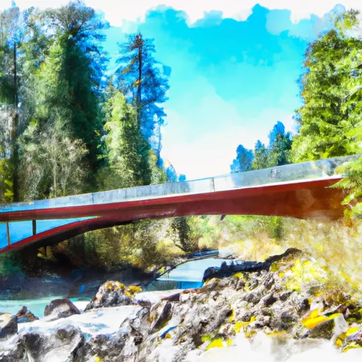
Hemlock Road Bridge To Gifford Pinchot Nf Boundary
This segment of the river is approximately 8.5 miles long and features several notable rapids and obstacles. Some of the most significant rapids include Boulder Drop, a class IV rapid that requires precise navigation through a narrow chute, and The Slot, a challenging class V rapid with a steep drop and tight channel.
There are specific regulations in place for this area. All boaters must have a valid Washington State Discover Pass, and all kayakers and rafters must wear a personal flotation device (PFD) at all times. Additionally, there are restrictions on the use of motors and drones in the area.
Plan your run down to the hour
Same weather feed Snoflo's iOS app uses -- updated continuously from NOAA / yr.no. Watch the precipitation column on the meteogram; rain ahead of a run typically lifts flows 12-48 hours later depending on the basin.
Next 5 days, hour by hour
Temperature line with weather symbols on top, snow + rain accumulation as columns, humidity as a dotted line.
5-day forecast table
Every 3 hours, broken out across temperature, snow, rain, humidity, and wind. Each cell is colour-coded relative to the column min/max.
| Time | Condition | Temp (°F) | Snow (in) | Rain (in) | Humidity (%) | Wind (mps) | Wind dir |
|---|---|---|---|---|---|---|---|
| Loading detailed forecast… | |||||||
15-day temperature & precipitation
Daily temperatures, snow, and rain projected over the next two weeks -- the upstream story that drives next week's flows.
Regional streamflow levels
USGS streamgauges around Hemlock Road Bridge To Gifford Pinchot Nf Boundary -- useful for spotting upstream pulses and gauging which tributary is contributing what.
| Streamgauge | Discharge | View |
|---|---|---|
| White Salmon River Near Underwood | 533 cfs | → |
| Hood River At Tucker Bridge | 246 cfs | → |
| Bull Run River At Lower Flume Nr Brightwood | 20 cfs | → |
| Bull Run River Near Multnomah Falls | 50 cfs | → |
| North Fork Bull Run River Near Multnomah Falls | 12 cfs | → |
| Blazed Alder Creek Near Rhododendron | 3 cfs | → |
Plan a longer trip
The closest boat launches, other paddle runs, and campgrounds so a day on the water can grow into a full weekend.
Boat launches
- Old Hatchery Road (Wind River)
- Stevenson
- Port Of Cascade Locks
- Drano Lake
- Kingsley Campground
- Columbia Trail, North Bonneville
Other river runs
- Headwaters In Sw1/4 Of Sec 13, T6n, R7e To Hemlock Road Bridge In Nw1/4 Of Sec 26, T4n, R7e
- Confluence Clear And Coe Creeks To Mt. Hood Nf Boundary
- Headwaters In Sw 1/4 Of Sec 8, T4n, R6e To Gifford Pinchot Nf Boundary
- Gifford Pinchot Nf Boundary To Maximum Pool Of Swift Reservoir In Nw1/4 Of Sec 35, T7n, R6e
- Confluence With Smith Creek To Confluence With Lewis River
Campgrounds
- Home Valley Campground
- Wyeth - Columbia River Gorge Area
- Wyeth Campground
- Herman Creek
- Deadwood Camp
- Ridge Camp
Whitewater safety
- Check the flow before you run
- Use the linked-gauge card and Regional Flow panel above. Class ratings change with flow -- a Class III at low water can become Class IV+ at high water.
- Know your skill ceiling
- Pick runs comfortably below your ceiling. Cold-water and big-water runs raise the consequences of any mistake.
- Wear the right gear
- Helmet, PFD, drysuit / wetsuit when water is below 60°F. Throw bag, knife, and whistle on your person, not in the boat.
- Scout, set safety, and run with a team
- Scout new rapids on foot, set safety with throw bags above the consequence pool, and run with at least one other competent paddler.
- Respect the river
- Strainers, undercuts, low-head dams, and wood can kill at any class rating. When in doubt, portage.
Set push alerts in the Snoflo app
Save Hemlock Road Bridge To Gifford Pinchot Nf Boundary as a favorite, set a discharge threshold (e.g. "alert me when flow hits 600 cfs"), and the iOS app pushes the moment the linked gauge crosses.
About Hemlock Road Bridge To Gifford Pinchot Nf Boundary
What's the optimal flow for Hemlock Road Bridge To Gifford Pinchot Nf Boundary?
The optimal flow depends on the section and the craft. Check the Run Details panel for the linked gauge and current status.
How fresh is the cfs reading on this page?
The linked USGS streamgauge reports continuously (every 15 minutes); Snoflo refreshes throughout the day. Hover the streamflow sparkline to read individual datapoints.
What's the whitewater class?
See the Run Details panel for the class rating Snoflo tracks for this run. Class ratings change with flow -- a Class III at low water can become Class IV in high water.
Where do I put in / take out?
Tap Directions in the hero above to open driving directions to the put-in. For shuttle planning, check the Nearby Boat Launches panel and the river run operator's site.
Can I get alerts when flows hit the optimal range?
Yes -- alerts are managed in the Snoflo iOS app. Favorite this run, set a discharge threshold, and you'll get a push the moment the gauge crosses.
Other runs near here
Snoflo-tracked paddle runs within driving distance of Hemlock Road Bridge To Gifford Pinchot Nf Boundary.