Shreve Store To Big Bend Campground River Run
Community Reviews
Been here? Share the conditions.
Reviews, ratings & photos are added in the free Snoflo iOS app — rate a spot, tag the conditions, and your visit is verified by location. Add or manage your reviews from the app.
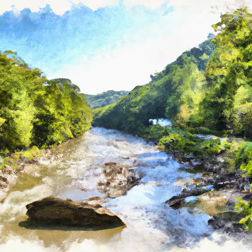
Shreve Store To Big Bend Campground
There are specific regulations to be aware of when paddling in this area. All boaters are required to wear personal flotation devices (PFDs) at all times, and helmets are recommended. Camping is available at designated sites along the river, but fires are only permitted in established fire rings. The river is also home to endangered species such as the West Virginia Spring Salamander, and visitors are asked to respect the natural environment and avoid disturbing wildlife.
Plan your run down to the hour
Same weather feed Snoflo's iOS app uses -- updated continuously from NOAA / yr.no. Watch the precipitation column on the meteogram; rain ahead of a run typically lifts flows 12-48 hours later depending on the basin.
Next 5 days, hour by hour
Temperature line with weather symbols on top, snow + rain accumulation as columns, humidity as a dotted line.
5-day forecast table
Every 3 hours, broken out across temperature, snow, rain, humidity, and wind. Each cell is colour-coded relative to the column min/max.
| Time | Condition | Temp (°F) | Snow (in) | Rain (in) | Humidity (%) | Wind (mps) | Wind dir |
|---|---|---|---|---|---|---|---|
| Loading detailed forecast… | |||||||
15-day temperature & precipitation
Daily temperatures, snow, and rain projected over the next two weeks -- the upstream story that drives next week's flows.
Regional streamflow levels
USGS streamgauges around Shreve Store To Big Bend Campground -- useful for spotting upstream pulses and gauging which tributary is contributing what.
| Streamgauge | Discharge | View |
|---|---|---|
| N F South Br Potomac R At Cabins | 70 cfs | → |
| So. Branch Potomac River Nr Petersburg | 172 cfs | → |
| So Fk South Branch Potomac R Nr Moorefield | 54 cfs | → |
| Blackwater R Nr Davis | 132 cfs | → |
| Blackwater R At Davis | 107 cfs | → |
| So Fk So Br Potomac R At Brandywine | 18 cfs | → |
Plan a longer trip
The closest boat launches, other paddle runs, and campgrounds so a day on the water can grow into a full weekend.
Boat launches
Other river runs
- Big Bend Campground To Canyon Exit (Just Prior To Confluence With North Branch)
- High Ridge Run To Outskirts Of Hopeville
- Jake Hill Road Bridge To Shreve Store
- Canyon Exit To Spruce Knob-Seneca Rocks Nra Boundary
- Perennial Stream At Forks To Dolly Sods Wilderness Boundary
Campgrounds
- Jess Judy Group Campground
- Red Creek Campground
- Princess Snowbird Campground
- Seneca Rocks Rv Resort
- Seneca Shadows Campground
- Camp Run Campground
Fishing spots
- Dry Fork
- Tomahawk Pond Day Use Area
- Briery Branch Day Use Area
- Snowy Creek
- Little Youghiogheny River Reservoir
- Broadford Lake
Whitewater safety
- Check the flow before you run
- Use the linked-gauge card and Regional Flow panel above. Class ratings change with flow -- a Class III at low water can become Class IV+ at high water.
- Know your skill ceiling
- Pick runs comfortably below your ceiling. Cold-water and big-water runs raise the consequences of any mistake.
- Wear the right gear
- Helmet, PFD, drysuit / wetsuit when water is below 60°F. Throw bag, knife, and whistle on your person, not in the boat.
- Scout, set safety, and run with a team
- Scout new rapids on foot, set safety with throw bags above the consequence pool, and run with at least one other competent paddler.
- Respect the river
- Strainers, undercuts, low-head dams, and wood can kill at any class rating. When in doubt, portage.
Set push alerts in the Snoflo app
Save Shreve Store To Big Bend Campground as a favorite, set a discharge threshold (e.g. "alert me when flow hits 600 cfs"), and the iOS app pushes the moment the linked gauge crosses.
About Shreve Store To Big Bend Campground
What's the optimal flow for Shreve Store To Big Bend Campground?
The optimal flow depends on the section and the craft. Check the Run Details panel for the linked gauge and current status.
How fresh is the cfs reading on this page?
The linked USGS streamgauge reports continuously (every 15 minutes); Snoflo refreshes throughout the day. Hover the streamflow sparkline to read individual datapoints.
What's the whitewater class?
See the Run Details panel for the class rating Snoflo tracks for this run. Class ratings change with flow -- a Class III at low water can become Class IV in high water.
Where do I put in / take out?
Tap Directions in the hero above to open driving directions to the put-in. For shuttle planning, check the Nearby Boat Launches panel and the river run operator's site.
Can I get alerts when flows hit the optimal range?
Yes -- alerts are managed in the Snoflo iOS app. Favorite this run, set a discharge threshold, and you'll get a push the moment the gauge crosses.
Other runs near here
Snoflo-tracked paddle runs within driving distance of Shreve Store To Big Bend Campground.