Source, Pickle Pass To Confluence With Hoback River River Run
Community Reviews
Been here? Share the conditions.
Reviews, ratings & photos are added in the free Snoflo iOS app — rate a spot, tag the conditions, and your visit is verified by location. Add or manage your reviews from the app.
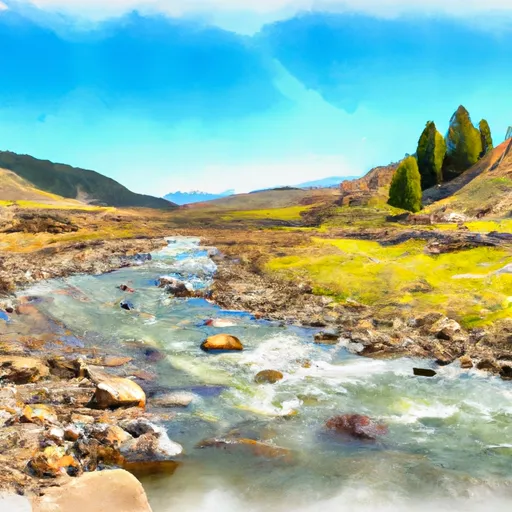
Source, Pickle Pass To Confluence With Hoback River
There are several notable rapids and obstacles on this run, including Lunch Counter, Big Kahuna, and The Wall. Lunch Counter is a large wave train that can be especially challenging at higher flows, while Big Kahuna features a large hole that can be difficult to avoid. The Wall is a steep drop that requires precise navigation to avoid potential hazards.
In terms of regulations, boaters should be aware that this section of the river is subject to seasonal closures to protect nesting birds and other wildlife. Additionally, all boaters are required to wear personal flotation devices at all times while on the water.
Plan your run down to the hour
Same weather feed Snoflo's iOS app uses -- updated continuously from NOAA / yr.no. Watch the precipitation column on the meteogram; rain ahead of a run typically lifts flows 12-48 hours later depending on the basin.
Next 5 days, hour by hour
Temperature line with weather symbols on top, snow + rain accumulation as columns, humidity as a dotted line.
5-day forecast table
Every 3 hours, broken out across temperature, snow, rain, humidity, and wind. Each cell is colour-coded relative to the column min/max.
| Time | Condition | Temp (°F) | Snow (in) | Rain (in) | Humidity (%) | Wind (mps) | Wind dir |
|---|---|---|---|---|---|---|---|
| Loading detailed forecast… | |||||||
15-day temperature & precipitation
Daily temperatures, snow, and rain projected over the next two weeks -- the upstream story that drives next week's flows.
Regional streamflow levels
USGS streamgauges around Source, Pickle Pass To Confluence With Hoback River -- useful for spotting upstream pulses and gauging which tributary is contributing what.
| Streamgauge | Discharge | View |
|---|---|---|
| Snake River Ab Reservoir Nr Alpine Wy | 6,960 cfs | → |
| Snake River Bl Flat Creek Nr Jackson Wy | 6,500 cfs | → |
| Greys River Ab Reservoir Nr Alpine Wy | 371 cfs | → |
| Salt River Ab Reservoir Nr Etna Wy | 333 cfs | → |
| Cache Creek Near Jackson | 11 cfs | → |
| Flat Creek Bel Cache Creek | 162 cfs | → |
Plan a longer trip
The closest boat launches, other paddle runs, and campgrounds so a day on the water can grow into a full weekend.
Boat launches
- Snake River
- East Table Boating Site
- West Table Boating Site
- Taco Hole Kayak Access
- King's Wave Kayak Access
- Sheep Gulch Boating Site
Other river runs
- Trailhead To Confluence With Greys River
- Source To Trailhead
- Source To Cliff Creek Trailhead
- Alpine Canyon (West Table To Sheep Gulch)
- Source To End Of Hoback Road
Campgrounds
- Waterdog Lake Hunting Camp
- Mccain Guard Station
- Hunting Camp
- Elbow
- East Table Creek
- East Table Campground
Fishing spots
Whitewater safety
- Check the flow before you run
- Use the linked-gauge card and Regional Flow panel above. Class ratings change with flow -- a Class III at low water can become Class IV+ at high water.
- Know your skill ceiling
- Pick runs comfortably below your ceiling. Cold-water and big-water runs raise the consequences of any mistake.
- Wear the right gear
- Helmet, PFD, drysuit / wetsuit when water is below 60°F. Throw bag, knife, and whistle on your person, not in the boat.
- Scout, set safety, and run with a team
- Scout new rapids on foot, set safety with throw bags above the consequence pool, and run with at least one other competent paddler.
- Respect the river
- Strainers, undercuts, low-head dams, and wood can kill at any class rating. When in doubt, portage.
Set push alerts in the Snoflo app
Save Source, Pickle Pass To Confluence With Hoback River as a favorite, set a discharge threshold (e.g. "alert me when flow hits 600 cfs"), and the iOS app pushes the moment the linked gauge crosses.
About Source, Pickle Pass To Confluence With Hoback River
What's the optimal flow for Source, Pickle Pass To Confluence With Hoback River?
The optimal flow depends on the section and the craft. Check the Run Details panel for the linked gauge and current status.
How fresh is the cfs reading on this page?
The linked USGS streamgauge reports continuously (every 15 minutes); Snoflo refreshes throughout the day. Hover the streamflow sparkline to read individual datapoints.
What's the whitewater class?
See the Run Details panel for the class rating Snoflo tracks for this run. Class ratings change with flow -- a Class III at low water can become Class IV in high water.
Where do I put in / take out?
Tap Directions in the hero above to open driving directions to the put-in. For shuttle planning, check the Nearby Boat Launches panel and the river run operator's site.
Can I get alerts when flows hit the optimal range?
Yes -- alerts are managed in the Snoflo iOS app. Favorite this run, set a discharge threshold, and you'll get a push the moment the gauge crosses.
Other runs near here
Snoflo-tracked paddle runs within driving distance of Source, Pickle Pass To Confluence With Hoback River.