Green River river run
Green River
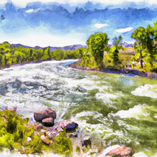
The Green River segment that is most commonly run by whitewater enthusiasts is the 9.7-mile stretch from the Warren Bridge put-in to the campground take-out. This segment includes several notable rapids, including Big Kahuna, the Narrows, and Sinks Canyon. Big Kahuna is a Class III+ rapid that features a steep drop and a large hole, while the Narrows is a technical Class III rapid with tight turns and boulder gardens. Sinks Canyon is a Class IV rapid that requires precise navigation through a series of drops and chutes.
The Green River is regulated by several agencies, including the Bureau of Land Management and the Wyoming Game and Fish Department. Boaters are required to obtain a permit from the Bureau of Land Management and adhere to all rules and regulations set forth by the agency. Additionally, boaters are required to carry appropriate safety equipment, including personal flotation devices and rescue gear. Overall, the Green River offers a challenging and exciting whitewater experience for paddlers of all skill levels.
Plan your run down to the hour
Same weather feed Snoflo's iOS app uses -- updated continuously from NOAA / yr.no. Watch the precipitation column on the meteogram; rain ahead of a run typically lifts flows 12-48 hours later depending on the basin.
Next 5 days, hour by hour
Temperature line with weather symbols on top, snow + rain accumulation as columns, humidity as a dotted line.
5-day forecast table
Every 3 hours, broken out across temperature, snow, rain, humidity, and wind. Each cell is colour-coded relative to the column min/max.
| Time | Condition | Temp (°F) | Snow (in) | Rain (in) | Humidity (%) | Wind (mps) | Wind dir |
|---|---|---|---|---|---|---|---|
| Loading detailed forecast… | |||||||
15-day temperature & precipitation
Daily temperatures, snow, and rain projected over the next two weeks -- the upstream story that drives next week's flows.
Regional streamflow levels
USGS streamgauges around Green River -- useful for spotting upstream pulses and gauging which tributary is contributing what.
| Streamgauge | Discharge | View |
|---|---|---|
| Green River At Warren Bridge | 1,300 cfs | → |
| Pine Creek Above Fremont Lake | 587 cfs | → |
| New Fork River Near Big Piney | 2,110 cfs | → |
| Snake River Bl Flat Creek Nr Jackson Wy | 9,740 cfs | → |
| Dinwoody Creek Above Lakes | 302 cfs | → |
| Snake River Ab Reservoir Nr Alpine Wy | 12,200 cfs | → |
Plan a longer trip
The closest boat launches, other paddle runs, and campgrounds so a day on the water can grow into a full weekend.
Boat launches
- Green River Access Site 3 Boat Launch
- Green River Access Site 2 Boat Launch
- Green River Access Site 1 Boat Ramp
- Green River Access Site 5 Boat Ramp
- Green River Access Site 6 Boat Launch
- Green River Access Site 8 Boat Launch
Campgrounds
- Green River Access Site 3 Campsite 1
- Green River Access Site 3 Campsite 2
- Green River Access Site 3 Campsite 3
- Green River Access Site 2 Campsite 3
- Warren Bridge/Green River Dispersed
- Green River Access Site 2 Campsite 2
Fishing spots
Points of interest
Whitewater safety
- Check the flow before you run
- Use the linked-gauge card and Regional Flow panel above. Class ratings change with flow -- a Class III at low water can become Class IV+ at high water.
- Know your skill ceiling
- Pick runs comfortably below your ceiling. Cold-water and big-water runs raise the consequences of any mistake.
- Wear the right gear
- Helmet, PFD, drysuit / wetsuit when water is below 60°F. Throw bag, knife, and whistle on your person, not in the boat.
- Scout, set safety, and run with a team
- Scout new rapids on foot, set safety with throw bags above the consequence pool, and run with at least one other competent paddler.
- Respect the river
- Strainers, undercuts, low-head dams, and wood can kill at any class rating. When in doubt, portage.
Set push alerts in the Snoflo app
Save Green River as a favorite, set a discharge threshold (e.g. "alert me when flow hits 600 cfs"), and the iOS app pushes the moment the linked gauge crosses.
About Green River
What's the optimal flow for Green River?
The optimal flow depends on the section and the craft. Check the Run Details panel for the linked gauge and current status.
How fresh is the cfs reading on this page?
The linked USGS streamgauge reports continuously (every 15 minutes); Snoflo refreshes throughout the day. Hover the streamflow sparkline to read individual datapoints.
What's the whitewater class?
See the Run Details panel for the class rating Snoflo tracks for this run. Class ratings change with flow -- a Class III at low water can become Class IV in high water.
Where do I put in / take out?
Tap Directions in the hero above to open driving directions to the put-in. For shuttle planning, check the Nearby Boat Launches panel and the river run operator's site.
Can I get alerts when flows hit the optimal range?
Yes -- alerts are managed in the Snoflo iOS app. Favorite this run, set a discharge threshold, and you'll get a push the moment the gauge crosses.
Other runs near here
Snoflo-tracked paddle runs within driving distance of Green River.