Littlefield Creek River Run
Community Reviews
Been here? Share the conditions.
Reviews, ratings & photos are added in the free Snoflo iOS app — rate a spot, tag the conditions, and your visit is verified by location. Add or manage your reviews from the app.
Littlefield Creek
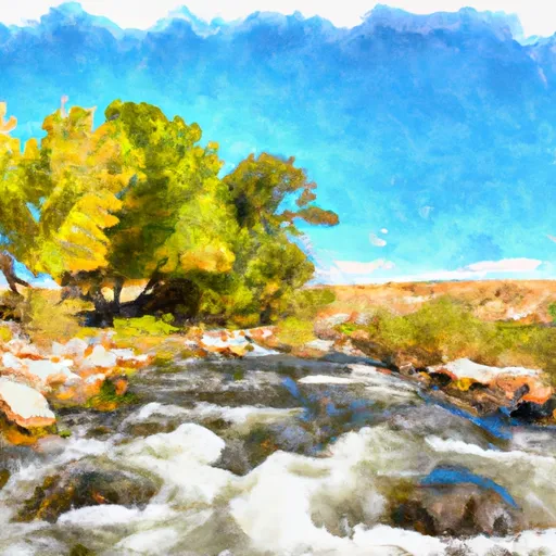
The segment mileage for Littlefield Creek is approximately 7.5 miles, with the put-in located at the Littlefield Creek Campground and the take-out at the confluence with the South Fork of the Shoshone River. Along the way, paddlers will encounter a variety of challenging rapids and obstacles, including drops, boulders, and tight turns.
Specific rapids on Littlefield Creek include "The Slot," a narrow chute with a steep drop, and "Little Niagara," a powerful drop with a large hydraulic at the bottom. Paddlers should also be aware of potential log jams and sweepers, particularly in areas where the creek flows through dense forest.
To ensure safety and protect the natural environment, there are several regulations that apply to Littlefield Creek. Paddlers must obtain a permit from the Shoshone National Forest and follow all rules related to camping, fires, and waste disposal. Additionally, motorized vehicles are not allowed in the creek or on the surrounding trails.
Plan your run down to the hour
Same weather feed Snoflo's iOS app uses -- updated continuously from NOAA / yr.no. Watch the precipitation column on the meteogram; rain ahead of a run typically lifts flows 12-48 hours later depending on the basin.
Next 5 days, hour by hour
Temperature line with weather symbols on top, snow + rain accumulation as columns, humidity as a dotted line.
5-day forecast table
Every 3 hours, broken out across temperature, snow, rain, humidity, and wind. Each cell is colour-coded relative to the column min/max.
| Time | Condition | Temp (°F) | Snow (in) | Rain (in) | Humidity (%) | Wind (mps) | Wind dir |
|---|---|---|---|---|---|---|---|
| Loading detailed forecast… | |||||||
15-day temperature & precipitation
Daily temperatures, snow, and rain projected over the next two weeks -- the upstream story that drives next week's flows.
Regional streamflow levels
USGS streamgauges around Littlefield Creek -- useful for spotting upstream pulses and gauging which tributary is contributing what.
| Streamgauge | Discharge | View |
|---|---|---|
| Jack Creek Above Coyote Draw | 133 cfs | → |
| Muddy Creek Below Young Draw | 0 cfs | → |
| Little Snake River Near Dixon | 0 cfs | → |
| Slater Fork Near Slater | 2 cfs | → |
| N Platte Riv Ab Seminoe Reservoir | 176 cfs | → |
| Little Snake River Near Slater | 18 cfs | → |
Plan a longer trip
The closest boat launches, other paddle runs, and campgrounds so a day on the water can grow into a full weekend.
Boat launches
- Teton Reservoir Boat Launch
- Teton Reservoir Boat Ramp
- High Savery Reservoir
- Rim Lake Day Use Area Boat Launch
Whitewater safety
- Check the flow before you run
- Use the linked-gauge card and Regional Flow panel above. Class ratings change with flow -- a Class III at low water can become Class IV+ at high water.
- Know your skill ceiling
- Pick runs comfortably below your ceiling. Cold-water and big-water runs raise the consequences of any mistake.
- Wear the right gear
- Helmet, PFD, drysuit / wetsuit when water is below 60°F. Throw bag, knife, and whistle on your person, not in the boat.
- Scout, set safety, and run with a team
- Scout new rapids on foot, set safety with throw bags above the consequence pool, and run with at least one other competent paddler.
- Respect the river
- Strainers, undercuts, low-head dams, and wood can kill at any class rating. When in doubt, portage.
Set push alerts in the Snoflo app
Save Littlefield Creek as a favorite, set a discharge threshold (e.g. "alert me when flow hits 600 cfs"), and the iOS app pushes the moment the linked gauge crosses.
About Littlefield Creek
What's the optimal flow for Littlefield Creek?
The optimal flow depends on the section and the craft. Check the Run Details panel for the linked gauge and current status.
How fresh is the cfs reading on this page?
The linked USGS streamgauge reports continuously (every 15 minutes); Snoflo refreshes throughout the day. Hover the streamflow sparkline to read individual datapoints.
What's the whitewater class?
See the Run Details panel for the class rating Snoflo tracks for this run. Class ratings change with flow -- a Class III at low water can become Class IV in high water.
Where do I put in / take out?
Tap Directions in the hero above to open driving directions to the put-in. For shuttle planning, check the Nearby Boat Launches panel and the river run operator's site.
Can I get alerts when flows hit the optimal range?
Yes -- alerts are managed in the Snoflo iOS app. Favorite this run, set a discharge threshold, and you'll get a push the moment the gauge crosses.
Other runs near here
Snoflo-tracked paddle runs within driving distance of Littlefield Creek.