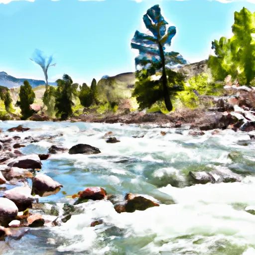
Big Creek river run
Community Reviews
Been here? Share the conditions.
Reviews, ratings & photos are added in the free Snoflo iOS app — rate a spot, tag the conditions, and your visit is verified by location. Add or manage your reviews from the app.
Big Creek
Big Creek is a popular river run in the state of Wyoming that offers exciting rapids and breathtaking scenery. The ideal streamflow range for Big Creek is between 300 and 800 cfs. The river is rated as Class III-IV, making it a suitable challenge for experienced paddlers. The segment mileage of Big Creek is approximately 6 miles, with rapids and obstacles scattered throughout the run. Some of the most notable rapids on Big Creek include Dierks Drop, The Maze, and Deadman's Curve.
As with any river run, there are specific regulations that must be followed in Big Creek. The use of personal flotation devices (PFDs) is mandatory, and all paddlers must have a throwable PFD on board. Additionally, the use of alcohol and drugs is strictly prohibited on the river. It is also essential to note that Big Creek is located in the Shoshone National Forest, and visitors must follow all regulations set forth by the National Park Service.
In conclusion, Big Creek is an excellent choice for experienced paddlers seeking a challenging river run in Wyoming. With its impressive rapids, stunning scenery, and specific regulations, this river offers a unique and exciting experience for anyone looking to test their paddling skills.
Plan your run down to the hour
Same weather feed Snoflo's iOS app uses -- updated continuously from NOAA / yr.no. Watch the precipitation column on the meteogram; rain ahead of a run typically lifts flows 12-48 hours later depending on the basin.
Next 5 days, hour by hour
Temperature line with weather symbols on top, snow + rain accumulation as columns, humidity as a dotted line.
5-day forecast table
Every 3 hours, broken out across temperature, snow, rain, humidity, and wind. Each cell is colour-coded relative to the column min/max.
| Time | Condition | Temp (°F) | Snow (in) | Rain (in) | Humidity (%) | Wind (mps) | Wind dir |
|---|---|---|---|---|---|---|---|
| Loading detailed forecast… | |||||||
15-day temperature & precipitation
Daily temperatures, snow, and rain projected over the next two weeks -- the upstream story that drives next week's flows.
Regional streamflow levels
USGS streamgauges around Big Creek -- useful for spotting upstream pulses and gauging which tributary is contributing what.
| Streamgauge | Discharge | View |
|---|---|---|
| South Brush Creek Near Saratoga | 18 cfs | → |
| Encampment River At Mouth | 19 cfs | → |
| North Brush Creek Near Saratoga | 9 cfs | → |
| North Platte River Near Northgate | 139 cfs | → |
| Encampment River Ab Hog Park Cr | 44 cfs | → |
| Little Laramie River Near Filmore | 671 cfs | → |
Plan a longer trip
The closest boat launches, other paddle runs, and campgrounds so a day on the water can grow into a full weekend.
Boat launches
- Bennett Creek Campground Boat Ramp
- Blm 3404 Carbon County
- Rob Roy Reservoir
- Encampment River
- North Platte River (Treasure Island)
Campgrounds
- Pickaroon Campground
- Pickaroon
- Pike Pole
- Corral Creek Campsite 6
- Corral Creek Campsite 1
- Corral Creek Campsite 5
Fishing spots
- Rob Roy Reservoir
- Big Creek Lakes Day Use Area
- Big Creek Lake(Lower)
- Big Creek Lake(Upper)
- Hog Park Reservoir
- Cowdrey Lake
Whitewater safety
- Check the flow before you run
- Use the linked-gauge card and Regional Flow panel above. Class ratings change with flow -- a Class III at low water can become Class IV+ at high water.
- Know your skill ceiling
- Pick runs comfortably below your ceiling. Cold-water and big-water runs raise the consequences of any mistake.
- Wear the right gear
- Helmet, PFD, drysuit / wetsuit when water is below 60°F. Throw bag, knife, and whistle on your person, not in the boat.
- Scout, set safety, and run with a team
- Scout new rapids on foot, set safety with throw bags above the consequence pool, and run with at least one other competent paddler.
- Respect the river
- Strainers, undercuts, low-head dams, and wood can kill at any class rating. When in doubt, portage.
Set push alerts in the Snoflo app
Save Big Creek as a favorite, set a discharge threshold (e.g. "alert me when flow hits 600 cfs"), and the iOS app pushes the moment the linked gauge crosses.
About Big Creek
What's the optimal flow for Big Creek?
The optimal flow depends on the section and the craft. Check the Run Details panel for the linked gauge and current status.
How fresh is the cfs reading on this page?
The linked USGS streamgauge reports continuously (every 15 minutes); Snoflo refreshes throughout the day. Hover the streamflow sparkline to read individual datapoints.
What's the whitewater class?
See the Run Details panel for the class rating Snoflo tracks for this run. Class ratings change with flow -- a Class III at low water can become Class IV in high water.
Where do I put in / take out?
Tap Directions in the hero above to open driving directions to the put-in. For shuttle planning, check the Nearby Boat Launches panel and the river run operator's site.
Can I get alerts when flows hit the optimal range?
Yes -- alerts are managed in the Snoflo iOS app. Favorite this run, set a discharge threshold, and you'll get a push the moment the gauge crosses.
Other runs near here
Snoflo-tracked paddle runs within driving distance of Big Creek.