Sweetwater River River Run
Community Reviews
Been here? Share the conditions.
Reviews, ratings & photos are added in the free Snoflo iOS app — rate a spot, tag the conditions, and your visit is verified by location. Add or manage your reviews from the app.
Sweetwater River
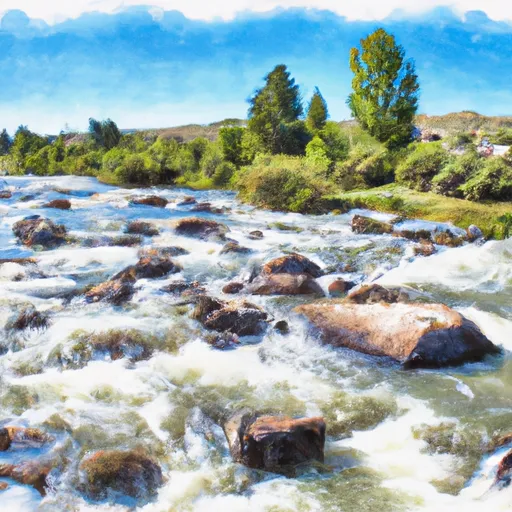
The Sweetwater River has several notable rapids, including Hell's Half Mile, which is a Class III rapid that requires precise navigation around large rocks and drops. Another notable rapid is the Devil's Gate, which is a Class II-III rapid that requires maneuvering through a narrow canyon. Additionally, the river has several flat sections that allow for scenic viewing and a chance to rest.
As for regulations, the Sweetwater River is managed by the Bureau of Land Management. The BLM requires all boaters to have a personal flotation device, whistle, and a throw rope. The use of alcohol or drugs is forbidden, and fires must be contained in fire pans. Additionally, it is important to respect the natural environment and practice Leave No Trace principles.
In summary, the Sweetwater River offers an exciting and scenic whitewater experience for intermediate level boaters. With ideal streamflow ranges, unique rapids, and specific regulations, it is a must-visit location for anyone looking for an adventurous outdoor experience in Wyoming.
Plan your run down to the hour
Same weather feed Snoflo's iOS app uses -- updated continuously from NOAA / yr.no. Watch the precipitation column on the meteogram; rain ahead of a run typically lifts flows 12-48 hours later depending on the basin.
Next 5 days, hour by hour
Temperature line with weather symbols on top, snow + rain accumulation as columns, humidity as a dotted line.
5-day forecast table
Every 3 hours, broken out across temperature, snow, rain, humidity, and wind. Each cell is colour-coded relative to the column min/max.
| Time | Condition | Temp (°F) | Snow (in) | Rain (in) | Humidity (%) | Wind (mps) | Wind dir |
|---|---|---|---|---|---|---|---|
| Loading detailed forecast… | |||||||
15-day temperature & precipitation
Daily temperatures, snow, and rain projected over the next two weeks -- the upstream story that drives next week's flows.
Regional streamflow levels
USGS streamgauges around Sweetwater River -- useful for spotting upstream pulses and gauging which tributary is contributing what.
| Streamgauge | Discharge | View |
|---|---|---|
| Sweetwater River Near Sweetwater Station | 11 cfs | → |
| Little Popo Agie River Near Lander | 25 cfs | → |
| Little Wind River Near Riverton | 232 cfs | → |
| Wind River At Riverton | 86 cfs | → |
| Sf L Wind Riv Ab Washakie Res | 109 cfs | → |
| Wind River Ab Boysen Reservoir | 289 cfs | → |
Plan a longer trip
The closest boat launches, other paddle runs, and campgrounds so a day on the water can grow into a full weekend.
Whitewater safety
- Check the flow before you run
- Use the linked-gauge card and Regional Flow panel above. Class ratings change with flow -- a Class III at low water can become Class IV+ at high water.
- Know your skill ceiling
- Pick runs comfortably below your ceiling. Cold-water and big-water runs raise the consequences of any mistake.
- Wear the right gear
- Helmet, PFD, drysuit / wetsuit when water is below 60°F. Throw bag, knife, and whistle on your person, not in the boat.
- Scout, set safety, and run with a team
- Scout new rapids on foot, set safety with throw bags above the consequence pool, and run with at least one other competent paddler.
- Respect the river
- Strainers, undercuts, low-head dams, and wood can kill at any class rating. When in doubt, portage.
Set push alerts in the Snoflo app
Save Sweetwater River as a favorite, set a discharge threshold (e.g. "alert me when flow hits 600 cfs"), and the iOS app pushes the moment the linked gauge crosses.
About Sweetwater River
What's the optimal flow for Sweetwater River?
The optimal flow depends on the section and the craft. Check the Run Details panel for the linked gauge and current status.
How fresh is the cfs reading on this page?
The linked USGS streamgauge reports continuously (every 15 minutes); Snoflo refreshes throughout the day. Hover the streamflow sparkline to read individual datapoints.
What's the whitewater class?
See the Run Details panel for the class rating Snoflo tracks for this run. Class ratings change with flow -- a Class III at low water can become Class IV in high water.
Where do I put in / take out?
Tap Directions in the hero above to open driving directions to the put-in. For shuttle planning, check the Nearby Boat Launches panel and the river run operator's site.
Can I get alerts when flows hit the optimal range?
Yes -- alerts are managed in the Snoflo iOS app. Favorite this run, set a discharge threshold, and you'll get a push the moment the gauge crosses.
Other runs near here
Snoflo-tracked paddle runs within driving distance of Sweetwater River.