9th Street Park park
9th Street Park
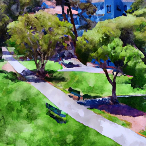
There are several points of interest within the park, including a large playground for children, a basketball court, and a large grassy area for picnics and other outdoor activities. The park is also home to several public art installations, including a mural by artist Mona Caron and a sculpture by artist Seyed Alavi.
In addition to its recreational opportunities, 9th Street Park is also of historical significance. It was once the site of a working-class neighborhood that was destroyed by the city during the mid-20th century for urban renewal. The park was established as a way to commemorate the former residents of the area.
The best time of year to visit 9th Street Park is during the spring and summer months when the weather is mild and the park is in full bloom. However, the park is open year-round and offers a peaceful escape from the hustle and bustle of the city.
Overall, 9th Street Park is a great destination for anyone looking to enjoy the natural beauty and cultural richness of San Francisco. Whether you're looking for a place to relax, play, or explore, this park has something to offer for everyone.
Park & land designation reference
A quick legend for the federal and state land categories Snoflo tracks. Each designation comes with different rules around access, recreation, and resource extraction.
- National Park
- Large protected natural areas managed by the federal government to preserve significant landscapes, ecosystems, and cultural resources; recreation is allowed but conservation is the priority.
- State Park
- Public natural or recreational areas managed by a state government, typically smaller than national parks and focused on regional natural features, recreation, and education.
- Local Park
- Community-level parks managed by cities or counties, emphasizing recreation, playgrounds, sports, and green space close to populated areas.
- Wilderness Area
- The highest level of land protection in the U.S.; designated areas where nature is left essentially untouched, with no roads, structures, or motorized motorized access permitted.
- National Recreation Area
- Areas set aside primarily for outdoor recreation (boating, hiking, fishing, often around reservoirs, rivers, or scenic landscapes); may allow more development.
- National Conservation Area (BLM)
- BLM-managed areas with special ecological, cultural, or scientific value; more protection than typical BLM land but less strict than Wilderness Areas.
- State Forest
- State-managed forests focused on habitat, watershed, recreation, and sustainable timber harvest.
- Bureau of Land Management (BLM) Land
- Vast federal lands managed for mixed use -- recreation, grazing, mining, conservation -- with fewer restrictions than national parks or forests.
Plan your visit down to the hour
Same weather feed Snoflo's iOS app uses -- updated continuously from NOAA / yr.no.
Next 5 days, hour by hour
Temperature line with weather symbols on top, snow + rain accumulation as columns, humidity as a dotted line.
5-day forecast table
Every 3 hours, broken out across temperature, snow, rain, humidity, and wind.
| Time | Condition | Temp (°F) | Snow (in) | Rain (in) | Humidity (%) | Wind (mps) | Wind dir |
|---|---|---|---|---|---|---|---|
| Loading detailed forecast… | |||||||
15-day temperature & precipitation
Daily temperatures, snow, and rain projected over the next two weeks.
Area campgrounds
Snoflo-tracked campgrounds within reach of 9th Street Park, with reservations status.
| Campground | Reservations | Toilets | View |
|---|---|---|---|
| Glen Helen Regional Park | ✗ | ✓ | → |
| Camp Seely | ✗ | ✗ | → |
| Dogwood | ✓ | ✓ | → |
| Dogwood Campground | ✗ | ✗ | → |
| Dogwood Family Campground | ✓ | ✗ | → |
| Rancho Jurupa Park | ✗ | ✗ | → |
Plan a longer trip
The closest parks, lakes, fishing spots, and POIs so a park visit can grow into a full weekend.
Responsible recreation & Leave No Trace
- Know before you go
- Check the operator's site for hours, permit requirements, seasonal closures, and fire restrictions before heading out.
- Stay on trail
- Stick to marked paths to protect vegetation, prevent erosion, and avoid disturbing wildlife habitat.
- Respect wildlife
- Observe from a distance, never feed wildlife, and store food securely if camping is permitted on-site.
- Pack it in, pack it out
- Carry out all trash, food scraps, and gear. Many parks have limited or no trash service.
- Leave what you find
- Don't take rocks, plants, or artifacts. They make the park what it is for the next visitor.
Set push alerts in the Snoflo app
Save 9th Street Park as a favorite, set a custom threshold (precipitation, freezing temperatures, fire-restriction days), and the iOS app will push the moment conditions cross.
About 9th Street Park
What can I do at 9th Street Park?
Most Snoflo-tracked parks support hiking, picnicking, and wildlife viewing. Check the operator's site for activity-specific rules (camping, fishing, paddling, hunting).
How fresh is the weather data?
The hourly forecast updates throughout the day from NOAA / yr.no. Streamflow comes live from USGS streamgauges.
When is the best time to visit?
Use the 15-day temperature & precipitation outlook on this page to plan -- pick a window with comfortable temperatures and low precipitation.
How do I get to 9th Street Park?
Tap Directions in the hero above to open driving directions in Google Maps, or Open in map to center the Snoflo interactive map on the park.
Can I get alerts when conditions change?
Yes -- alerts are managed in the Snoflo iOS app. Favorite this park, set a threshold (temperature, precipitation), and you'll get a push the moment it crosses.
Other parks near here
Snoflo-tracked parks within driving distance of 9th Street Park.