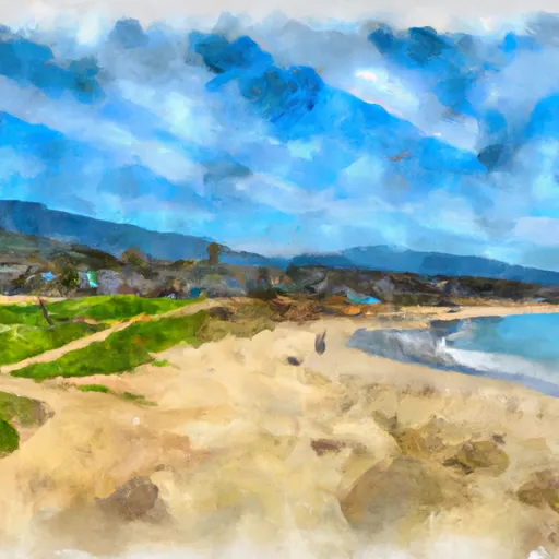
San Buenaventura State Beach
Community Reviews
Been here? Share the conditions.
Reviews, ratings & photos are added in the free Snoflo iOS app — rate a spot, tag the conditions, and your visit is verified by location. Add or manage your reviews from the app.
San Buenaventura State Beach
1. Reasons to Visit:
- Scenic Beauty: San Buenaventura State Beach boasts stunning ocean views, expansive sandy shores, and picturesque sunsets, making it a perfect spot for relaxation and natural beauty.
- Outdoor Activities: The beach offers various recreational activities, including swimming, sunbathing, beachcombing, picnicking, and fishing.
- Walking and Biking Path: A paved path runs along the beach, providing an excellent opportunity for walking, jogging, or cycling while enjoying the coastal scenery.
- Wildlife Viewing: The beach is home to a diverse range of marine life, including seals, dolphins, and various bird species, making it a popular spot for wildlife enthusiasts.
2. Points of Interest:
- Ventura Pier: Adjacent to the beach is the Ventura Pier, which extends into the Pacific Ocean. It offers panoramic views, fishing opportunities, and a charming atmosphere.
- Surfer's Point: Located nearby, Surfer's Point is renowned for its excellent surfing conditions, attracting surfers from around the region.
- Emma Wood State Beach: Situated to the north of San Buenaventura State Beach, Emma Wood State Beach is another beautiful beach known for its camping facilities and scenic hiking trails.
3. Interesting Facts:
- Historical Significance: San Buenaventura State Beach is steeped in history, as it was a significant location for the Chumash Native American tribe and later served as a transportation hub during the early 20th century.
- Movie Filming Location: The beach has been featured in various films and TV shows, including scenes from "The Big Lebowski" and "The Aviator."
- Camping Facilities: The nearby Emma Wood State Beach offers beachfront camping facilities, allowing visitors to stay overnight in close proximity to San Buenaventura State Beach.
4. Best Time to Visit:
San Buenaventura State Beach enjoys a Mediterranean climate, with mild temperatures year-round. The summer months (June to August) offer the warmest weather for beach activities, with temperatures ranging from the mid-70s to low-80s Fahrenheit (mid-20s to high-20s Celsius). Spring and fall also provide pleasant weather while being less crowded. However, it's worth noting that the beach may experience marine layer fog, particularly during the mornings, which usually burns off by midday.
To ensure accuracy, it is recommended to consult the official website of San Buenaventura State Beach, travel guides, and reputable tourism sources to verify the information provided.
Trails in San Buenaventura State Beach
Named trails whose route falls inside the park.
Plan your visit down to the hour
Same weather feed Snoflo's iOS app uses -- updated continuously from NOAA / yr.no.
Next 5 days, hour by hour
Temperature line with weather symbols on top, snow + rain accumulation as columns, humidity as a dotted line.
5-day forecast table
Every 3 hours, broken out across temperature, snow, rain, humidity, and wind.
| Time | Condition | Temp (°F) | Snow (in) | Rain (in) | Humidity (%) | Wind (mps) | Wind dir |
|---|---|---|---|---|---|---|---|
| Loading detailed forecast… | |||||||
15-day temperature & precipitation
Daily temperatures, snow, and rain projected over the next two weeks.
Responsible recreation & Leave No Trace
- Know before you go
- Check the operator's site for hours, permit requirements, seasonal closures, and fire restrictions before heading out.
- Stay on trail
- Stick to marked paths to protect vegetation, prevent erosion, and avoid disturbing wildlife habitat.
- Respect wildlife
- Observe from a distance, never feed wildlife, and store food securely if camping is permitted on-site.
- Pack it in, pack it out
- Carry out all trash, food scraps, and gear. Many parks have limited or no trash service.
- Leave what you find
- Don't take rocks, plants, or artifacts. They make the park what it is for the next visitor.
Set push alerts in the Snoflo app
Save San Buenaventura State Beach as a favorite, set a custom threshold (precipitation, freezing temperatures, fire-restriction days), and the iOS app will push the moment conditions cross.
About San Buenaventura State Beach
What can I do at San Buenaventura State Beach?
Most Snoflo-tracked parks support hiking, picnicking, and wildlife viewing. Check the operator's site for activity-specific rules (camping, fishing, paddling, hunting).
How fresh is the weather data?
The hourly forecast updates throughout the day from NOAA / yr.no. Streamflow comes live from USGS streamgauges.
When is the best time to visit?
Use the 15-day temperature & precipitation outlook on this page to plan -- pick a window with comfortable temperatures and low precipitation.
How do I get to San Buenaventura State Beach?
Tap Directions in the hero above to open driving directions in Google Maps, or Open in map to center the Snoflo interactive map on the park.
Can I get alerts when conditions change?
Yes -- alerts are managed in the Snoflo iOS app. Favorite this park, set a threshold (temperature, precipitation), and you'll get a push the moment it crosses.
Park & land designation reference
A quick legend for the federal and state land categories Snoflo tracks. Each designation comes with different rules around access, recreation, and resource extraction.
- National Park
- Large protected natural areas managed by the federal government to preserve significant landscapes, ecosystems, and cultural resources; recreation is allowed but conservation is the priority.
- State Park
- Public natural or recreational areas managed by a state government, typically smaller than national parks and focused on regional natural features, recreation, and education.
- Local Park
- Community-level parks managed by cities or counties, emphasizing recreation, playgrounds, sports, and green space close to populated areas.
- Wilderness Area
- The highest level of land protection in the U.S.; designated areas where nature is left essentially untouched, with no roads, structures, or motorized motorized access permitted.
- National Recreation Area
- Areas set aside primarily for outdoor recreation (boating, hiking, fishing, often around reservoirs, rivers, or scenic landscapes); may allow more development.
- National Conservation Area (BLM)
- BLM-managed areas with special ecological, cultural, or scientific value; more protection than typical BLM land but less strict than Wilderness Areas.
- State Forest
- State-managed forests focused on habitat, watershed, recreation, and sustainable timber harvest.
- Bureau of Land Management (BLM) Land
- Vast federal lands managed for mixed use -- recreation, grazing, mining, conservation -- with fewer restrictions than national parks or forests.