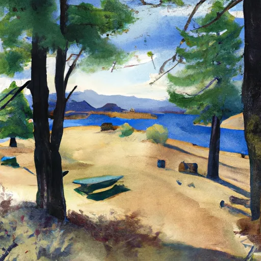
Wilderness Desolation
Community Reviews
Been here? Share the conditions.
Reviews, ratings & photos are added in the free Snoflo iOS app — rate a spot, tag the conditions, and your visit is verified by location. Add or manage your reviews from the app.

Wilderness Desolation
Reasons to Visit:
1. Pristine Wilderness: Wilderness Desolation is an unspoiled and remote region, perfect for those seeking solitude and tranquility in nature.
2. Hiking and Backpacking: The area boasts an extensive network of trails, making it a haven for hikers and backpackers of all skill levels.
3. Unparalleled Scenery: Visitors can marvel at towering granite peaks, crystal clear alpine lakes, lush forests, and cascading waterfalls.
4. Exceptional Wildlife: The region is home to a diverse range of wildlife, including black bears, mountain lions, mule deer, and various bird species, offering excellent opportunities for wildlife observation and photography.
5. Historic Significance: Wilderness Desolation also holds historical importance as it was once a significant route for Native American tribes and later served as an essential pathway for explorers during the California Gold Rush.
Points of Interest:
1. Desolation Wilderness: This magnificent wilderness area features over 63,000 acres of granite peaks, glacially carved valleys, and pristine alpine lakes, including the popular Lake Tahoe and Lake Aloha.
2. Echo Lakes: Echo Lakes are a pair of stunningly beautiful alpine lakes that offer superb fishing and boating opportunities, as well as access to numerous hiking trails.
3. Pyramid Peak: Standing at an elevation of 9,983 feet, Pyramid Peak presents a challenging yet rewarding climb for experienced hikers, providing breathtaking panoramic views from its summit.
4. Rubicon Trail: Known for its off-roading and hiking opportunities, the Rubicon Trail winds through stunning landscapes, including dense forests and rugged terrain, offering an exhilarating adventure.
Interesting Facts:
1. Wilderness Desolation is part of the Eldorado National Forest, which spans over 800,000 acres and contains a vast array of ecosystems, including five wilderness areas.
2. The area has a rich geological history, with evidence of ancient volcanic activity and glacial formations visible throughout the landscape.
3. Many of the alpine lakes in the region are remnants of the last Ice Age and were carved by glaciers thousands of years ago.
4. The region is home to the federally threatened Sierra Nevada yellow-legged frog, which can be found in several of the area's lakes and streams.
Best Time to Visit:
The best time to visit Wilderness Desolation is typically during the summer months, from June to September, when the weather is generally mild, and trails are accessible. However, weather conditions can be unpredictable in the mountains, so it is advisable to check local forecasts and trail conditions before planning your visit.
Please note that it is always essential to verify the information provided by consulting multiple independent sources, such as official park websites, travel guides, and local authorities, to ensure accuracy and up-to-date information.
Trails in Wilderness Desolation
Named trails whose route falls inside the park.
Camping in Wilderness Desolation
Campgrounds inside the park, with today's conditions score.
Plan your visit down to the hour
Same weather feed Snoflo's iOS app uses -- updated continuously from NOAA / yr.no.
Next 5 days, hour by hour
Temperature line with weather symbols on top, snow + rain accumulation as columns, humidity as a dotted line.
5-day forecast table
Every 3 hours, broken out across temperature, snow, rain, humidity, and wind.
| Time | Condition | Temp (°F) | Snow (in) | Rain (in) | Humidity (%) | Wind (mps) | Wind dir |
|---|---|---|---|---|---|---|---|
| Loading detailed forecast… | |||||||
15-day temperature & precipitation
Daily temperatures, snow, and rain projected over the next two weeks.
Responsible recreation & Leave No Trace
- Know before you go
- Check the operator's site for hours, permit requirements, seasonal closures, and fire restrictions before heading out.
- Stay on trail
- Stick to marked paths to protect vegetation, prevent erosion, and avoid disturbing wildlife habitat.
- Respect wildlife
- Observe from a distance, never feed wildlife, and store food securely if camping is permitted on-site.
- Pack it in, pack it out
- Carry out all trash, food scraps, and gear. Many parks have limited or no trash service.
- Leave what you find
- Don't take rocks, plants, or artifacts. They make the park what it is for the next visitor.
Set push alerts in the Snoflo app
Save Wilderness Desolation as a favorite, set a custom threshold (precipitation, freezing temperatures, fire-restriction days), and the iOS app will push the moment conditions cross.
About Wilderness Desolation
What can I do at Wilderness Desolation?
Most Snoflo-tracked parks support hiking, picnicking, and wildlife viewing. Check the operator's site for activity-specific rules (camping, fishing, paddling, hunting).
How fresh is the weather data?
The hourly forecast updates throughout the day from NOAA / yr.no. Streamflow comes live from USGS streamgauges.
When is the best time to visit?
Use the 15-day temperature & precipitation outlook on this page to plan -- pick a window with comfortable temperatures and low precipitation.
How do I get to Wilderness Desolation?
Tap Directions in the hero above to open driving directions in Google Maps, or Open in map to center the Snoflo interactive map on the park.
Can I get alerts when conditions change?
Yes -- alerts are managed in the Snoflo iOS app. Favorite this park, set a threshold (temperature, precipitation), and you'll get a push the moment it crosses.
Park & land designation reference
A quick legend for the federal and state land categories Snoflo tracks. Each designation comes with different rules around access, recreation, and resource extraction.
- National Park
- Large protected natural areas managed by the federal government to preserve significant landscapes, ecosystems, and cultural resources; recreation is allowed but conservation is the priority.
- State Park
- Public natural or recreational areas managed by a state government, typically smaller than national parks and focused on regional natural features, recreation, and education.
- Local Park
- Community-level parks managed by cities or counties, emphasizing recreation, playgrounds, sports, and green space close to populated areas.
- Wilderness Area
- The highest level of land protection in the U.S.; designated areas where nature is left essentially untouched, with no roads, structures, or motorized motorized access permitted.
- National Recreation Area
- Areas set aside primarily for outdoor recreation (boating, hiking, fishing, often around reservoirs, rivers, or scenic landscapes); may allow more development.
- National Conservation Area (BLM)
- BLM-managed areas with special ecological, cultural, or scientific value; more protection than typical BLM land but less strict than Wilderness Areas.
- State Forest
- State-managed forests focused on habitat, watershed, recreation, and sustainable timber harvest.
- Bureau of Land Management (BLM) Land
- Vast federal lands managed for mixed use -- recreation, grazing, mining, conservation -- with fewer restrictions than national parks or forests.