Yucaipa Regional Park
Community Reviews
Been here? Share the conditions.
Reviews, ratings & photos are added in the free Snoflo iOS app — rate a spot, tag the conditions, and your visit is verified by location. Add or manage your reviews from the app.

Yucaipa Regional Park
One of the main attractions of Yucaipa Regional Park is its picturesque setting. The park features beautiful lakes, rolling hills, and lush greenery, providing a serene and tranquil environment for visitors. Whether you enjoy hiking, picnicking, or simply taking a leisurely stroll, the park offers numerous well-maintained trails and open spaces to explore.
For those interested in water activities, the park boasts two large lakes, Lake Yucaipa and Lake Perris, where visitors can go fishing, boating, or even try their hand at paddleboarding. The lakes are home to various fish species, including largemouth bass and catfish, making them a popular spot for anglers. Additionally, Lake Perris offers a beach area that is perfect for swimming and sunbathing during the summer months.
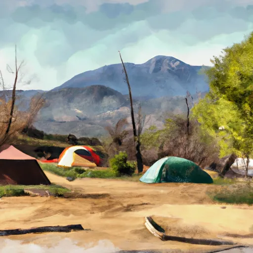
Yucaipa Regional Park also features a well-equipped campground, providing an opportunity for overnight stays. The campground offers both tent and RV camping options, with amenities such as showers, restrooms, and picnic areas available. The park is well-known for its family-friendly atmosphere, and many visitors enjoy spending quality time with their loved ones amidst the natural beauty of the surroundings.
Moreover, the park offers interesting points of interest, such as the Yucaipa Adobe. Built in the 1850s, this historic adobe house provides a glimpse into the area's rich history and is open for guided tours. The park is also home to an equestrian center, allowing horse enthusiasts to explore the trails on horseback.
When planning a visit to Yucaipa Regional Park, it's important to consider the best time of year to go. The park is open year-round, but the most pleasant weather is typically experienced during the spring and fall seasons. California's mild winters also make it possible to visit during this time. However, it's worth noting that summers in the area can be quite hot, so visitors should come prepared with sunscreen, hats, and plenty of water.
To ensure accuracy, it is always recommended to verify this information across multiple independent sources, such as official park websites, travel guides, and reputable online resources.
Trails in Yucaipa Regional Park
Named trails whose route falls inside the park.
Camping in Yucaipa Regional Park
Campgrounds inside the park, with today's conditions score.
Plan your visit down to the hour
Same weather feed Snoflo's iOS app uses -- updated continuously from NOAA / yr.no.
Next 5 days, hour by hour
Temperature line with weather symbols on top, snow + rain accumulation as columns, humidity as a dotted line.
5-day forecast table
Every 3 hours, broken out across temperature, snow, rain, humidity, and wind.
| Time | Condition | Temp (°F) | Snow (in) | Rain (in) | Humidity (%) | Wind (mps) | Wind dir |
|---|---|---|---|---|---|---|---|
| Loading detailed forecast… | |||||||
15-day temperature & precipitation
Daily temperatures, snow, and rain projected over the next two weeks.
Responsible recreation & Leave No Trace
- Know before you go
- Check the operator's site for hours, permit requirements, seasonal closures, and fire restrictions before heading out.
- Stay on trail
- Stick to marked paths to protect vegetation, prevent erosion, and avoid disturbing wildlife habitat.
- Respect wildlife
- Observe from a distance, never feed wildlife, and store food securely if camping is permitted on-site.
- Pack it in, pack it out
- Carry out all trash, food scraps, and gear. Many parks have limited or no trash service.
- Leave what you find
- Don't take rocks, plants, or artifacts. They make the park what it is for the next visitor.
Set push alerts in the Snoflo app
Save Yucaipa Regional Park as a favorite, set a custom threshold (precipitation, freezing temperatures, fire-restriction days), and the iOS app will push the moment conditions cross.
About Yucaipa Regional Park
What can I do at Yucaipa Regional Park?
Most Snoflo-tracked parks support hiking, picnicking, and wildlife viewing. Check the operator's site for activity-specific rules (camping, fishing, paddling, hunting).
How fresh is the weather data?
The hourly forecast updates throughout the day from NOAA / yr.no. Streamflow comes live from USGS streamgauges.
When is the best time to visit?
Use the 15-day temperature & precipitation outlook on this page to plan -- pick a window with comfortable temperatures and low precipitation.
How do I get to Yucaipa Regional Park?
Tap Directions in the hero above to open driving directions in Google Maps, or Open in map to center the Snoflo interactive map on the park.
Can I get alerts when conditions change?
Yes -- alerts are managed in the Snoflo iOS app. Favorite this park, set a threshold (temperature, precipitation), and you'll get a push the moment it crosses.
Park & land designation reference
A quick legend for the federal and state land categories Snoflo tracks. Each designation comes with different rules around access, recreation, and resource extraction.
- National Park
- Large protected natural areas managed by the federal government to preserve significant landscapes, ecosystems, and cultural resources; recreation is allowed but conservation is the priority.
- State Park
- Public natural or recreational areas managed by a state government, typically smaller than national parks and focused on regional natural features, recreation, and education.
- Local Park
- Community-level parks managed by cities or counties, emphasizing recreation, playgrounds, sports, and green space close to populated areas.
- Wilderness Area
- The highest level of land protection in the U.S.; designated areas where nature is left essentially untouched, with no roads, structures, or motorized motorized access permitted.
- National Recreation Area
- Areas set aside primarily for outdoor recreation (boating, hiking, fishing, often around reservoirs, rivers, or scenic landscapes); may allow more development.
- National Conservation Area (BLM)
- BLM-managed areas with special ecological, cultural, or scientific value; more protection than typical BLM land but less strict than Wilderness Areas.
- State Forest
- State-managed forests focused on habitat, watershed, recreation, and sustainable timber harvest.
- Bureau of Land Management (BLM) Land
- Vast federal lands managed for mixed use -- recreation, grazing, mining, conservation -- with fewer restrictions than national parks or forests.