Ross Prairie Wildlife Management Area
Community Reviews
Been here? Share the conditions.
Reviews, ratings & photos are added in the free Snoflo iOS app — rate a spot, tag the conditions, and your visit is verified by location. Add or manage your reviews from the app.

Ross Prairie Wildlife Management Area
One of the primary reasons to visit Ross Prairie Wildlife Management Area is its abundant wildlife. The area is home to a variety of species, including white-tailed deer, wild turkeys, bobcats, and various species of waterfowl. Birdwatchers will especially appreciate the opportunity to spot numerous bird species, including sandhill cranes, bald eagles, and red-cockaded woodpeckers.
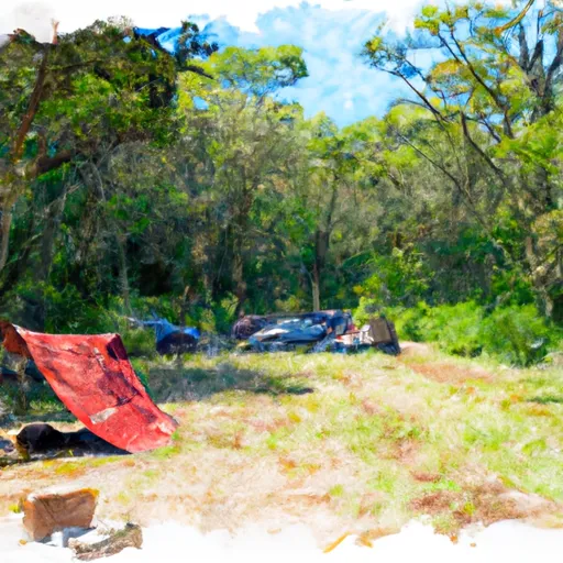
Several points of interest within the wildlife management area are worth exploring. The Ross Prairie State Forest, encompassing a large portion of the area, is a popular spot for hiking, biking, and horseback riding. Visitors can enjoy the unpaved trails that wind through the forest, offering a chance to observe the natural beauty and wildlife up close. Additionally, the Ross Prairie Campground provides a peaceful place for camping and picnicking, with facilities available for visitors.
Interesting facts about Ross Prairie Wildlife Management Area include its significant contribution to the conservation of Florida's native species and ecosystems. This area plays a crucial role in protecting the habitat of various endangered and threatened species, ensuring their long-term survival. Moreover, Ross Prairie is part of an extensive network of protected lands in Florida, contributing to the overall preservation of the state's natural heritage.
The best time of year to visit Ross Prairie Wildlife Management Area is during the cooler months, typically between November and March. Florida's hot and humid climate can be challenging to bear during the summer months, so visiting during winter or early spring allows for a more pleasant experience. Additionally, this time of year offers better wildlife viewing opportunities as animals tend to be more active in the cooler temperatures.
To ensure accuracy, it is always advisable to verify information across multiple independent sources.
Camping in Ross Prairie Wildlife Management Area
Campgrounds inside the park, with today's conditions score.
Plan your visit down to the hour
Same weather feed Snoflo's iOS app uses -- updated continuously from NOAA / yr.no.
Next 5 days, hour by hour
Temperature line with weather symbols on top, snow + rain accumulation as columns, humidity as a dotted line.
5-day forecast table
Every 3 hours, broken out across temperature, snow, rain, humidity, and wind.
| Time | Condition | Temp (°F) | Snow (in) | Rain (in) | Humidity (%) | Wind (mps) | Wind dir |
|---|---|---|---|---|---|---|---|
| Loading detailed forecast… | |||||||
15-day temperature & precipitation
Daily temperatures, snow, and rain projected over the next two weeks.
Responsible recreation & Leave No Trace
- Know before you go
- Check the operator's site for hours, permit requirements, seasonal closures, and fire restrictions before heading out.
- Stay on trail
- Stick to marked paths to protect vegetation, prevent erosion, and avoid disturbing wildlife habitat.
- Respect wildlife
- Observe from a distance, never feed wildlife, and store food securely if camping is permitted on-site.
- Pack it in, pack it out
- Carry out all trash, food scraps, and gear. Many parks have limited or no trash service.
- Leave what you find
- Don't take rocks, plants, or artifacts. They make the park what it is for the next visitor.
Set push alerts in the Snoflo app
Save Ross Prairie Wildlife Management Area as a favorite, set a custom threshold (precipitation, freezing temperatures, fire-restriction days), and the iOS app will push the moment conditions cross.
About Ross Prairie Wildlife Management Area
What can I do at Ross Prairie Wildlife Management Area?
Most Snoflo-tracked parks support hiking, picnicking, and wildlife viewing. Check the operator's site for activity-specific rules (camping, fishing, paddling, hunting).
How fresh is the weather data?
The hourly forecast updates throughout the day from NOAA / yr.no. Streamflow comes live from USGS streamgauges.
When is the best time to visit?
Use the 15-day temperature & precipitation outlook on this page to plan -- pick a window with comfortable temperatures and low precipitation.
How do I get to Ross Prairie Wildlife Management Area?
Tap Directions in the hero above to open driving directions in Google Maps, or Open in map to center the Snoflo interactive map on the park.
Can I get alerts when conditions change?
Yes -- alerts are managed in the Snoflo iOS app. Favorite this park, set a threshold (temperature, precipitation), and you'll get a push the moment it crosses.
Park & land designation reference
A quick legend for the federal and state land categories Snoflo tracks. Each designation comes with different rules around access, recreation, and resource extraction.
- National Park
- Large protected natural areas managed by the federal government to preserve significant landscapes, ecosystems, and cultural resources; recreation is allowed but conservation is the priority.
- State Park
- Public natural or recreational areas managed by a state government, typically smaller than national parks and focused on regional natural features, recreation, and education.
- Local Park
- Community-level parks managed by cities or counties, emphasizing recreation, playgrounds, sports, and green space close to populated areas.
- Wilderness Area
- The highest level of land protection in the U.S.; designated areas where nature is left essentially untouched, with no roads, structures, or motorized motorized access permitted.
- National Recreation Area
- Areas set aside primarily for outdoor recreation (boating, hiking, fishing, often around reservoirs, rivers, or scenic landscapes); may allow more development.
- National Conservation Area (BLM)
- BLM-managed areas with special ecological, cultural, or scientific value; more protection than typical BLM land but less strict than Wilderness Areas.
- State Forest
- State-managed forests focused on habitat, watershed, recreation, and sustainable timber harvest.
- Bureau of Land Management (BLM) Land
- Vast federal lands managed for mixed use -- recreation, grazing, mining, conservation -- with fewer restrictions than national parks or forests.