Community Reviews
Been here? Share the conditions.
Reviews, ratings & photos are added in the free Snoflo iOS app — rate a spot, tag the conditions, and your visit is verified by location. Add or manage your reviews from the app.
State Wildlife Area Mayfield
Reasons to visit:
1. Abundant Wildlife: Mayfield is home to a wide variety of wildlife species, making it a paradise for nature enthusiasts and wildlife watchers. Visitors can spot mule deer, elk, wild turkeys, and even the occasional black bear or mountain lion.
2. Birding Haven: The area boasts a significant bird population, attracting birdwatchers from far and wide. The diverse habitats in and around Mayfield provide an ideal setting for spotting native and migratory birds.
3. Fishing Opportunities: Mayfield State Wildlife Area encompasses several ponds and reservoirs, providing excellent angling opportunities. Common fish species found here include rainbow trout, brown trout, largemouth bass, and bluegill.
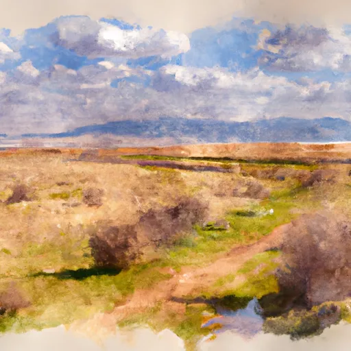
4. Scenic Beauty: The picturesque landscapes of Mayfield, characterized by rugged mountains, rolling hills, and meandering streams, offer breathtaking views and ample opportunities for photography and scenic hikes.
Points of interest:
1. Mayfield Reservoir: This scenic reservoir is a popular spot for fishing, boating, and picnicking. Surrounded by stunning mountain views, it offers peace and tranquility in a serene setting.
2. Wildlife Viewing: Mayfield serves as a habitat for various animal species, making it an ideal place for wildlife observation. Wildlife enthusiasts can explore the area's trails and meadows to spot animals in their natural habitat.
3. Hiking and Camping: Mayfield is home to numerous hiking trails that cater to different skill levels. Visitors can also enjoy camping in designated areas, immersing themselves in the beauty of the area.
Interesting facts:
1. Mayfield is located in the Manti-La Sal National Forest, adding to its scenic and ecological significance.
2. The area is known for its diverse plant life, including aspen groves, conifer forests, and wildflower meadows.
3. Mayfield is a year-round destination that offers various recreational activities in different seasons, from fishing and hiking in the summer to snowshoeing and cross-country skiing in the winter.
Best time to visit:
The best time to visit Mayfield State Wildlife Area is during the summer and early fall months (June to September). This period offers pleasant weather for outdoor activities, including fishing, hiking, and wildlife spotting. However, each season brings its own unique beauty and recreational opportunities, making Mayfield an attractive destination throughout the year.
Please note that local weather conditions and specific regulations may vary, so it is advisable to check with local authorities or visitor centers before planning your trip.
Plan your visit down to the hour
Same weather feed Snoflo's iOS app uses -- updated continuously from NOAA / yr.no.
Next 5 days, hour by hour
Temperature line with weather symbols on top, snow + rain accumulation as columns, humidity as a dotted line.
5-day forecast table
Every 3 hours, broken out across temperature, snow, rain, humidity, and wind.
| Time | Condition | Temp (°F) | Snow (in) | Rain (in) | Humidity (%) | Wind (mps) | Wind dir |
|---|---|---|---|---|---|---|---|
| Loading detailed forecast… | |||||||
15-day temperature & precipitation
Daily temperatures, snow, and rain projected over the next two weeks.
Responsible recreation & Leave No Trace
- Know before you go
- Check the operator's site for hours, permit requirements, seasonal closures, and fire restrictions before heading out.
- Stay on trail
- Stick to marked paths to protect vegetation, prevent erosion, and avoid disturbing wildlife habitat.
- Respect wildlife
- Observe from a distance, never feed wildlife, and store food securely if camping is permitted on-site.
- Pack it in, pack it out
- Carry out all trash, food scraps, and gear. Many parks have limited or no trash service.
- Leave what you find
- Don't take rocks, plants, or artifacts. They make the park what it is for the next visitor.
Set push alerts in the Snoflo app
Save State Wildlife Area Mayfield as a favorite, set a custom threshold (precipitation, freezing temperatures, fire-restriction days), and the iOS app will push the moment conditions cross.
About State Wildlife Area Mayfield
What can I do at State Wildlife Area Mayfield?
Most Snoflo-tracked parks support hiking, picnicking, and wildlife viewing. Check the operator's site for activity-specific rules (camping, fishing, paddling, hunting).
How fresh is the weather data?
The hourly forecast updates throughout the day from NOAA / yr.no. Streamflow comes live from USGS streamgauges.
When is the best time to visit?
Use the 15-day temperature & precipitation outlook on this page to plan -- pick a window with comfortable temperatures and low precipitation.
How do I get to State Wildlife Area Mayfield?
Tap Directions in the hero above to open driving directions in Google Maps, or Open in map to center the Snoflo interactive map on the park.
Can I get alerts when conditions change?
Yes -- alerts are managed in the Snoflo iOS app. Favorite this park, set a threshold (temperature, precipitation), and you'll get a push the moment it crosses.
Park & land designation reference
A quick legend for the federal and state land categories Snoflo tracks. Each designation comes with different rules around access, recreation, and resource extraction.
- National Park
- Large protected natural areas managed by the federal government to preserve significant landscapes, ecosystems, and cultural resources; recreation is allowed but conservation is the priority.
- State Park
- Public natural or recreational areas managed by a state government, typically smaller than national parks and focused on regional natural features, recreation, and education.
- Local Park
- Community-level parks managed by cities or counties, emphasizing recreation, playgrounds, sports, and green space close to populated areas.
- Wilderness Area
- The highest level of land protection in the U.S.; designated areas where nature is left essentially untouched, with no roads, structures, or motorized motorized access permitted.
- National Recreation Area
- Areas set aside primarily for outdoor recreation (boating, hiking, fishing, often around reservoirs, rivers, or scenic landscapes); may allow more development.
- National Conservation Area (BLM)
- BLM-managed areas with special ecological, cultural, or scientific value; more protection than typical BLM land but less strict than Wilderness Areas.
- State Forest
- State-managed forests focused on habitat, watershed, recreation, and sustainable timber harvest.
- Bureau of Land Management (BLM) Land
- Vast federal lands managed for mixed use -- recreation, grazing, mining, conservation -- with fewer restrictions than national parks or forests.