
Rillito Creek At La Cholla Blvd Near Tucson, Az. Realtime Data
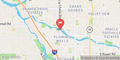
RILLITO CREEK AT LA CHOLLA BLVD NEAR TUCSON, AZ.
Realtime Data • Report • Conditions
3,150
Discharge (cfs)
6.5
Gauge Height (ft)
USGS 09486055
Streamflow discharge was last observed at 3,150 cfs, and a gauge height of 6.52 feet.
With the
% decrease since yesterday,
the streamflow average over the past 10 days is 315 .
Weather today, Tomorrow,
The main contributors to the flow of water in the Rillito Creek are stormwater runoff and groundwater discharge. There are no significant dams or tributaries that affect the flow of water at this particular location. The hydrology of the Rillito Creek is highly seasonal, with peak flows occurring in late summer due to monsoon season. Interestingly, the Rillito River Walk, a popular hiking and biking trail, runs alongside the Rillito Creek and is often flooded during the monsoon season, making for a unique outdoor experience.
November 2, 2026
| Elevation | 2,254.0 ft |
| Last Updated | |
| Gage height, ft | 6.52 ft |
| Streamflow, ft³/s | 3150.0 ft3/s |
| Percent of Normal | 84,000% |
| Year Over Year Average | 4 cfs |
| 24hr Flow Prediction | cfs |
| Maximum Recorded | 3,920 cfs |
| Geolocation | 32.30, -111.01 |
 Continue with Snoflo Premium