

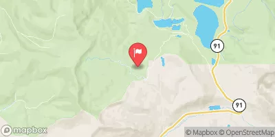
Columbine Ditch Near Fremont Pass, Co. Realtime Data
COLUMBINE DITCH NEAR FREMONT PASS, CO.
Realtime Data • Report • Conditions
0
Discharge (cfs)
0.0
Gauge Height (ft)
USGS 09061500
Streamflow discharge was last observed at 0 cfs, and a gauge height of 0.02 feet.
With the
% decrease since yesterday,
the streamflow average over the past 10 days is 0 .
Weather today, Tomorrow,
The primary flow provider is the Columbine Ditch, which diverts water from the West Fork of the Arkansas River. Other potential tributaries include the Tenmile Creek and the Blue River. There are no major dams in the immediate vicinity. Seasonal trends show that flow is highest in the spring and early summer months, and lowest in the winter. Interestingly, the Columbine Ditch is used for agricultural purposes, specifically for irrigation of hay fields, rather than for drinking water or other domestic uses.
October 24, 2026
| Elevation | 11,321.0 ft |
| Last Updated | |
| Gage height, feet | 0.02 ft |
| Streamflow, ft3/s | 0.05 ft3/s |
| Percent of Normal | 100% |
| Year Over Year Average | 0 cfs |
| 24hr Flow Prediction | cfs |
| Maximum Recorded | 67 cfs |
| Geolocation | 39.38, -106.23 |
 Continue with Snoflo Premium