

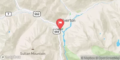
Mineral Creek At Silverton, Co Realtime Data
MINERAL CREEK AT SILVERTON, CO
Realtime Data • Report • Conditions
263
Discharge (cfs)
1.7
Gauge Height (ft)
Streamflow discharge was last observed at 200 cfs, and a gauge height of 1.70 feet.
With the
% decrease since yesterday,
the streamflow average over the past 10 days is 127 .
Weather today, Tomorrow,
The watershed is composed of mostly granite with some volcanic rocks. The flow is fed by snowmelt and precipitation. The watershed has several tributaries, including South Mineral Creek, and is impacted by several dams, including the Animas La Plata Project. The stream experiences high flow during spring snowmelt and summer monsoons, and low flow during winter months. The hydrology is interesting due to the historical mining activity in the area, which has impacted water quality and flow. The stream has also been designated as impaired due to high levels of metals and acidity.
October 15, 2026
| Elevation | 9,242.0 ft |
| Last Updated | |
| Gage height, ft | 1.7 ft |
| Stream water level elevation above NAVD 1988, in ft | 9253.13 ft |
| Streamflow, ft³/s | 200.0 ft3/s |
| Specific conductance, water, unfiltered, microsiemens per centimeter at 25°C | 553.0 uS/cm @25C |
| Turbidity, water, unfiltered, monochrome near infra-red LED light, 780-900 nm, detection angle 90 ±2.5°, formazin nephelometric units (FNU) | 17.3 FNU |
| pH, water, unfiltered, field, standard units | 5.7 std units |
| Temperature, water, degC | 0.5 deg C |
| Percent of Normal | 591% |
| Year Over Year Average | 44 cfs |
| 24hr Flow Prediction | cfs |
| Maximum Recorded | 1,110 cfs |
| Geolocation | 37.80, -107.67 |
 Continue with Snoflo Premium