

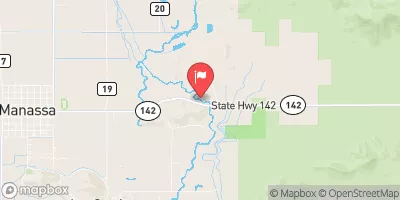
San Antonio River At Mouth, Near Manassa, Co. Realtime Data
SAN ANTONIO RIVER AT MOUTH, NEAR MANASSA, CO.
Realtime Data • Report • Conditions
0
Discharge (cfs)
0.2
Gauge Height (ft)
USGS 08248500
Streamflow discharge was last observed at 0 cfs, and a gauge height of 0.16 feet.
With the
% decrease since yesterday,
the streamflow average over the past 10 days is 0 .
Weather today, Tomorrow,
The flow is primarily provided by snowmelt and precipitation in the San Juan Mountains. The river is fed by several tributaries, including the Los Pinos River and the Conejos River. The Platoro Reservoir is a notable dam that regulates the flow of the San Antonio River. The river experiences seasonal fluctuations in flow, with the highest flows occurring in the spring and early summer due to snowmelt. Interestingly, the San Antonio River flows into both the Rio Grande and the Colorado River watersheds.
October 9, 2026
| Elevation | 7,662.0 ft |
| Last Updated | |
| Gage height, feet | 0.16 ft |
| Streamflow, ft3/s | 0.0 ft3/s |
| Percent of Normal | 0% |
| Year Over Year Average | 36 cfs |
| 24hr Flow Prediction | cfs |
| Maximum Recorded | 1,290 cfs |
| Geolocation | 37.18, -105.88 |
 Continue with Snoflo Premium