

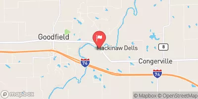
Mackinaw River Near Congerville, Il Realtime Data
MACKINAW RIVER NEAR CONGERVILLE, IL
Realtime Data • Report • Conditions
62
Discharge (cfs)
1.1
Gauge Height (ft)
USGS 05567500
Streamflow discharge was last observed at 62 cfs, and a gauge height of 1.13 feet.
With the
% decrease since yesterday,
the streamflow average over the past 10 days is 70 .
Weather today, Tomorrow,
The river is fed by several tributaries and its flow is influenced by seasonal trends, with higher flow rates typically occurring in the spring and lower flow rates in the summer. There are no major dams on the Mackinaw River near Congerville, but the river does have some interesting hydrological features, such as steep banks and a variety of aquatic plant and animal species. Overall, the Mackinaw River near Congerville is an important resource for understanding the hydrology of the area and its impact on local ecosystems.
October 22, 2026
| Elevation | 611.0 ft |
| Last Updated | |
| Gage height, ft | 1.13 ft |
| Nitrate plus nitrite, water, in situ, mg/L as N | 0.7 mg/l as N |
| Streamflow, ft³/s | 61.7 ft3/s |
| Specific conductance, water, unfiltered, microsiemens per centimeter at 25°C | 714.0 uS/cm @25C |
| Dissolved oxygen, water, unfiltered, mg/L | 5.2 mg/l |
| Turbidity, water, unfiltered, monochrome near infra-red LED light, 780-900 nm, detection angle 90 ±2.5°, formazin nephelometric units (FNU) | 4.1 FNU |
| pH, water, unfiltered, field, standard units | 7.8 std units |
| Temperature, air, °C | 26.9 deg C |
| Temperature, water, degC | 8.1 deg C |
| Percent of Normal | 71% |
| Year Over Year Average | 88 cfs |
| 24hr Flow Prediction | cfs |
| Maximum Recorded | 23,700 cfs |
 Continue with Snoflo Premium