

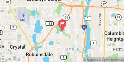
Shingle Creek At Queen Ave In Minneapolis, Mn Realtime Data
SHINGLE CREEK AT QUEEN AVE IN MINNEAPOLIS, MN
Realtime Data • Report • Conditions
0
Discharge (cfs)
9.2
Gauge Height (ft)
Streamflow discharge was last observed at 0 cfs, and a gauge height of 9.19 feet.
With the
% decrease since yesterday,
the streamflow average over the past 10 days is 1 .
Weather today, Tomorrow,
The creek is fed by several small tributaries and is part of the larger Mississippi River watershed. There are no major dams on the creek, but it has been heavily modified for urban development. Seasonal trends show an increase in flow during the spring and a decrease in the fall. Interesting facts about the hydrology of the creek include its historical use as a source of water for mills and the fact that it was once considered a "lost" creek due to its underground routing through pipes. Overall, the Shingle Creek at Queen Ave provides valuable data for understanding the hydrology of urban streams.
October 22, 2026
| Elevation | 905.0 ft |
| Last Updated | |
| Gage height, ft | 9.19 ft |
| Stream water level elevation above NAVD 1988, in ft | 835.04 ft |
| Streamflow, ft³/s | 0.3 ft3/s |
| Specific conductance, water, unfiltered, microsiemens per centimeter at 25°C | 904.0 uS/cm @25C |
| Temperature, water, °C | 13.6 deg C |
| Percent of Normal | 4% |
| Year Over Year Average | 8 cfs |
| 24hr Flow Prediction | cfs |
| Maximum Recorded | 259 cfs |
| Geolocation | 45.05, -93.31 |
 Continue with Snoflo Premium