

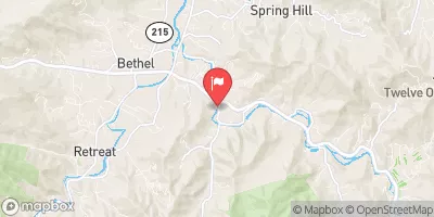
East Fork Pigeon River Near Canton, Nc Realtime Data
EAST FORK PIGEON RIVER NEAR CANTON, NC
Realtime Data • Report • Conditions
22
Discharge (cfs)
-0.5
Gauge Height (ft)
Streamflow discharge was last observed at 22 cfs, and a gauge height of -0.47 feet.
With the
% decrease since yesterday,
the streamflow average over the past 10 days is 24 .
Weather today, Tomorrow,
The river is a part of the French Broad River Basin and is critical for the water supply of the region. The primary flow constituents of this river are rainfall and snowmelt. The river is known for its great fishing opportunities, and several fish species can be found here, including trout and smallmouth bass. The seasonal flow of the river is highly variable, with the highest flows occurring during the spring and summer months. The river has several tributaries, including Shoal Creek, the largest tributary, and is home to several dams. Interestingly, East Fork Pigeon River was once used to transport logs from the mountains to the mills downstream.
October 9, 2026
| Elevation | 2,681.0 ft |
| Last Updated | |
| Gage height, ft | -0.47 ft |
| Precipitation, total, in | 0.0 in |
| Stream water level elevation above NAVD 1988, in ft | 2673.94 ft |
| Streamflow, ft³/s | 21.7 ft3/s |
| Percent of Normal | 39% |
| Year Over Year Average | 56 cfs |
| 24hr Flow Prediction | cfs |
| Maximum Recorded | 6,240 cfs |
| Geolocation | 35.46, -82.87 |
 Continue with Snoflo Premium