

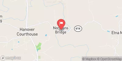
Pamunkey River Near Hanover, Va Realtime Data
PAMUNKEY RIVER NEAR HANOVER, VA
Realtime Data • Report • Conditions
126
Discharge (cfs)
3.5
Gauge Height (ft)
USGS 01673000
Streamflow discharge was last observed at 144 cfs, and a gauge height of 3.47 feet.
With the
% decrease since yesterday,
the streamflow average over the past 10 days is 131 .
Weather today, Tomorrow,
The river is fed by several small tributaries and has a watershed area of 1,110 square miles. The hydrology of the river is influenced by seasonal patterns, with higher flows occurring during the winter and spring months due to increased precipitation and snowmelt. There are no major dams on the Pamunkey River, but there are several smaller dams and impoundments that may affect the flow. Interestingly, the Pamunkey River was once home to the Pamunkey Indian Tribe and was a major source of food and transportation for the tribe.
October 13, 2026
| Elevation | 64.0 ft |
| Last Updated | |
| Gage height, ft | 3.47 ft |
| Nitrate plus nitrite, water, in situ, mg/L as N | 0.34 mg/l as N |
| Streamflow, ft³/s | 144.0 ft3/s |
| Specific conductance, water, unfiltered, microsiemens per centimeter at 25°C | 172.0 uS/cm @25C |
| Dissolved oxygen, water, unfiltered, mg/L | 7.9 mg/l |
| Turbidity, water, unfiltered, monochrome near infra-red LED light, 780-900 nm, detection angle 90 ±2.5°, formazin nephelometric units (FNU) | 10.5 FNU |
| pH, water, unfiltered, field, standard units | 7.3 std units |
| Temperature, water, °C | 18.9 deg C |
| Percent of Normal | 76% |
| Year Over Year Average | 167 cfs |
| 24hr Flow Prediction | cfs |
| Maximum Recorded | 25,500 cfs |
 Continue with Snoflo Premium