

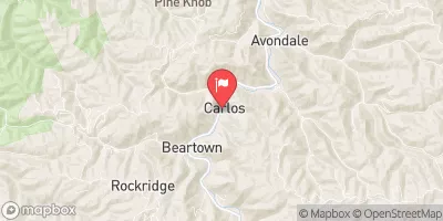
Dry Fork At Beartown, W. Va. Realtime Data
DRY FORK AT BEARTOWN, W. VA.
Realtime Data • Report • Conditions
54
Discharge (cfs)
2.8
Gauge Height (ft)
Streamflow discharge was last observed at 54 cfs, and a gauge height of 2.80 feet.
With the
% decrease since yesterday,
the streamflow average over the past 10 days is 86 .
Weather today, Tomorrow,
The primary contributors to the flow are precipitation and snowmelt. There are no major tributaries or dams that significantly impact the flow of the Dry Fork. The hydrology of the area is characterized by seasonal trends, with higher flows during the spring and summer months due to increased precipitation and snowmelt. Interestingly, the area surrounding the Dry Fork is known for its unique rock formations and is a popular location for hiking and outdoor recreation. Overall, the Dry Fork at Beartown, WV stream gauge provides valuable data for understanding the hydrology of the area and informing decisions related to water management.
October 22, 2026
| Elevation | 1,076.0 ft |
| Last Updated | |
| Gage height, ft | 2.8 ft |
| Precipitation, total, in | 0.0 in |
| Streamflow, ft³/s | 54.3 ft3/s |
| Percent of Normal | 114% |
| Year Over Year Average | 48 cfs |
| 24hr Flow Prediction | cfs |
| Maximum Recorded | 14,000 cfs |
| Geolocation | 37.40, -81.80 |
 Continue with Snoflo Premium