Brewer Lake Dam Dam

Brewer Lake Dam
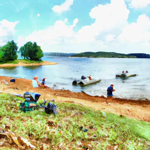
Brewer Lake Dam in Carroll County, Arkansas, stands as a testament to man's ingenuity and dedication to recreation. Completed in 1966, this earth dam boasts a height of 16 feet and a length of 650 feet, creating a reservoir with a storage capacity of 75 acre-feet. Situated on the Osage Creek, this dam serves primarily for recreational purposes, offering a tranquil setting for water enthusiasts and nature lovers alike. With a low hazard potential and a condition assessment of "Not Rated," Brewer Lake Dam promises a safe and enjoyable experience for visitors.
Owned and operated by a private entity, Brewer Lake Dam is not subject to state regulation or inspection. Its location in Delmar, Arkansas, provides easy access for visitors seeking a peaceful retreat in the great outdoors. The dam's structure, with a hydraulic height matching its structural height of 16 feet, ensures the safety and stability of the reservoir, while its proximity to the Osage Creek guarantees a picturesque setting for various water activities. With a maximum storage capacity of 75 acre-feet and a normal storage level of 56 acre-feet, Brewer Lake Dam offers a serene escape for those looking to unwind and reconnect with nature.
Despite not being under the jurisdiction of state agencies, Brewer Lake Dam continues to attract water resource and climate enthusiasts with its pristine surroundings and well-maintained facilities. The dam's design and construction, overseen by the Little Rock District of the US Army Corps of Engineers, reflect a commitment to quality and safety. Under the stewardship of private ownership, this recreational gem in Carroll County remains a hidden oasis for those seeking solace and adventure in the heart of Arkansas.
Plan around the weather
Same NOAA / yr.no feed Snoflo's iOS app uses. Watch the precipitation column on the meteogram -- rain on the basin upstream typically lifts inflow 24-72 hours later.
Next 5 days, hour by hour
Temperature line with weather symbols on top, snow + rain accumulation as columns, humidity as a dotted line.
5-day forecast table
Every 3 hours, broken out across temperature, snow, rain, humidity, and wind. Each cell is colour-coded relative to the column min/max.
| Time | Condition | Temp (°F) | Snow (in) | Rain (in) | Humidity (%) | Wind (mps) | Wind dir |
|---|---|---|---|---|---|---|---|
| Loading detailed forecast… | |||||||
15-day temperature & precipitation
Daily temperatures, snow, and rain projected over the next two weeks.
Nearby streamflow gauges
USGS streamgauges around Brewer Lake Dam -- inflows here typically show up in storage 24-72 hours later.
| Streamgauge | Discharge | View |
|---|---|---|
| Buffalo River Near Boxley | 16 cfs | → |
| Yocum Creek Near Oak Grove | 40 cfs | → |
| Kings River Near Berryville | 95 cfs | → |
| War Eagle Creek Near Hindsville | 127 cfs | → |
| Richland Creek Near Witts Spring | 53 cfs | → |
| Buffalo River Near St. Joe | 231 cfs | → |


About Brewer Lake Dam
Where does the data for Brewer Lake Dam come from?
Structural and regulatory data come from the U.S. Army Corps of Engineers' National Inventory of Dams (NID). Weather forecast comes from NOAA / yr.no -- the same feed Snoflo's iOS app uses.
How often is the report updated?
NID structural data refreshes annually as the Corps publishes updated assessments. The weather forecast refreshes throughout the day.
What does the Low hazard rating mean?
The Corps of Engineers' hazard potential classification grades probable consequences if the dam fails: High = probable loss of human life; Significant = no probable loss of human life but possible economic loss / environmental damage; Low = no probable loss of human life, only minor economic / environmental losses. See the Dam Data Reference card below for the full definitions.
What's "% of normal"?
The current storage value compared to the historical average storage on this calendar day. 100% = right on average; values above 100% mean above-normal storage (wet year); values below mean below-normal (dry year or drought).
Can I get alerts when storage crosses a threshold?
Yes -- alerts are managed in the Snoflo iOS app. Favorite this dam, set a threshold, and you'll get a push the moment conditions cross.
Dam data reference
Condition Assessment
- Satisfactory
- No existing or potential dam safety deficiencies are recognized. Acceptable performance is expected under all loading conditions (static, hydrologic, seismic) in accordance with the minimum applicable state or federal regulatory criteria or tolerable risk guidelines.
- Fair
- No existing dam safety deficiencies are recognized for normal operating conditions. Rare or extreme hydrologic and/or seismic events may result in a dam safety deficiency. Risk may be in the range to take further action.
- Poor
- A dam safety deficiency is recognized for normal operating conditions which may realistically occur. Remedial action is necessary. POOR may also be used when uncertainties exist as to critical analysis parameters which identify a potential dam safety deficiency.
- Unsatisfactory
- A dam safety deficiency is recognized that requires immediate or emergency remedial action for problem resolution.
- Not Rated
- The dam has not been inspected, is not under state or federal jurisdiction, or has been inspected but, for whatever reason, has not been rated.
Hazard Potential Classification
- High
- Dams assigned the high hazard potential classification are those where failure or mis-operation will probably cause loss of human life.
- Significant
- Dams assigned the significant hazard potential classification are those dams where failure or mis-operation results in no probable loss of human life but can cause economic loss, environmental damage, disruption of lifeline facilities, or impact other concerns. Significant hazard potential classification dams are often located in predominantly rural or agricultural areas but could be in areas with population and significant infrastructure.
- Low
- Dams assigned the low hazard potential classification are those where failure or mis-operation results in no probable loss of human life and low economic and/or environmental losses. Losses are principally limited to the owner's property.
- Undetermined
- Dams for which a downstream hazard potential has not been designated or is not provided.