Marina Lagoon Dam

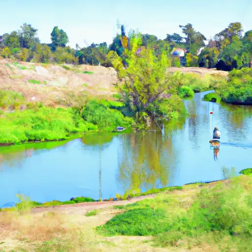
Marina Lagoon
Marina Lagoon, also known as Seal Slough, is a crucial water resource in San Mateo, California, managed by the local government. Built in 1953, this earth dam serves the primary purpose of flood risk reduction, while also offering recreational opportunities in the area. With a height of 17 feet and a hydraulic height of 14 feet, Marina Lagoon has a storage capacity of 1600 acre-feet and covers a surface area of 200 acres. Despite being labeled as low hazard potential, the dam is regularly inspected and deemed to be in satisfactory condition.
Located on the Belmont Slough in the San Francisco Bay area, Marina Lagoon plays a significant role in managing water flow and protecting the surrounding communities from flooding. The dam is regulated by the Department of Water Resources and the Safety of Dams agency in California, ensuring that it meets all state permitting, inspection, and enforcement requirements. While no spillway type or width is specified, the dam's construction and design reflect its effective flood risk reduction capabilities, contributing to the overall safety and resilience of the region.
With Congresswoman Jackie Speier representing the area, Marina Lagoon stands as a testament to effective water resource management and climate resilience efforts in California. As a key infrastructure for flood risk reduction, this earth dam not only safeguards communities but also provides a space for recreational activities, highlighting the harmonious coexistence of human development and environmental conservation. The continuous monitoring and maintenance of Marina Lagoon demonstrate a commitment to ensuring its long-term functionality and safety for generations to come.
Plan around the weather
Same NOAA / yr.no feed Snoflo's iOS app uses. Watch the precipitation column on the meteogram -- rain on the basin upstream typically lifts inflow 24-72 hours later.
Next 5 days, hour by hour
Temperature line with weather symbols on top, snow + rain accumulation as columns, humidity as a dotted line.
5-day forecast table
Every 3 hours, broken out across temperature, snow, rain, humidity, and wind. Each cell is colour-coded relative to the column min/max.
| Time | Condition | Temp (°F) | Snow (in) | Rain (in) | Humidity (%) | Wind (mps) | Wind dir |
|---|---|---|---|---|---|---|---|
| Loading detailed forecast… | |||||||
15-day temperature & precipitation
Daily temperatures, snow, and rain projected over the next two weeks.
Nearby streamflow gauges
USGS streamgauges around Marina Lagoon -- inflows here typically show up in storage 24-72 hours later.
| Streamgauge | Discharge | View |
|---|---|---|
| San Mateo C Bl Lo Crystal Sp Res Nr San Mateo Ca | 4 cfs | → |
| Pilarcitos C Bl Stone Dam Nr Hillsborough Ca | 2 cfs | → |
| Pilarcitos C A Half Moon Bay Ca | 4 cfs | → |
| San Lorenzo C A San Lorenzo Ca | 2 cfs | → |
| San Francisquito C A Stanford University Ca | 0 cfs | → |
| Matadero C A Palo Alto Ca | 0 cfs | → |
Make a day of it
Boat launches, lakeside camping, fishing access, and other reservoirs near Marina Lagoon.
Boat launches
See all →


Campgrounds
See all →


Fishing spots
See all →


River runs
See all →


About Marina Lagoon
Where does the data for Marina Lagoon come from?
Structural and regulatory data come from the U.S. Army Corps of Engineers' National Inventory of Dams (NID). Weather forecast comes from NOAA / yr.no -- the same feed Snoflo's iOS app uses.
How often is the report updated?
NID structural data refreshes annually as the Corps publishes updated assessments. The weather forecast refreshes throughout the day.
What does the Low hazard rating mean?
The Corps of Engineers' hazard potential classification grades probable consequences if the dam fails: High = probable loss of human life; Significant = no probable loss of human life but possible economic loss / environmental damage; Low = no probable loss of human life, only minor economic / environmental losses. See the Dam Data Reference card below for the full definitions.
What's "% of normal"?
The current storage value compared to the historical average storage on this calendar day. 100% = right on average; values above 100% mean above-normal storage (wet year); values below mean below-normal (dry year or drought).
Can I get alerts when storage crosses a threshold?
Yes -- alerts are managed in the Snoflo iOS app. Favorite this dam, set a threshold, and you'll get a push the moment conditions cross.
Dam data reference
Condition Assessment
- Satisfactory
- No existing or potential dam safety deficiencies are recognized. Acceptable performance is expected under all loading conditions (static, hydrologic, seismic) in accordance with the minimum applicable state or federal regulatory criteria or tolerable risk guidelines.
- Fair
- No existing dam safety deficiencies are recognized for normal operating conditions. Rare or extreme hydrologic and/or seismic events may result in a dam safety deficiency. Risk may be in the range to take further action.
- Poor
- A dam safety deficiency is recognized for normal operating conditions which may realistically occur. Remedial action is necessary. POOR may also be used when uncertainties exist as to critical analysis parameters which identify a potential dam safety deficiency.
- Unsatisfactory
- A dam safety deficiency is recognized that requires immediate or emergency remedial action for problem resolution.
- Not Rated
- The dam has not been inspected, is not under state or federal jurisdiction, or has been inspected but, for whatever reason, has not been rated.
Hazard Potential Classification
- High
- Dams assigned the high hazard potential classification are those where failure or mis-operation will probably cause loss of human life.
- Significant
- Dams assigned the significant hazard potential classification are those dams where failure or mis-operation results in no probable loss of human life but can cause economic loss, environmental damage, disruption of lifeline facilities, or impact other concerns. Significant hazard potential classification dams are often located in predominantly rural or agricultural areas but could be in areas with population and significant infrastructure.
- Low
- Dams assigned the low hazard potential classification are those where failure or mis-operation results in no probable loss of human life and low economic and/or environmental losses. Losses are principally limited to the owner's property.
- Undetermined
- Dams for which a downstream hazard potential has not been designated or is not provided.