Summary
It serves primarily for irrigation purposes and has a low hazard potential with an unsatisfactory condition assessment. The dam stands at a height of 24 feet with a hydraulic height of 30 feet and a structural height of 30 feet, holding a maximum storage capacity of 372 acre-feet.
Despite its low hazard potential, Burg poses a high risk due to its condition assessment and the surrounding area's risk assessment rating of 2. The dam lacks a spillway type but has slide and uncontrolled outlet gates. The last inspection of Burg took place on June 26, 2018, with an inspection frequency of 6 years.
Water resource and climate enthusiasts interested in Burg can delve into its historical data, construction details, and risk assessment to understand its role in the local water supply infrastructure and potential challenges posed by its current condition. As a critical irrigation structure in Mesa County, Colorado, Burg's management and maintenance are essential to ensure the safety and reliability of its operations for both agricultural and environmental sustainability.
°F
°F
mph
Wind
%
Humidity
15-Day Weather Outlook
Dam Length |
610 |
Dam Height |
24 |
River Or Stream |
FISH CREEK |
Primary Dam Type |
Earth |
Surface Area |
17 |
Hydraulic Height |
30 |
Drainage Area |
1 |
Nid Storage |
372 |
Structural Height |
30 |
Outlet Gates |
Slide (sluice gate), Uncontrolled |
Hazard Potential |
Low |
Foundations |
Rock, Soil |
Nid Height |
30 |
Seasonal Comparison
5-Day Hourly Forecast Detail
Nearby Streamflow Levels
 Dolores River Near Gateway
|
103cfs |
 Dolores River Near Cisco
|
107cfs |
 Colorado River Near Colorado-Utah State Line
|
2040cfs |
 Gunnison River Near Grand Junction
|
770cfs |
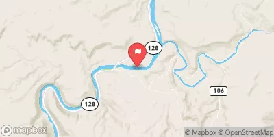 Colorado River Near Cisco
|
2100cfs |
 Colo River Blw Grd Valley Div Nr Palisade Co
|
1060cfs |
Dam Data Reference
Condition Assessment
SatisfactoryNo existing or potential dam safety deficiencies are recognized. Acceptable performance is expected under all loading conditions (static, hydrologic, seismic) in accordance with the minimum applicable state or federal regulatory criteria or tolerable risk guidelines.
Fair
No existing dam safety deficiencies are recognized for normal operating conditions. Rare or extreme hydrologic and/or seismic events may result in a dam safety deficiency. Risk may be in the range to take further action. Note: Rare or extreme event is defined by the regulatory agency based on their minimum
Poor A dam safety deficiency is recognized for normal operating conditions which may realistically occur. Remedial action is necessary. POOR may also be used when uncertainties exist as to critical analysis parameters which identify a potential dam safety deficiency. Investigations and studies are necessary.
Unsatisfactory
A dam safety deficiency is recognized that requires immediate or emergency remedial action for problem resolution.
Not Rated
The dam has not been inspected, is not under state or federal jurisdiction, or has been inspected but, for whatever reason, has not been rated.
Not Available
Dams for which the condition assessment is restricted to approved government users.
Hazard Potential Classification
HighDams assigned the high hazard potential classification are those where failure or mis-operation will probably cause loss of human life.
Significant
Dams assigned the significant hazard potential classification are those dams where failure or mis-operation results in no probable loss of human life but can cause economic loss, environment damage, disruption of lifeline facilities, or impact other concerns. Significant hazard potential classification dams are often located in predominantly rural or agricultural areas but could be in areas with population and significant infrastructure.
Low
Dams assigned the low hazard potential classification are those where failure or mis-operation results in no probable loss of human life and low economic and/or environmental losses. Losses are principally limited to the owner's property.
Undetermined
Dams for which a downstream hazard potential has not been designated or is not provided.
Not Available
Dams for which the downstream hazard potential is restricted to approved government users.

 Mud Springs Group Site B4
 Mud Springs Group Site B3
 Mud Springs Overflow Site O2
 Mud Springs Overflow Site O3
 Mud Springs Overflow Site O1
 Mud Springs Overflow Site O4
 Burg
Burg