Annex #8 Reservoir Report
Nearby: Windsor #8 Elder
Last Updated: February 12, 2026
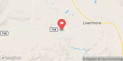
Annex #8 is a privately owned irrigation dam located in Larimer County, Colorado, near Fort Collins.
Summary
Completed in 1903, this Earth dam stands at a height of 26 feet and has a length of 1960 feet, providing a storage capacity of 4385 acre-feet for irrigation purposes. Situated on the Cache la Poudre River, Annex #8 is regulated by the Colorado Department of Water Resources and is subject to regular inspections to ensure its structural integrity.
Despite being classified as having a significant hazard potential, Annex #8 received a satisfactory condition assessment during its last inspection in June 2019. The dam's Emergency Action Plan was last revised in December 2018, and it is noted to meet guidelines for risk management measures. With a moderate risk assessment rating of 3, Annex #8 remains a crucial piece of infrastructure for water resource management in the region, serving as a vital source for irrigation in the surrounding agricultural areas.
Owned and operated privately, Annex #8 plays a key role in water resource management and climate adaptation efforts in Larimer County, Colorado. With its historical significance dating back over a century, this dam continues to provide essential water storage capacity for agricultural activities, highlighting the importance of maintaining and monitoring such vital infrastructure in the face of changing climate conditions and increasing water demands.
°F
°F
mph
Wind
%
Humidity
15-Day Weather Outlook
Years Modified |
2003 - Structural |
Year Completed |
1903 |
Dam Length |
1960 |
Dam Height |
26 |
River Or Stream |
CACHE LA POUDRE-OS |
Primary Dam Type |
Earth |
Surface Area |
179 |
Hydraulic Height |
26 |
Nid Storage |
4385 |
Structural Height |
26 |
Hazard Potential |
Significant |
Foundations |
Rock, Soil |
Nid Height |
26 |
Seasonal Comparison
5-Day Hourly Forecast Detail
Nearby Streamflow Levels
Dam Data Reference
Condition Assessment
SatisfactoryNo existing or potential dam safety deficiencies are recognized. Acceptable performance is expected under all loading conditions (static, hydrologic, seismic) in accordance with the minimum applicable state or federal regulatory criteria or tolerable risk guidelines.
Fair
No existing dam safety deficiencies are recognized for normal operating conditions. Rare or extreme hydrologic and/or seismic events may result in a dam safety deficiency. Risk may be in the range to take further action. Note: Rare or extreme event is defined by the regulatory agency based on their minimum
Poor A dam safety deficiency is recognized for normal operating conditions which may realistically occur. Remedial action is necessary. POOR may also be used when uncertainties exist as to critical analysis parameters which identify a potential dam safety deficiency. Investigations and studies are necessary.
Unsatisfactory
A dam safety deficiency is recognized that requires immediate or emergency remedial action for problem resolution.
Not Rated
The dam has not been inspected, is not under state or federal jurisdiction, or has been inspected but, for whatever reason, has not been rated.
Not Available
Dams for which the condition assessment is restricted to approved government users.
Hazard Potential Classification
HighDams assigned the high hazard potential classification are those where failure or mis-operation will probably cause loss of human life.
Significant
Dams assigned the significant hazard potential classification are those dams where failure or mis-operation results in no probable loss of human life but can cause economic loss, environment damage, disruption of lifeline facilities, or impact other concerns. Significant hazard potential classification dams are often located in predominantly rural or agricultural areas but could be in areas with population and significant infrastructure.
Low
Dams assigned the low hazard potential classification are those where failure or mis-operation results in no probable loss of human life and low economic and/or environmental losses. Losses are principally limited to the owner's property.
Undetermined
Dams for which a downstream hazard potential has not been designated or is not provided.
Not Available
Dams for which the downstream hazard potential is restricted to approved government users.


 Annex #8
 Horsetooth Reservoir
 Filter Plant River Access Point (Put-In)
 Filter Plant
 North Shields Ponds
 McMurry Ponds
 Douglas Reservoir
 Kingfisher Point Ponds
 Sheldon Lake (City Park)