Pawnee Raw Water Dam

Pawnee Raw Water
Pawnee Raw Water is a crucial water supply infrastructure located in Brush, Colorado, along the South Platte-OS river system. Completed in 1979, this earth dam stands at a height of 38 feet and spans a length of 10,600 feet. With a storage capacity of 3,810 acre-feet, it serves as a primary source of water for the region, supporting various water supply needs.
Managed by the Colorado Department of Water Resources, Pawnee Raw Water is regulated, inspected, and enforced to ensure its safety and efficiency. Despite its significant hazard potential, the dam's condition assessment remains satisfactory as of the last inspection in November 2019. With a moderate risk rating, the dam is equipped with emergency action plans, although their last revision dates back to 2012.
Water resource and climate enthusiasts will find Pawnee Raw Water to be an essential component of the water supply infrastructure in Morgan County, Colorado. Its strategic location along the South Platte-OS river system, combined with its storage capacity and regulatory oversight, highlights its importance in sustaining water resources for the community. As efforts continue to manage and maintain this critical infrastructure, it plays a vital role in ensuring water security and resilience in the face of changing climate conditions.
Plan around the weather
Same NOAA / yr.no feed Snoflo's iOS app uses. Watch the precipitation column on the meteogram -- rain on the basin upstream typically lifts inflow 24-72 hours later.
Next 5 days, hour by hour
Temperature line with weather symbols on top, snow + rain accumulation as columns, humidity as a dotted line.
5-day forecast table
Every 3 hours, broken out across temperature, snow, rain, humidity, and wind. Each cell is colour-coded relative to the column min/max.
| Time | Condition | Temp (°F) | Snow (in) | Rain (in) | Humidity (%) | Wind (mps) | Wind dir |
|---|---|---|---|---|---|---|---|
| Loading detailed forecast… | |||||||
15-day temperature & precipitation
Daily temperatures, snow, and rain projected over the next two weeks.
Nearby streamflow gauges
USGS streamgauges around Pawnee Raw Water -- inflows here typically show up in storage 24-72 hours later.
| Streamgauge | Discharge | View |
|---|---|---|
| South Platte River At Fort Morgan | 83 cfs | → |
| South Platte River At Cooper Bridge | 130 cfs | → |
| South Platte River Near Weldona | 131 cfs | → |
| South Platte River At Masters | 107 cfs | → |
| South Platte River Near Kersey | 115 cfs | → |
| Cache La Poudre River Near Greeley | 46 cfs | → |
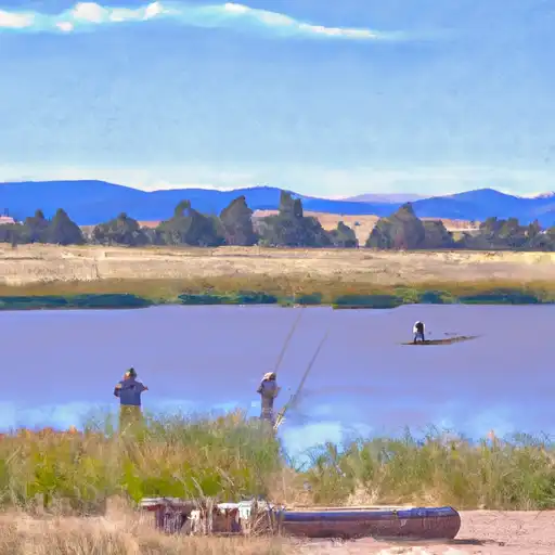
Make a day of it
Boat launches, lakeside camping, fishing access, and other reservoirs near Pawnee Raw Water.


About Pawnee Raw Water
Where does the data for Pawnee Raw Water come from?
Structural and regulatory data come from the U.S. Army Corps of Engineers' National Inventory of Dams (NID). Weather forecast comes from NOAA / yr.no -- the same feed Snoflo's iOS app uses.
How often is the report updated?
NID structural data refreshes annually as the Corps publishes updated assessments. The weather forecast refreshes throughout the day.
What does the Significant hazard rating mean?
The Corps of Engineers' hazard potential classification grades probable consequences if the dam fails: High = probable loss of human life; Significant = no probable loss of human life but possible economic loss / environmental damage; Low = no probable loss of human life, only minor economic / environmental losses. See the Dam Data Reference card below for the full definitions.
What's "% of normal"?
The current storage value compared to the historical average storage on this calendar day. 100% = right on average; values above 100% mean above-normal storage (wet year); values below mean below-normal (dry year or drought).
Can I get alerts when storage crosses a threshold?
Yes -- alerts are managed in the Snoflo iOS app. Favorite this dam, set a threshold, and you'll get a push the moment conditions cross.
Dam data reference
Condition Assessment
- Satisfactory
- No existing or potential dam safety deficiencies are recognized. Acceptable performance is expected under all loading conditions (static, hydrologic, seismic) in accordance with the minimum applicable state or federal regulatory criteria or tolerable risk guidelines.
- Fair
- No existing dam safety deficiencies are recognized for normal operating conditions. Rare or extreme hydrologic and/or seismic events may result in a dam safety deficiency. Risk may be in the range to take further action.
- Poor
- A dam safety deficiency is recognized for normal operating conditions which may realistically occur. Remedial action is necessary. POOR may also be used when uncertainties exist as to critical analysis parameters which identify a potential dam safety deficiency.
- Unsatisfactory
- A dam safety deficiency is recognized that requires immediate or emergency remedial action for problem resolution.
- Not Rated
- The dam has not been inspected, is not under state or federal jurisdiction, or has been inspected but, for whatever reason, has not been rated.
Hazard Potential Classification
- High
- Dams assigned the high hazard potential classification are those where failure or mis-operation will probably cause loss of human life.
- Significant
- Dams assigned the significant hazard potential classification are those dams where failure or mis-operation results in no probable loss of human life but can cause economic loss, environmental damage, disruption of lifeline facilities, or impact other concerns. Significant hazard potential classification dams are often located in predominantly rural or agricultural areas but could be in areas with population and significant infrastructure.
- Low
- Dams assigned the low hazard potential classification are those where failure or mis-operation results in no probable loss of human life and low economic and/or environmental losses. Losses are principally limited to the owner's property.
- Undetermined
- Dams for which a downstream hazard potential has not been designated or is not provided.