Folly Pond Reservoir Report
Nearby: Upper Robinson Martin
Last Updated: February 21, 2026
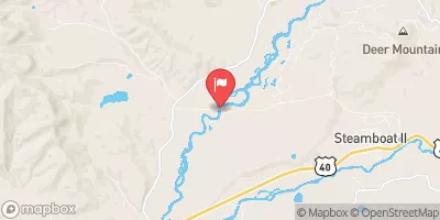
Folly Pond, located in Routt County, Colorado, is a privately owned water resource that serves multiple purposes including fire protection, stock watering, and as a small fish pond.
Summary
Built in 1982, this earth dam structure stands at 28 feet tall and spans 30 feet in length, with a maximum storage capacity of 56 acre-feet. The pond covers a surface area of 5 acres and has a drainage area of 1 square mile, with a maximum discharge capacity of 430 cubic feet per second.
Although Folly Pond is classified as having a low hazard potential, its condition assessment in 2018 was rated as fair. The dam's inspection frequency is every 6 years, with the last inspection conducted in October 2018. Despite its moderate risk assessment level, the pond's risk management measures and emergency preparedness plans are currently not specified. With its scenic location near Oak Creek and its role in supporting local wildlife and recreational activities, Folly Pond remains a significant water resource for the community of Steamboat Springs.
°F
°F
mph
Wind
%
Humidity
15-Day Weather Outlook
Year Completed |
1982 |
Dam Length |
30 |
Dam Height |
28 |
River Or Stream |
OAK CREEK-TR |
Primary Dam Type |
Earth |
Surface Area |
5 |
Hydraulic Height |
28 |
Drainage Area |
1 |
Nid Storage |
56 |
Structural Height |
28 |
Hazard Potential |
Low |
Nid Height |
28 |
Seasonal Comparison
5-Day Hourly Forecast Detail
Nearby Streamflow Levels
Dam Data Reference
Condition Assessment
SatisfactoryNo existing or potential dam safety deficiencies are recognized. Acceptable performance is expected under all loading conditions (static, hydrologic, seismic) in accordance with the minimum applicable state or federal regulatory criteria or tolerable risk guidelines.
Fair
No existing dam safety deficiencies are recognized for normal operating conditions. Rare or extreme hydrologic and/or seismic events may result in a dam safety deficiency. Risk may be in the range to take further action. Note: Rare or extreme event is defined by the regulatory agency based on their minimum
Poor A dam safety deficiency is recognized for normal operating conditions which may realistically occur. Remedial action is necessary. POOR may also be used when uncertainties exist as to critical analysis parameters which identify a potential dam safety deficiency. Investigations and studies are necessary.
Unsatisfactory
A dam safety deficiency is recognized that requires immediate or emergency remedial action for problem resolution.
Not Rated
The dam has not been inspected, is not under state or federal jurisdiction, or has been inspected but, for whatever reason, has not been rated.
Not Available
Dams for which the condition assessment is restricted to approved government users.
Hazard Potential Classification
HighDams assigned the high hazard potential classification are those where failure or mis-operation will probably cause loss of human life.
Significant
Dams assigned the significant hazard potential classification are those dams where failure or mis-operation results in no probable loss of human life but can cause economic loss, environment damage, disruption of lifeline facilities, or impact other concerns. Significant hazard potential classification dams are often located in predominantly rural or agricultural areas but could be in areas with population and significant infrastructure.
Low
Dams assigned the low hazard potential classification are those where failure or mis-operation results in no probable loss of human life and low economic and/or environmental losses. Losses are principally limited to the owner's property.
Undetermined
Dams for which a downstream hazard potential has not been designated or is not provided.
Not Available
Dams for which the downstream hazard potential is restricted to approved government users.
Area Campgrounds
| Location | Reservations | Toilets |
|---|---|---|
 Stagecoach State Park
|
||
 Meadows
|
||
 Walton Creek
|


 Folly Pond
 Lower Fish Creek