


Pappaws Reservoir Report
Last Updated: April 23, 2026
Nearby: Pine Tree Fourth Of July
°F
°F
mph
Wind
%
Humidity
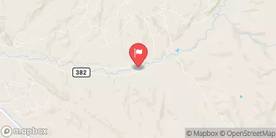
Pappaws, a federal-owned dam located in Rio Arriba, New Mexico, serves primarily for irrigation purposes along Los Alamos Creek.
Summary
Managed by the Bureau of Indian Affairs, this Earth-type dam stands at a height of 16 feet with a length of 389 feet, creating a surface area of 2.2 acres. Despite being classified as having a high hazard potential, the condition assessment of Pappaws is currently marked as "Not Available", indicating a potential need for further evaluation and updates on its risk management measures.
With a spillway width of 31 feet and an uncontrolled spillway type, Pappaws has not undergone any modifications since its last inspection in July 2012. The Emergency Action Plan (EAP) for the dam was last revised in June 2015, suggesting a need for periodic updates to ensure it meets safety guidelines. The risk assessment for Pappaws indicates a moderate risk level, highlighting the importance of ongoing monitoring and risk management measures to safeguard the surrounding community and infrastructure in the event of a potential emergency.
Water resource and climate enthusiasts interested in Pappaws can explore its unique features and management by the Bureau of Indian Affairs, as well as its critical role in irrigation along Los Alamos Creek. With a focus on hazard potential and risk assessment, Pappaws presents an opportunity for further study and potential improvements to its emergency preparedness and risk management strategies.
Regional Streamflow Levels
 Navajo River Bl Oso Diversion Dam Nr Chromo
|
37cfs |
 Rio Chama Near La Puente
|
256cfs |
 Navajo R At Banded Peak Ranch
|
90cfs |
 Rio Chama Below El Vado Dam
|
279cfs |
 Conejos River Near Mogote
|
259cfs |
 Rio Blanco Bl Blanco Div Dam
|
21cfs |
15-Day Long Term Forecast
Dam Length |
389 |
Dam Height |
16 |
River Or Stream |
LOS ALAMOS CREEK |
Primary Dam Type |
Earth |
Surface Area |
2.2 |
Structural Height |
16 |
Hazard Potential |
High |
Nid Height |
16 |
Seasonal Comparison
5-Day Hourly Forecast Detail
Dam Data Reference
Condition Assessment
SatisfactoryNo existing or potential dam safety deficiencies are recognized. Acceptable performance is expected under all loading conditions (static, hydrologic, seismic) in accordance with the minimum applicable state or federal regulatory criteria or tolerable risk guidelines.
Fair
No existing dam safety deficiencies are recognized for normal operating conditions. Rare or extreme hydrologic and/or seismic events may result in a dam safety deficiency. Risk may be in the range to take further action. Note: Rare or extreme event is defined by the regulatory agency based on their minimum
Poor A dam safety deficiency is recognized for normal operating conditions which may realistically occur. Remedial action is necessary. POOR may also be used when uncertainties exist as to critical analysis parameters which identify a potential dam safety deficiency. Investigations and studies are necessary.
Unsatisfactory
A dam safety deficiency is recognized that requires immediate or emergency remedial action for problem resolution.
Not Rated
The dam has not been inspected, is not under state or federal jurisdiction, or has been inspected but, for whatever reason, has not been rated.
Not Available
Dams for which the condition assessment is restricted to approved government users.
Hazard Potential Classification
HighDams assigned the high hazard potential classification are those where failure or mis-operation will probably cause loss of human life.
Significant
Dams assigned the significant hazard potential classification are those dams where failure or mis-operation results in no probable loss of human life but can cause economic loss, environment damage, disruption of lifeline facilities, or impact other concerns. Significant hazard potential classification dams are often located in predominantly rural or agricultural areas but could be in areas with population and significant infrastructure.
Low
Dams assigned the low hazard potential classification are those where failure or mis-operation results in no probable loss of human life and low economic and/or environmental losses. Losses are principally limited to the owner's property.
Undetermined
Dams for which a downstream hazard potential has not been designated or is not provided.
Not Available
Dams for which the downstream hazard potential is restricted to approved government users.
 Lower Branch--Sec 28, T33N, R3E; Upper Branch--Sec 15, T33N, R3E To Sec 7, T32N, R4E