Tom Frost dam

Tom Frost
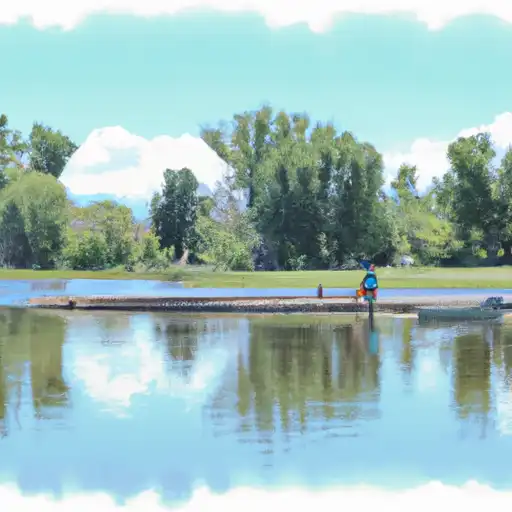
Tom Frost is a local government-owned dam located in Broomfield, Colorado, designed by the USDA NRCS to serve as a flood risk reduction structure along the Big Dry Creek-OS. Completed in 1951, this earth-type dam stands at a height of 12 feet and stretches 1068 feet in length. With a storage capacity of 160 acre-feet, it also serves the dual purpose of creating a fish and wildlife pond in addition to flood risk reduction.
Despite its relatively low hazard potential and moderate risk assessment, Tom Frost has not been rated for its current condition as of the last inspection conducted in 1998. The dam is equipped with an uncontrolled spillway, measuring 133 feet in width, to manage excess water flow during periods of high discharge. While the structure has not been modified in recent years, it is subject to regular state inspection, permitting, and enforcement to ensure its continued functionality and safety in mitigating flood risks in the area.
Enthusiasts of water resources and climate will find Tom Frost to be an intriguing example of a locally owned dam with historical significance in the region. Its purposeful design by the USDA NRCS, ongoing state regulation, and unique combination of flood risk reduction and ecological benefits make it a noteworthy feature in the landscape of water management and conservation efforts in Colorado.
Plan around the weather
Same NOAA / yr.no feed Snoflo's iOS app uses. Watch the precipitation column on the meteogram -- rain on the basin upstream typically lifts inflow 24-72 hours later.
Next 5 days, hour by hour
Temperature line with weather symbols on top, snow + rain accumulation as columns, humidity as a dotted line.
5-day forecast table
Every 3 hours, broken out across temperature, snow, rain, humidity, and wind. Each cell is colour-coded relative to the column min/max.
| Time | Condition | Temp (°F) | Snow (in) | Rain (in) | Humidity (%) | Wind (mps) | Wind dir |
|---|---|---|---|---|---|---|---|
| Loading detailed forecast… | |||||||
15-day temperature & precipitation
Daily temperatures, snow, and rain projected over the next two weeks.
Nearby streamflow gauges
USGS streamgauges around Tom Frost -- inflows here typically show up in storage 24-72 hours later.
| Streamgauge | Discharge | View |
|---|---|---|
| Big Dry Creek At Westminster | 1 cfs | → |
| Little Dry Creek At Westminster | 0 cfs | → |
| Clear Creek At Mouth | 1 cfs | → |
| South Platte River At Henderson | 127 cfs | → |
| South Platte R At 64th Ave. Commerce City | 50 cfs | → |
| Sand Crk Abv Burlington Ditch Nr Commerce City | 7 cfs | → |


About Tom Frost
Where does the data for Tom Frost come from?
Structural and regulatory data come from the U.S. Army Corps of Engineers' National Inventory of Dams (NID). Weather forecast comes from NOAA / yr.no -- the same feed Snoflo's iOS app uses.
How often is the report updated?
NID structural data refreshes annually as the Corps publishes updated assessments. The weather forecast refreshes throughout the day.
What does the Low hazard rating mean?
The Corps of Engineers' hazard potential classification grades probable consequences if the dam fails: High = probable loss of human life; Significant = no probable loss of human life but possible economic loss / environmental damage; Low = no probable loss of human life, only minor economic / environmental losses. See the Dam Data Reference card below for the full definitions.
What's "% of normal"?
The current storage value compared to the historical average storage on this calendar day. 100% = right on average; values above 100% mean above-normal storage (wet year); values below mean below-normal (dry year or drought).
Can I get alerts when storage crosses a threshold?
Yes -- alerts are managed in the Snoflo iOS app. Favorite this dam, set a threshold, and you'll get a push the moment conditions cross.
Dam data reference
Condition Assessment
- Satisfactory
- No existing or potential dam safety deficiencies are recognized. Acceptable performance is expected under all loading conditions (static, hydrologic, seismic) in accordance with the minimum applicable state or federal regulatory criteria or tolerable risk guidelines.
- Fair
- No existing dam safety deficiencies are recognized for normal operating conditions. Rare or extreme hydrologic and/or seismic events may result in a dam safety deficiency. Risk may be in the range to take further action.
- Poor
- A dam safety deficiency is recognized for normal operating conditions which may realistically occur. Remedial action is necessary. POOR may also be used when uncertainties exist as to critical analysis parameters which identify a potential dam safety deficiency.
- Unsatisfactory
- A dam safety deficiency is recognized that requires immediate or emergency remedial action for problem resolution.
- Not Rated
- The dam has not been inspected, is not under state or federal jurisdiction, or has been inspected but, for whatever reason, has not been rated.
Hazard Potential Classification
- High
- Dams assigned the high hazard potential classification are those where failure or mis-operation will probably cause loss of human life.
- Significant
- Dams assigned the significant hazard potential classification are those dams where failure or mis-operation results in no probable loss of human life but can cause economic loss, environmental damage, disruption of lifeline facilities, or impact other concerns. Significant hazard potential classification dams are often located in predominantly rural or agricultural areas but could be in areas with population and significant infrastructure.
- Low
- Dams assigned the low hazard potential classification are those where failure or mis-operation results in no probable loss of human life and low economic and/or environmental losses. Losses are principally limited to the owner's property.
- Undetermined
- Dams for which a downstream hazard potential has not been designated or is not provided.