Sumter Co. Water Dam

Sumter Co. Water
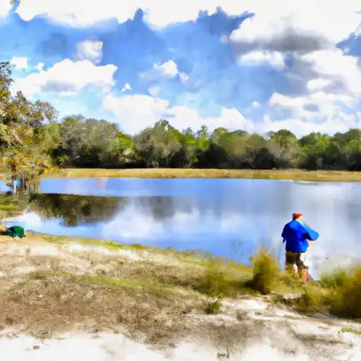
Located in Sumter County, Florida, the Sumter Co. Water, also known as Gant Lake Dam, is a vital water resource managed by the local government for irrigation purposes. Built in 1969 by the USDA NRCS, this dam stands at a height of 12 feet and has a storage capacity of 528 acre-feet. Situated along the Withlacoochee River in Webster, this structure serves various functions including fire protection, stock watering, flood risk reduction, and recreation.
With a low hazard potential and a condition assessment that is not rated, Sumter Co. Water has not been inspected since July 1994. The dam's spillway width is 30 feet, and it covers a surface area of 44 acres with a drainage area of 19.45 square miles. While the dam is primarily made of stone with a soil foundation, its purpose extends beyond irrigation to support fish and wildlife habitats, as well as small fish ponds. Despite its age, the dam continues to play a crucial role in water management and conservation in the region.
As a key infrastructure managed by the local government, Sumter Co. Water serves as a vital link in the water supply chain, ensuring sustainable water resources for the community. With its strategic location and multi-faceted purposes, this dam remains a cornerstone of water management efforts in Sumter County, contributing to the overall resilience of the region's water systems. As climate change continues to impact water resources, the maintenance and upkeep of structures like Sumter Co. Water will be essential in safeguarding against future water challenges and ensuring a reliable water supply for generations to come.
Plan around the weather
Same NOAA / yr.no feed Snoflo's iOS app uses. Watch the precipitation column on the meteogram -- rain on the basin upstream typically lifts inflow 24-72 hours later.
Next 5 days, hour by hour
Temperature line with weather symbols on top, snow + rain accumulation as columns, humidity as a dotted line.
5-day forecast table
Every 3 hours, broken out across temperature, snow, rain, humidity, and wind. Each cell is colour-coded relative to the column min/max.
| Time | Condition | Temp (°F) | Snow (in) | Rain (in) | Humidity (%) | Wind (mps) | Wind dir |
|---|---|---|---|---|---|---|---|
| Loading detailed forecast… | |||||||
15-day temperature & precipitation
Daily temperatures, snow, and rain projected over the next two weeks.
Nearby streamflow gauges
USGS streamgauges around Sumter Co. Water -- inflows here typically show up in storage 24-72 hours later.
| Streamgauge | Discharge | View |
|---|---|---|
| Little Withlacoochee River At Rerdell | · | → |
| Little Withlacoochee River Nr Tarrytown | · | → |
| Withlacoochee River At Croom | 6 cfs | → |
| Withlacoochee River At Rital Fl | 7 cfs | → |
| Jumper Creek Canal Nr Bushnell | 5 cfs | → |
| Withlacoochee River At Trilby | 9 cfs | → |
Make a day of it
Boat launches, lakeside camping, fishing access, and other reservoirs near Sumter Co. Water.
Boat launches
See all →


Campgrounds
See all →


Fishing spots
See all →


River runs
See all →


About Sumter Co. Water
Where does the data for Sumter Co. Water come from?
Structural and regulatory data come from the U.S. Army Corps of Engineers' National Inventory of Dams (NID). Weather forecast comes from NOAA / yr.no -- the same feed Snoflo's iOS app uses.
How often is the report updated?
NID structural data refreshes annually as the Corps publishes updated assessments. The weather forecast refreshes throughout the day.
What does the Low hazard rating mean?
The Corps of Engineers' hazard potential classification grades probable consequences if the dam fails: High = probable loss of human life; Significant = no probable loss of human life but possible economic loss / environmental damage; Low = no probable loss of human life, only minor economic / environmental losses. See the Dam Data Reference card below for the full definitions.
What's "% of normal"?
The current storage value compared to the historical average storage on this calendar day. 100% = right on average; values above 100% mean above-normal storage (wet year); values below mean below-normal (dry year or drought).
Can I get alerts when storage crosses a threshold?
Yes -- alerts are managed in the Snoflo iOS app. Favorite this dam, set a threshold, and you'll get a push the moment conditions cross.
Dam data reference
Condition Assessment
- Satisfactory
- No existing or potential dam safety deficiencies are recognized. Acceptable performance is expected under all loading conditions (static, hydrologic, seismic) in accordance with the minimum applicable state or federal regulatory criteria or tolerable risk guidelines.
- Fair
- No existing dam safety deficiencies are recognized for normal operating conditions. Rare or extreme hydrologic and/or seismic events may result in a dam safety deficiency. Risk may be in the range to take further action.
- Poor
- A dam safety deficiency is recognized for normal operating conditions which may realistically occur. Remedial action is necessary. POOR may also be used when uncertainties exist as to critical analysis parameters which identify a potential dam safety deficiency.
- Unsatisfactory
- A dam safety deficiency is recognized that requires immediate or emergency remedial action for problem resolution.
- Not Rated
- The dam has not been inspected, is not under state or federal jurisdiction, or has been inspected but, for whatever reason, has not been rated.
Hazard Potential Classification
- High
- Dams assigned the high hazard potential classification are those where failure or mis-operation will probably cause loss of human life.
- Significant
- Dams assigned the significant hazard potential classification are those dams where failure or mis-operation results in no probable loss of human life but can cause economic loss, environmental damage, disruption of lifeline facilities, or impact other concerns. Significant hazard potential classification dams are often located in predominantly rural or agricultural areas but could be in areas with population and significant infrastructure.
- Low
- Dams assigned the low hazard potential classification are those where failure or mis-operation results in no probable loss of human life and low economic and/or environmental losses. Losses are principally limited to the owner's property.
- Undetermined
- Dams for which a downstream hazard potential has not been designated or is not provided.