Red Rock Dam - Southeast Des Moines And Southwest Pleasant Hill Remedial Works Reservoir Report
Last Updated: February 5, 2026
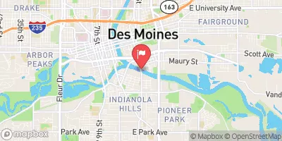
The Red Rock Dam in Southeast Des Moines and Southwest Pleasant Hill is a critical structure designed for flood risk reduction along the Des Moines River in Iowa.
°F
°F
mph
Wind
%
Humidity
15-Day Weather Outlook
Summary
Completed in 1968, this gravity dam stands at 18 feet tall and spans over 7,000 feet in length. The dam is owned and operated by the US Army Corps of Engineers and serves as a key component in protecting the surrounding communities from potential flooding events.
A recent risk assessment classified the Red Rock Dam project as having a moderate risk level, primarily due to its design to withstand a 100-year flood event. However, there are concerns about potential overtopping during larger flood events, as well as the risk of seepage undermining the embankment and flood wall foundations. Despite these challenges, the remedial works project has been deemed well-designed, constructed, and maintained, with measures in place to mitigate risks and ensure the safety of nearby residents and infrastructure.
To manage and reduce risks associated with the Red Rock Dam, the US Army Corps of Engineers has implemented a comprehensive risk management plan. This includes regular updates to the Emergency Action Plan, coordination with state and local emergency management agencies, conducting emergency exercises, and engaging in communication activities with stakeholders and the public. Continuous monitoring, inspections, and maintenance activities are also carried out to ensure the integrity of the dam and remedial works project. Additionally, updates to the Water Control Manual for Lake Red Rock aim to improve reservoir management and prevent larger-magnitude flooding events.
Year Completed |
1968 |
Dam Length |
7014 |
Dam Height |
18 |
River Or Stream |
DES MOINES RIVER |
Primary Dam Type |
Gravity |
Hydraulic Height |
15 |
Structural Height |
18 |
Hazard Potential |
High |
Nid Height |
18 |
Seasonal Comparison
Hourly Weather Forecast
Nearby Streamflow Levels
 Middle River Near Indianola
|
48cfs |
 Des Moines River Blw Raccoon Riv At Des Moines
|
1010cfs |
 Fourmile Creek At Des Moines
|
22cfs |
 North River Near Norwalk
|
48cfs |
 Raccoon River At Fleur Drive
|
1200cfs |
 Des Moines River At 2nd Avenue
|
418cfs |
Dam Data Reference
Condition Assessment
SatisfactoryNo existing or potential dam safety deficiencies are recognized. Acceptable performance is expected under all loading conditions (static, hydrologic, seismic) in accordance with the minimum applicable state or federal regulatory criteria or tolerable risk guidelines.
Fair
No existing dam safety deficiencies are recognized for normal operating conditions. Rare or extreme hydrologic and/or seismic events may result in a dam safety deficiency. Risk may be in the range to take further action. Note: Rare or extreme event is defined by the regulatory agency based on their minimum
Poor A dam safety deficiency is recognized for normal operating conditions which may realistically occur. Remedial action is necessary. POOR may also be used when uncertainties exist as to critical analysis parameters which identify a potential dam safety deficiency. Investigations and studies are necessary.
Unsatisfactory
A dam safety deficiency is recognized that requires immediate or emergency remedial action for problem resolution.
Not Rated
The dam has not been inspected, is not under state or federal jurisdiction, or has been inspected but, for whatever reason, has not been rated.
Not Available
Dams for which the condition assessment is restricted to approved government users.
Hazard Potential Classification
HighDams assigned the high hazard potential classification are those where failure or mis-operation will probably cause loss of human life.
Significant
Dams assigned the significant hazard potential classification are those dams where failure or mis-operation results in no probable loss of human life but can cause economic loss, environment damage, disruption of lifeline facilities, or impact other concerns. Significant hazard potential classification dams are often located in predominantly rural or agricultural areas but could be in areas with population and significant infrastructure.
Low
Dams assigned the low hazard potential classification are those where failure or mis-operation results in no probable loss of human life and low economic and/or environmental losses. Losses are principally limited to the owner's property.
Undetermined
Dams for which a downstream hazard potential has not been designated or is not provided.
Not Available
Dams for which the downstream hazard potential is restricted to approved government users.

 Red Rock Dam - Southeast Des Moines And Southwest Pleasant Hill Remedial Works
 Polk County