Bays Branch Reservoir Report
Nearby: Smith Dam Mleynek Dam
Last Updated: February 2, 2026
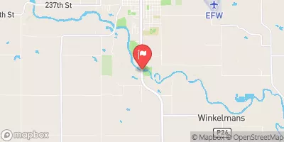
Bays Branch is a state-regulated Earth dam located in Redfield, Iowa, with a primary purpose of recreation.
°F
°F
mph
Wind
%
Humidity
15-Day Weather Outlook
Summary
Completed in 1962, this dam stands at 19 feet in height and spans 700 feet in length, providing a storage capacity of 3,638 acre-feet. With a surface area of 272 acres and a drainage area of 14.9 square miles, Bays Branch offers a tranquil setting for water resource and climate enthusiasts to enjoy recreational activities such as fishing and boating.
Despite its low hazard potential and satisfactory condition assessment, Bays Branch is subject to regular inspections every five years to ensure its safety and integrity. The dam is equipped with an uncontrolled spillway with a width of 12 feet, and it is situated on TR-Bay Branch, a tributary in Guthrie County, Iowa. With Cindy Axne (D) as the congressional representative for the area, Bays Branch serves as a valuable resource for the local community and visitors alike, showcasing the importance of sustainable water management practices in the region.
As a key feature in the landscape of Redfield, Iowa, Bays Branch not only provides recreational opportunities but also serves as a vital component of water resource infrastructure in the area. With its moderate risk assessment and satisfactory condition, this Earth dam continues to play a crucial role in local water management efforts. Its storage capacity, surface area, and drainage area contribute to the overall resilience of the region's water resources, making Bays Branch a noteworthy site for water resource and climate enthusiasts to explore and appreciate.
Year Completed |
1962 |
Dam Length |
700 |
Dam Height |
19 |
River Or Stream |
TR-BAY BRANCH |
Primary Dam Type |
Earth |
Surface Area |
272 |
Drainage Area |
14.9 |
Nid Storage |
3638 |
Hazard Potential |
Low |
Foundations |
Soil |
Nid Height |
19 |
Seasonal Comparison
Hourly Weather Forecast
Nearby Streamflow Levels
 Middle Raccoon River At Panora
|
92cfs |
 Middle Raccoon River Near Bayard
|
121cfs |
 South Raccoon River At Redfield
|
268cfs |
 North Raccoon River Near Jefferson
|
530cfs |
 Raccoon River At Van Meter
|
1640cfs |
 Beaver Creek Near Grimes
|
183cfs |
Dam Data Reference
Condition Assessment
SatisfactoryNo existing or potential dam safety deficiencies are recognized. Acceptable performance is expected under all loading conditions (static, hydrologic, seismic) in accordance with the minimum applicable state or federal regulatory criteria or tolerable risk guidelines.
Fair
No existing dam safety deficiencies are recognized for normal operating conditions. Rare or extreme hydrologic and/or seismic events may result in a dam safety deficiency. Risk may be in the range to take further action. Note: Rare or extreme event is defined by the regulatory agency based on their minimum
Poor A dam safety deficiency is recognized for normal operating conditions which may realistically occur. Remedial action is necessary. POOR may also be used when uncertainties exist as to critical analysis parameters which identify a potential dam safety deficiency. Investigations and studies are necessary.
Unsatisfactory
A dam safety deficiency is recognized that requires immediate or emergency remedial action for problem resolution.
Not Rated
The dam has not been inspected, is not under state or federal jurisdiction, or has been inspected but, for whatever reason, has not been rated.
Not Available
Dams for which the condition assessment is restricted to approved government users.
Hazard Potential Classification
HighDams assigned the high hazard potential classification are those where failure or mis-operation will probably cause loss of human life.
Significant
Dams assigned the significant hazard potential classification are those dams where failure or mis-operation results in no probable loss of human life but can cause economic loss, environment damage, disruption of lifeline facilities, or impact other concerns. Significant hazard potential classification dams are often located in predominantly rural or agricultural areas but could be in areas with population and significant infrastructure.
Low
Dams assigned the low hazard potential classification are those where failure or mis-operation results in no probable loss of human life and low economic and/or environmental losses. Losses are principally limited to the owner's property.
Undetermined
Dams for which a downstream hazard potential has not been designated or is not provided.
Not Available
Dams for which the downstream hazard potential is restricted to approved government users.

 Bays Branch
 Lake Panorama At Panora