Ames Basin #2 Reservoir Report
Nearby: Ames Basin #4 Ames Basin #3
Last Updated: January 10, 2026
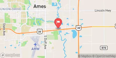
Ames Basin #2, located in Ames, Iowa, is a flood risk reduction structure managed by the local government and regulated by the Iowa Department of Natural Resources.
°F
°F
mph
Wind
%
Humidity
Summary
Completed in 1985, this earth dam stands at a height of 13 feet and has a length of 1000 feet, providing a storage capacity of 155 acre-feet to mitigate flooding in the area. The dam is situated on the TR- SKUNK R. river, within the Rock Island District of the US Army Corps of Engineers.
With a high hazard potential and a satisfactory condition assessment as of June 2020, Ames Basin #2 is a crucial infrastructure for flood control in Story County. The dam's spillway is uncontrolled with a width of 3 feet, and it has a drainage area of 0.57 square miles. The structure is inspected every two years to ensure its operational readiness and safety for the surrounding community. The risk assessment for the dam is moderate, indicating the need for continued monitoring and risk management measures.
As a key component of flood risk reduction efforts in the region, Ames Basin #2 serves as a vital structure for water resource management and climate resilience. Its strategic location and design help to protect the city of Ames and surrounding areas from potential flooding events, highlighting the importance of proactive infrastructure investment and maintenance in the face of changing climate conditions. The dam's satisfactory condition and regular inspections demonstrate a commitment to ensuring the safety and effectiveness of this essential water resource facility for the community.
Year Completed |
1985 |
Dam Length |
1000 |
Dam Height |
13 |
River Or Stream |
TR- SKUNK R. |
Primary Dam Type |
Earth |
Drainage Area |
0.57 |
Nid Storage |
155 |
Hazard Potential |
High |
Foundations |
Soil |
Nid Height |
13 |
Seasonal Comparison
Weather Forecast
Nearby Streamflow Levels
Dam Data Reference
Condition Assessment
SatisfactoryNo existing or potential dam safety deficiencies are recognized. Acceptable performance is expected under all loading conditions (static, hydrologic, seismic) in accordance with the minimum applicable state or federal regulatory criteria or tolerable risk guidelines.
Fair
No existing dam safety deficiencies are recognized for normal operating conditions. Rare or extreme hydrologic and/or seismic events may result in a dam safety deficiency. Risk may be in the range to take further action. Note: Rare or extreme event is defined by the regulatory agency based on their minimum
Poor A dam safety deficiency is recognized for normal operating conditions which may realistically occur. Remedial action is necessary. POOR may also be used when uncertainties exist as to critical analysis parameters which identify a potential dam safety deficiency. Investigations and studies are necessary.
Unsatisfactory
A dam safety deficiency is recognized that requires immediate or emergency remedial action for problem resolution.
Not Rated
The dam has not been inspected, is not under state or federal jurisdiction, or has been inspected but, for whatever reason, has not been rated.
Not Available
Dams for which the condition assessment is restricted to approved government users.
Hazard Potential Classification
HighDams assigned the high hazard potential classification are those where failure or mis-operation will probably cause loss of human life.
Significant
Dams assigned the significant hazard potential classification are those dams where failure or mis-operation results in no probable loss of human life but can cause economic loss, environment damage, disruption of lifeline facilities, or impact other concerns. Significant hazard potential classification dams are often located in predominantly rural or agricultural areas but could be in areas with population and significant infrastructure.
Low
Dams assigned the low hazard potential classification are those where failure or mis-operation results in no probable loss of human life and low economic and/or environmental losses. Losses are principally limited to the owner's property.
Undetermined
Dams for which a downstream hazard potential has not been designated or is not provided.
Not Available
Dams for which the downstream hazard potential is restricted to approved government users.


 Ames Basin #2